Surging Seas Risk Zone Map for Climate Central
Visualizing the impact of rising sea levels on coastal communities worldwide
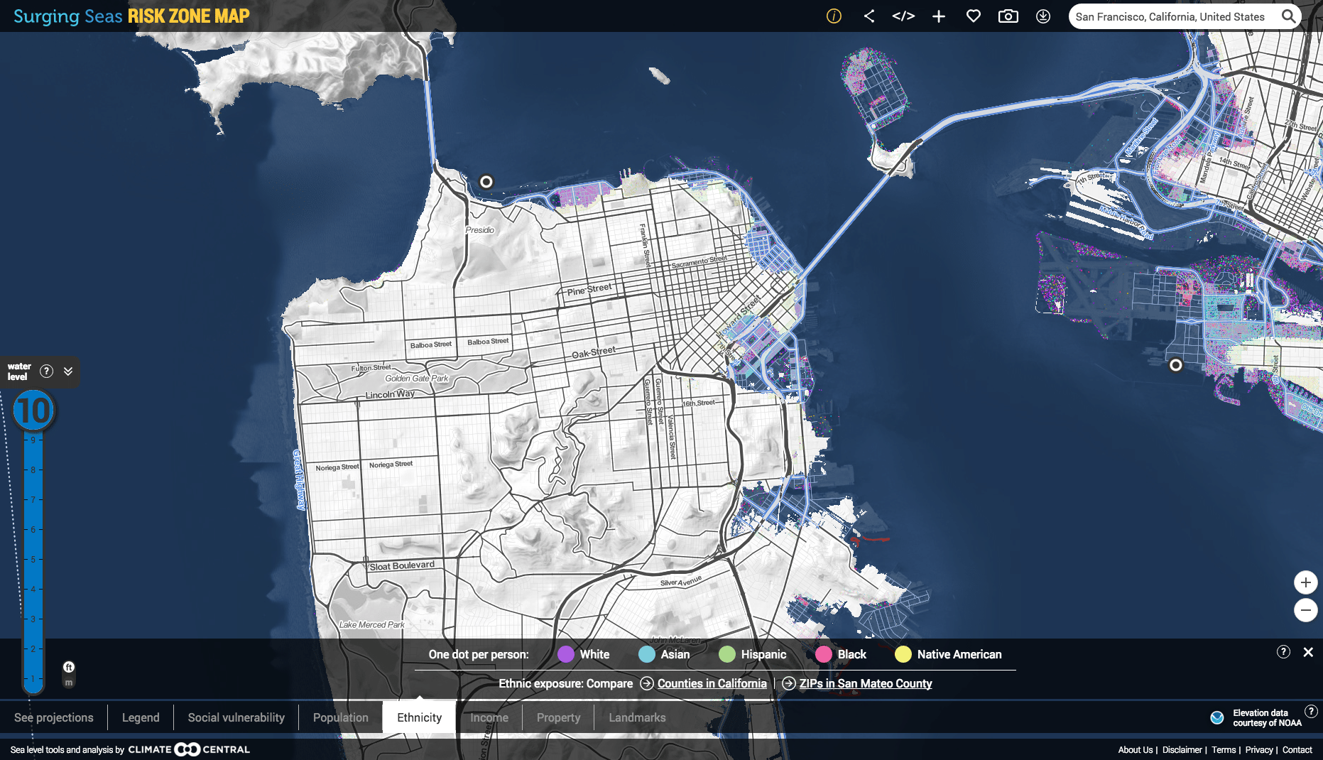
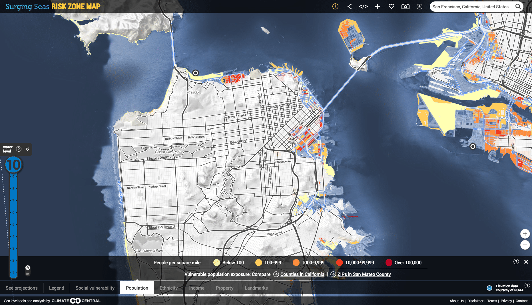
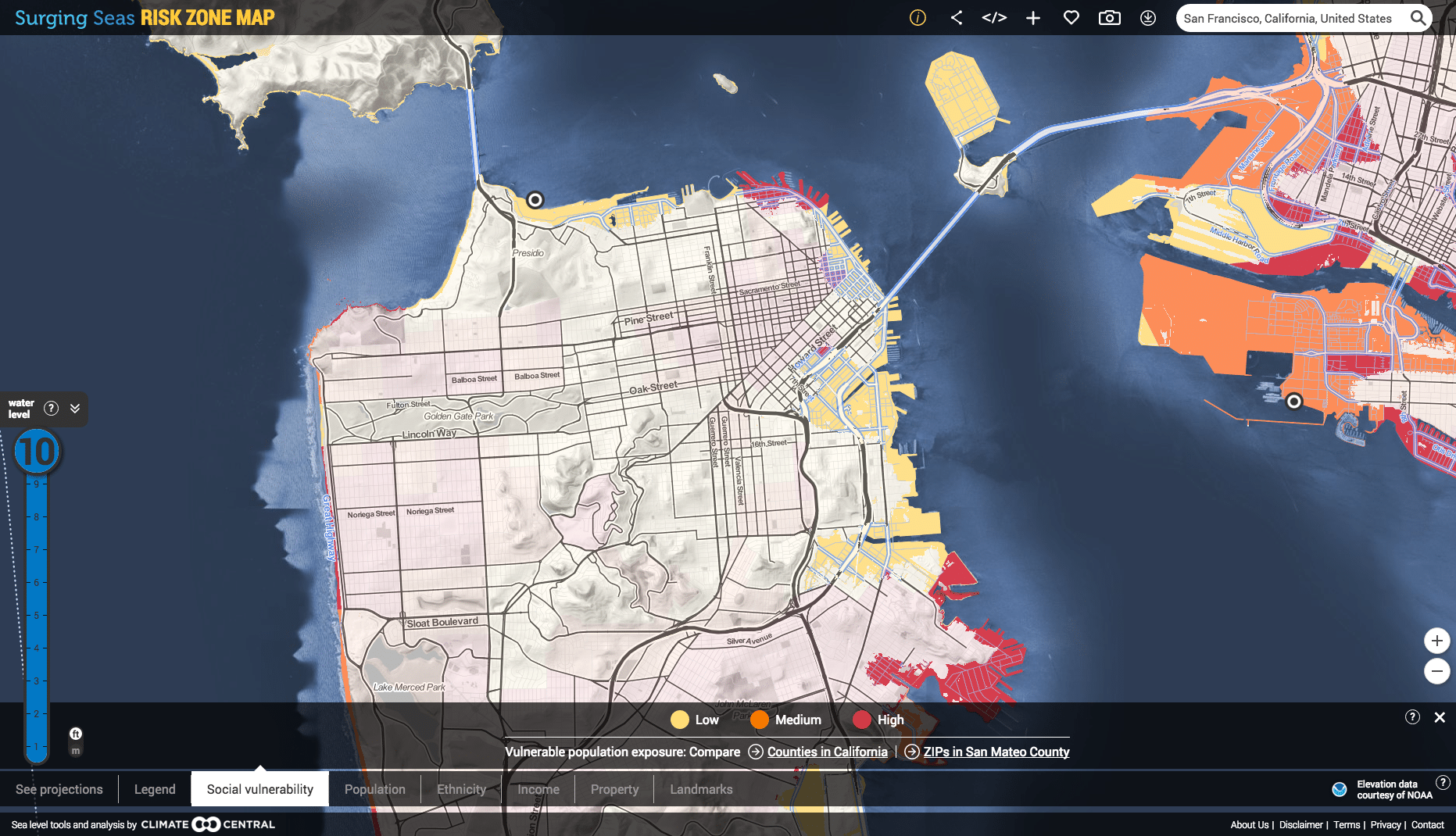
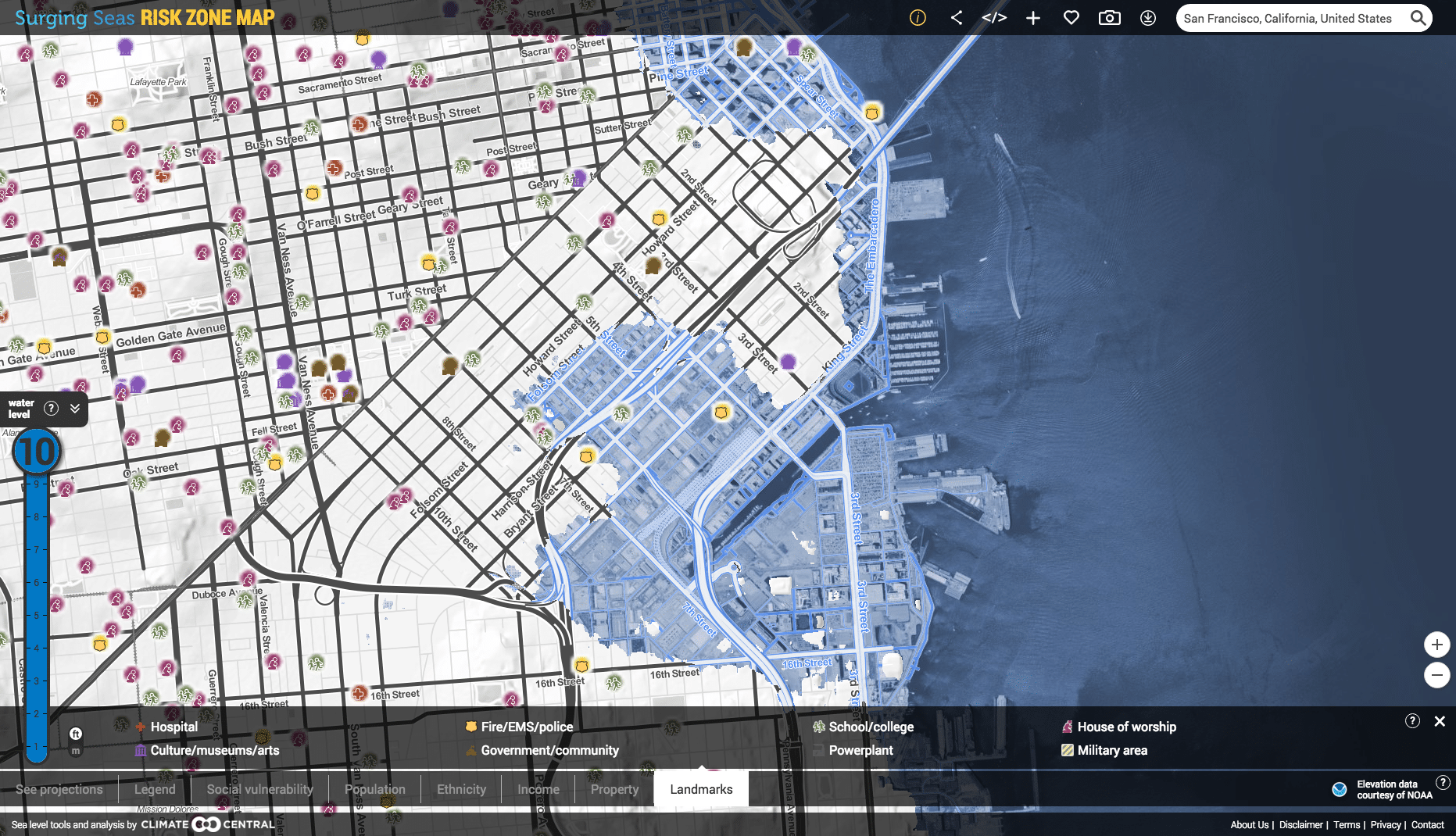
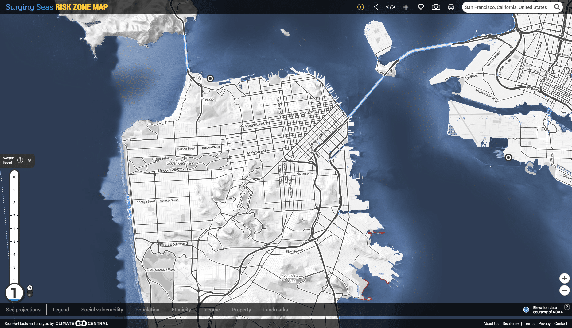
Over multiple years, we worked with Climate Central and New American Media to visualize the impact of rising sea levels to coastal residents, infrastructure, and property. The Risk Zone Map combines census data with elevational projections to create an interactive map of impact for various future scenarios. Individual locales can be seen in high resolution to show specific impact to a small area, or regions can viewed to identify districts within a region that are under threat of future inundation. The data can be then be isolated to analyze more specific impacts and vulnerabilities within a jurisdiction.
Climate Central pinpointed Stamen’s Surging Seas project as giving them unprecedented access to media and partnerships. The interface has been used as a tool by countless organizations for climate change education throughout the country. As a direct result of this work, Climate Central developed partnerships nationwide, including with the CLEO Institute in Florida and a nationwide partnership for climate change initiatives with the NAACP. The Surging Seas site was mentioned in over 700 media stories, including National Geographic, Washington Post, Huffington Post, and New Republic.
Since 2010, my collaborators at Stamen have been working with me to turn my organization's scientific research into online maps of sea-level rise and coastal flood risk. The maps broke new ground, unveiling and emphasizing areas at risk, instead of covering them with overlays. The maps are beautiful, kept simple by Stamen's passionate resistance to adding unnecessary features. And most importantly, the maps have played a critical role in advancing national awareness of climate change-driven sea level rise, and the coastal flooding it drives - since more than half a year before Hurricane Sandy. We publicly launched the first edition of these maps in March 2012. The research and maps were covered on the front page of the New York Times; on NBC, CBS and PBS national evening news; and in about 800 stories nationwide within two months. Within six weeks of the initial surge of coverage, a U.S. Senate committee announced and held a hearing on the threat posed by sea level rise to infrastructure, inviting my map-based testimony. The Atlantic Cities named our map the most important map of the year. From the start of our collaboration, Stamen's mastery of maps, passion for excellence, and dedication to doing work that serves the greater good have always been evident...they set an outstanding example for others to follow. Ben Strauss CEO, Climate Central