
The City from the Valley: Google, Apple, Facebook buses
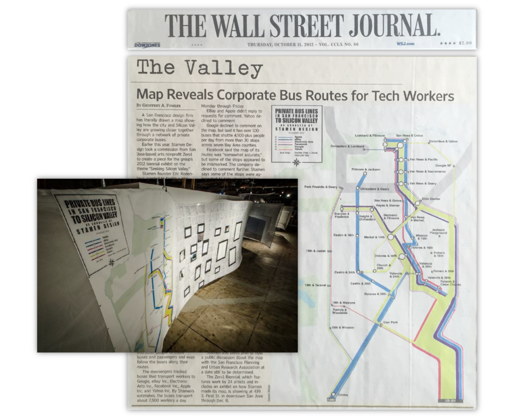
Tech shuttles in San Francisco, mapped
Historically, workers have lived in residential suburbs while commuting to work in the city. For Silicon Valley, however, the situation is reversed: Many of the largest technology companies are based in suburbs but look to recruit younger knowledge workers who are more likely to dwell in the city.
An alternate transportation network of private buses (commonly referred to as “tech shuttles” or “Google buses”)—fully equipped with wifi—threads daily through San Francisco, picking up workers at unmarked bus stops (though many coexist in digital space), carrying them southward via the commuter lanes of the 101 and 280 freeways, and eventually delivers them to their campuses. Commissioned by ZERO1 and supported by the James Irvine Foundation, this subway-style map is the end result; it’s not a literal representation, but it’s much more readable than the actual routes. We also wanted to show the relative volumes, so the map segments are scaled by how many trips pass through them; you get a sense for just how much traffic the highways get, and how the routes branch out from there to cover the city.
We only mapped San Francisco shuttles; many of these companies operate additional routes in East Bay, the Peninsula, and around San Jose, including direct routes from Caltrain stations to corporate campuses.