
At Stamen, we specialize in creating visually stunning and technically sophisticated maps. We can break down and customize this process to tailor it to the unique and varied needs of your project.
Our team of experts can assist in every stage of the map-making process, from defining project requirements to implementing the final product. Our focus on user experience and cartographic excellence can ensure that your platform provides an engaging and intuitive mapping experience.
We are fluent on most mapping platforms and services for cartographic display, including Mapbox, MapLibre, MapTiler, Stadia Maps, HERE, Esri, Felt, and Google Location Services, and are able to provide full-stack cartographic advice tailored to your unique product requirements.
Here is a sampling of the domain expertise our full-stack cartography solutions can bring to your organization:
- Product prototyping, vision and strategy
- Cartographic best practices
- Custom or branded cartographic design
- Data pipeline analysis, support, and tooling
- Map tile server or serverless tile setup
- Production and release support for a suite of related map styles
- Full-stack engineering, design, and cartographic data workflow integrations
- Performance optimization
- Map-focused UI/UX design
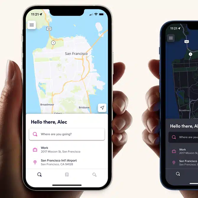
Lyft Maps
Designing bespoke maps for Lyft riders & drivers
Lyft partnered with Stamen to design and implement their first custom maps for their riders and driver. Stamen worked with Lyft’s product designers and researchers to understand the unique needs of their users while developing a cartographic design system that reflected their brands visual style.
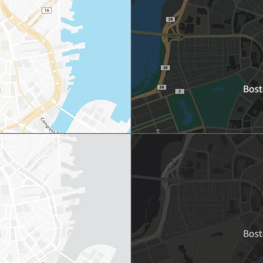
Expanding Basemap Offerings for a Global Audience with AWS
Helping a global tech leader expand their open data map offerings
Amazon Web Services brought on Stamen as a partner to develop a suite of new map styles as part of the Amazon Location Service Open Data Maps collection. These map are designed for AWS customers who need to track assets or fleets in real time, visualize data on a map, or show a store or property location.
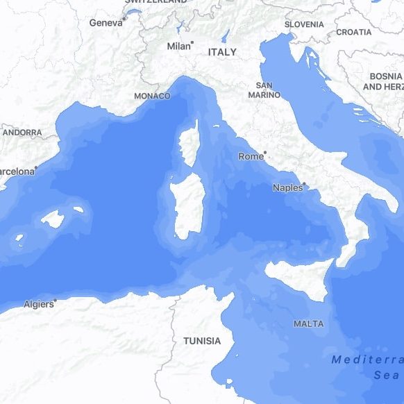
Facebook’s New Global Base Map
Creating a beautiful and functional base map for billions of users
It’s been our privilege to work on one of our largest and most ambitious undertakings ever: collaborating closely with a team of Facebook engineers, designers, and data experts to roll out a global, multi-scale base map for all of Facebook’s billions of users.
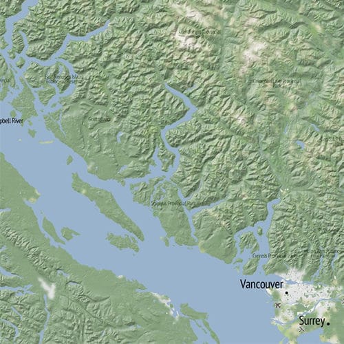
Open Terrain
A global set of terrain maps stitched together from multiple sources
We’ve been quietly working under a grant from the Knight Foundation to do something that no one seems to have done before: publicly compiling as many open-licensed, locally-created terrain data sets as possible to stitch together a global set.