A collection of all blog posts by Stamen Design.

blog/Stamen Design

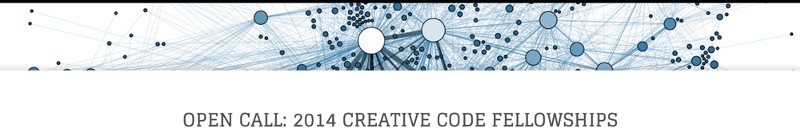
Stamen + Gray Area Partnering on Creative Code Fellowship + Classes! Apply now for Summer 2014!

Stamen Design | 05.13.14

Today is an exciting one: we’re pleased to announce that Stamen is offering a summer Fellowship! AND we’re doing it in partnership with longtime friends at Gray Area Foundation for the Arts, along with Obscura Digital and Helios. This is a real opportunity for someone to come and work with us and Gray Area for...

Mapping the Intersection Between Social Media and Open Spaces in California

Stamen Design | 04.30.14

What happens when you map the social media footprint of the great outdoors? Last month, Stamen launched parks.stamen.com, a project we created in partnership with the Electric Roadrunner Lab, with the goal of revealing the diversity of social media activity that happens inside parks and other open spaces in California. If you haven’t already looked...

OpenStreetMap Spring Editathon

Stamen Design | 04.29.14

Last Saturday Stamen hosted the Bay Area edition of the OpenStreetMap Spring Editathon, one of 10 locations across the country. We had nearly 40 people show up over the course of the day, all of them eager to help contribute to the development of OpenStreetMap, “the Wikipedia of Maps”. At Stamen we use OpenStreetMap data...

Stamen DODOcases go international: introducing Paris, London and Tokyo

Stamen Design | 04.28.14

There’s something really lovely about carrying a new, sleek piece of technology in something that looks and feels like a book, and was made using old-school bookbinding methods. This old-meets-new quality of DODOcase is exactly why we at Stamen love them and are delighted to partner with them again! Just last year, Stamen’s maps appeared...

Stamen Speaking at State of the Map US

Stamen Design | 04.09.14

We’re delighted to be participating again in the American flagship OpenStreetMap conference, State of the Map US, as both sponsors and speakers. Here’s the lineup for Saturday: 9:45 AM: Building Businesses Using OpenStreetMap by Eric Rodenbeck 4:30 PM: Teaching Mapping to Geographers by Stephanie May (Urban Mapping) & Alan McConchie And for Sunday: 11:30 AM:...

New Work: A Conversation About California Parks

Stamen Design | 03.27.14

Today marks the official launch of parks.stamen.com, a project designed to highlight social media from parks and open spaces across California, created in partnership with Electric Roadrunner Lab. “Stories pour out of our parks every day. This project is a first step towards visualizing Twitter, Flickr, Instagram, and Foursquare content using the actual boundaries of...

Visualizing a failed bitcoin market: The MtGox 500

Stamen Design | 03.20.14

In late February 2014 MtGox, one of the oldest Bitcoin exchanges, filed for bankruptcy protection. On March 9th a group posted a leak of MtGox data, which included the trading history of users from April 2011 to November 2013. We’ve been collaborating with Kai Chang & Mary Becica on some visualizations of this data; they’re...

The Parks Conservancy Map: The Baking of a Multi-Layered Data Cake

Stamen Design | 03.13.14

Back in December, we launched a new map for the Golden Gate National Parks Conservancy. The goal was to help people get to the parks and once there, around them, and to create a framework for Parks Conservancy staff, volunteers, and partners to add additional data and content as needed. At first, custom cartography wasn’t...

A Tale of Two Cities’ Maps: Dataviz is a Garden, not Architecture

Stamen Design | 02.26.14

This post is a check on both our ambitions and our processes. The uses of data visualization are different according to whether the goal is to communicate a specific thought for a single moment, e.g. as a poster, or the goal is to provide a durable tool for social change. It should be mighty safe...

Surging Seas is an Atlantic Favorite Map Of The Year

Stamen Design | 12.20.13

Today, The Atlantic Cities published their favorite maps of the year, and our work with Climate Central on Surging Seas tops the list: “the most frightening, important maps of the year come from Climate Central’s Surging Seas project, which offers an interactive map of all coastal areas of the Lower 48. In the discussion of...