
A Historical Atlas of America, Built for the 21st Century
Bloomberg CityLab
12.15.2015
When Charles Paullin’s Atlas of the Historical Geography of the United States first appeared in 1932, it was hailed as a “monument to historical scholarship.” Its 700 maps traced nearly every dimension of American life across the country’s geographical bounds—its natural history, its settlement by Europeans, the spread of railroads, state boundaries, suffrage, and much else.
Paullin, a naval historian, hoped his meticulous research and beautiful renderings would inspire new research into history’s old narratives. They did. And yet for nearly a century, no other project really attempted to match its depth.
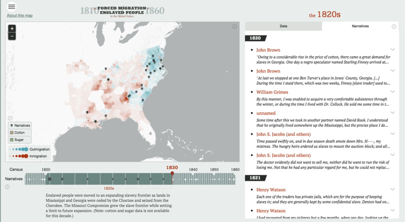
Inspired by the scope and intellectual ambition of its predecessor, a new project promises an American historical atlas for the online era. Produced in collaboration by the University of Richmond’s Digital Scholarship Lab and cartography firm Stamen, the American Panorama is an array of maps that revive the country’s most formative stories in modern, digital form….
To be clear, these are not the simple animated maps or hover-over statistical visualizations to which Internet trawlers are by now so accustomed. The Panorama’s plates are dense, like entire textbook chapters turned interactive tools.