
American Panorama Is an Interactive Atlas for the 21st Century
Wired Magazine
01.17.2016
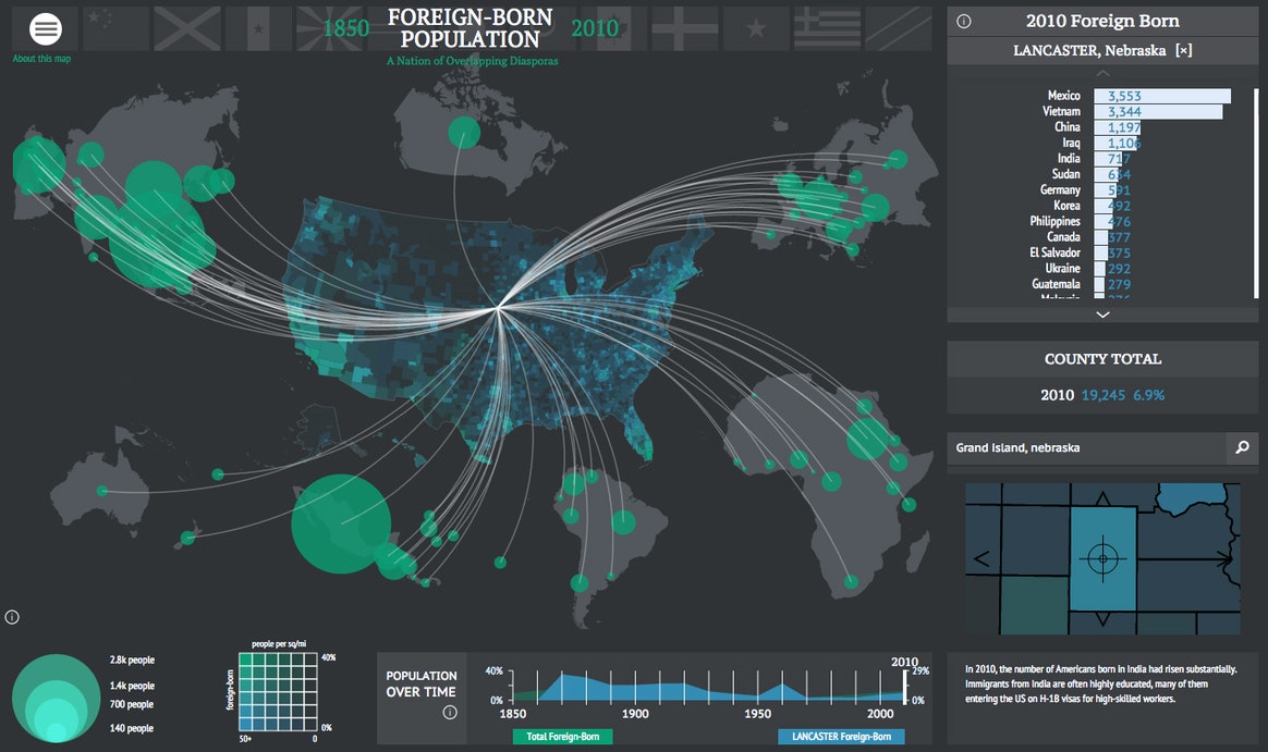
American Panorama comprises four maps created by design studio Stamen. And these maps have depth. Adding a layers of technology and interactivity to an otherwise daunting trove of data helps us make connections we might otherwise miss. For example, in a map that looks at the foreign-born population from 1850 to 2010, I was able to see that my ancestors’ arrival to Nebraska in the 1880s coincided with the influx of Swedish immigrants at the time. Dragging the scrubber along the dateline reveals how, a century later, the foreign-born population in the state was mostly Asian (the map explains that 1980 was the first time the country’s largest immigrant population was not European), and how, by 2010, European immigrants had been largely superseded by people from Latin America, Vietnam, China and Iraq.
…as American Panorama develops into a full-fledged digital atlas, it’s only going to become more powerful and compelling. Because as it turns out, the addition of even the simplest interactions can make it feel as though you’re looking at history with a very powerful magnifying glass in hand—and that’s a very cool thing.