
Play God With this New AI that Predicts Wealth from Space
Vice
07.05.2017
Hundreds of miles above our heads, Earth-imaging satellites are hard at work, snapping high-resolution photos of our planet and its inhabitants (say cheese). This abundance of imagery has revolutionized how we travel, communicate, and perceive our surroundings, and also provides unexpected insights into our civilization that aren’t obvious at ground level—like the impact of a neighborhood’s wealth on its overhead appearance.
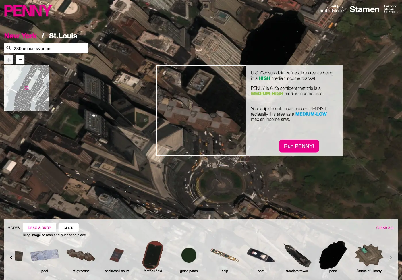
This idea served as the inspiration for the newly launched tool Penny, an artificial intelligence platform trained to use satellite pictures to predict the income brackets of urban neighborhoods. Developed by the Colorado-based satellite company DigitalGlobe, the data visualization studio Stamen Design, and researchers at Carnegie Mellon University, Penny generates estimates of a particular city block’s wealth based on satellite imagery, and compares its results with real census data.
Penny also acts as a virtual sandbox, where users can click-and-drop items like trees, freeways, or baseball diamonds into neighborhoods to see how they affect the AI’s perception of an area’s wealth.