blog/Cartography

Working & Designing with Spatial Data

| 10.13.16

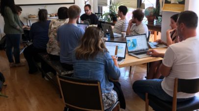
Late this summer, 10 people gathered at Stamen Design’s studios to learn how to design and work with geospatial data on the web. What we set out to do We all set aside 4 hours of a Sunday afternoon to get a hands-on introduction to the leading tools for web based mapping visualization. With a repo full...

An ode to d3.js projections

| 05.30.16

When it comes to making maps online there are many tools available, but they all have one thing in common: Geographic coordinates go in and a two-dimensional image comes out. Converting from geographic coordinates (longitude,latitude) to pixel coordinates is accomplished via a map projection. Most of the tools made for online map making focus on facilitating the navigation...