Interacting with plants at the Exploratorium
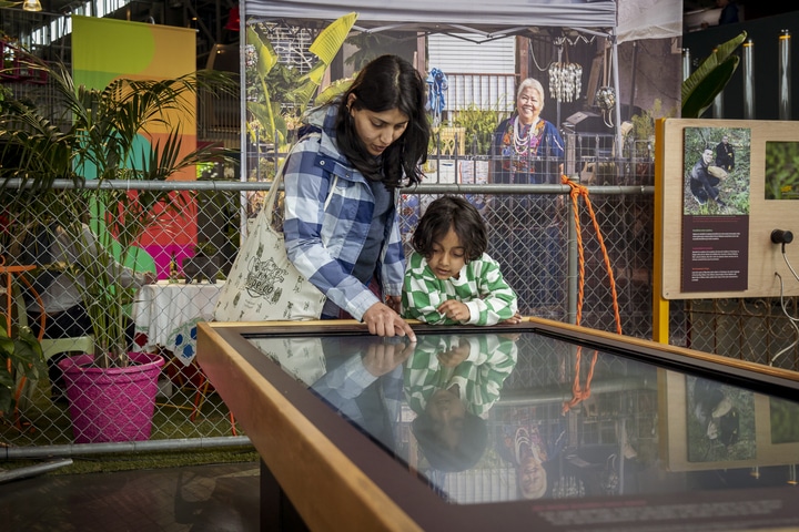
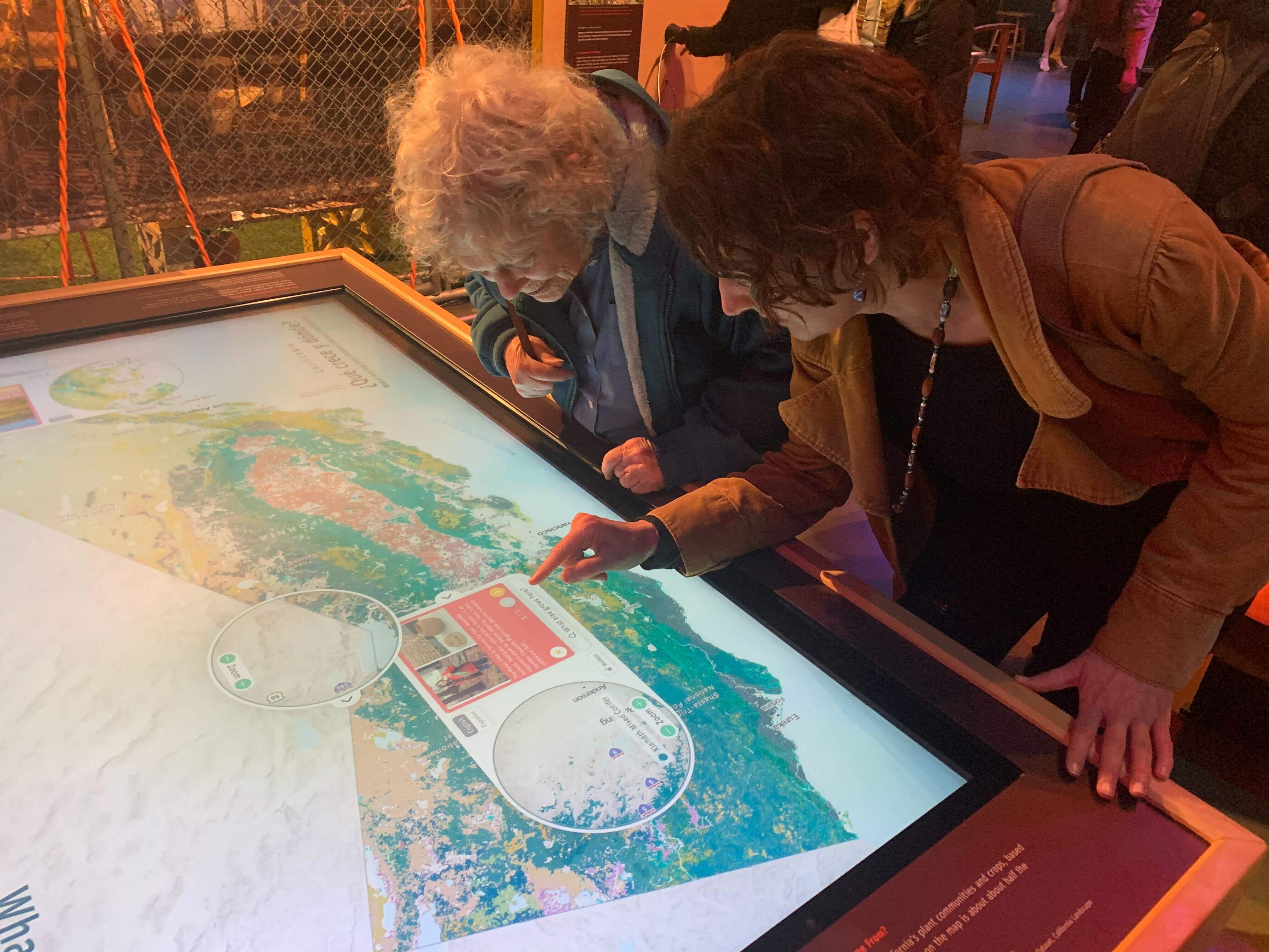
An immersive map experience on a large interactive touch table for museum visitors to explore the diverse plant ecosystems of California
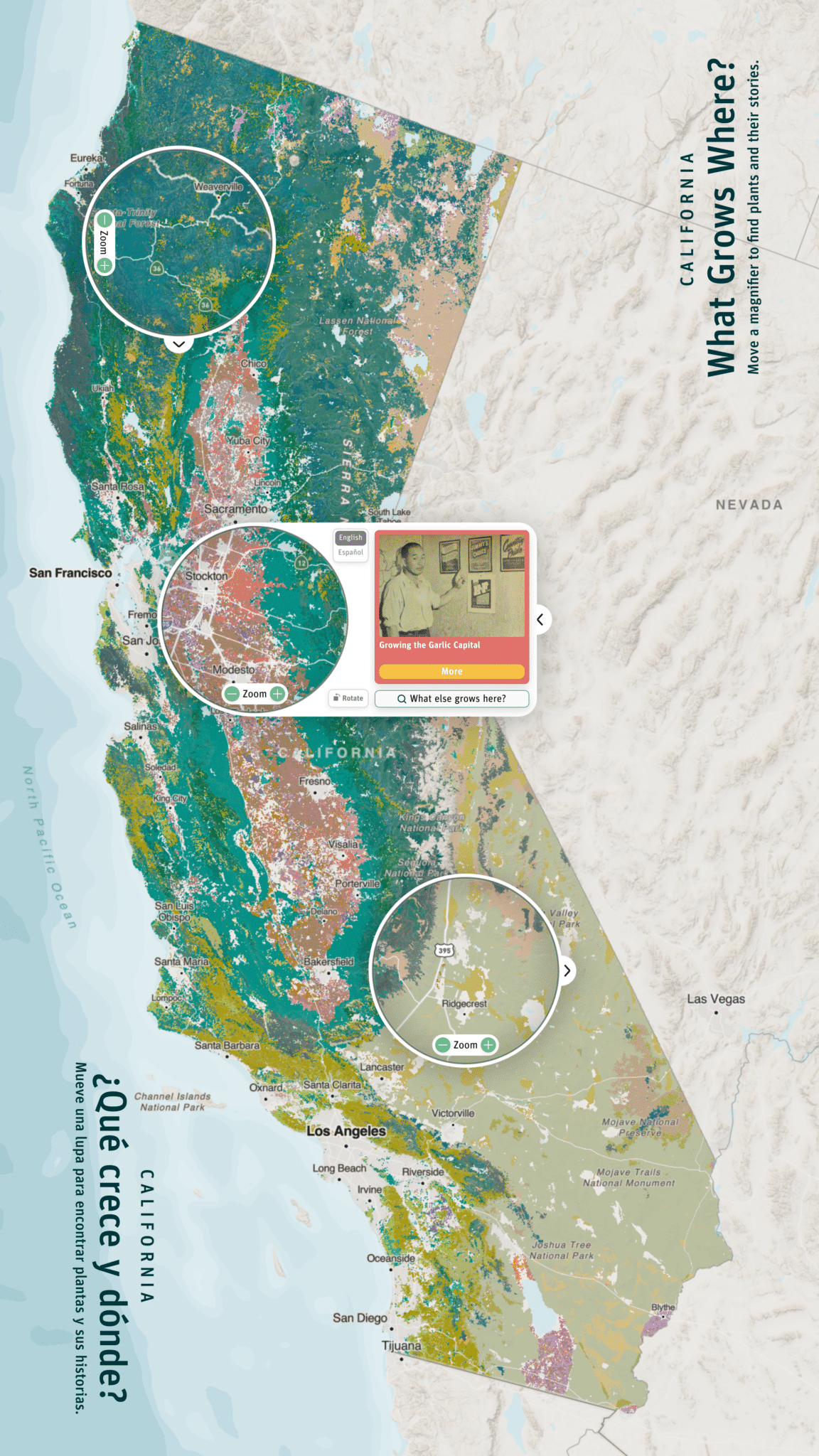
The Exploratorium reached out to Stamen to help with an installation for their exhibit, ¡Plantásticas!, which provides a unique exploration of the plant world in California through diverse perspectives. We worked with their team to create an engaging and educational map experience that integrates the lived experiences of communities all around California with geospatial data. The 65” touchscreen table allows visitors to navigate California’s plant geography using movable magnifiers on a large map, offering a playful yet powerful encounter for a broad audience, from grade-schoolers to graduate students. Overcoming the challenge of presenting a massive plant dataset in an interactive manner, we employed innovative design techniques like using the golden ratio for color palette and “geo-fencing” plant-related stories around the map for visitors to discover.
The map of California’s plant communities offers two paths for interaction: a story mode that reveals human narratives around the plant and agricultural world, and an explore mode that lets visitors dive deeper into the scientific complexities of all the plants in the dataset. With two modes, over 200 plants, and a multi-touch user experience in mind, we utilized new kinds of tools for development. Deploying and debugging remotely, we employed applications like TeamViewer for access and coordination with Exploratorium staff. To ensure multitouch support for simultaneous user interactions, we found solutions like mimicking touch events using TUIO protocol via a smartphone. In creating this interactive exhibit, we not only overcame technical challenges but also attempted to merge art and science, creating an immersive experience built to inspire a connection between visitors and the diverse plant ecosystems of California.