Facebook’s Own Global Base Map
Creating a beautiful and functional base map for billions of users
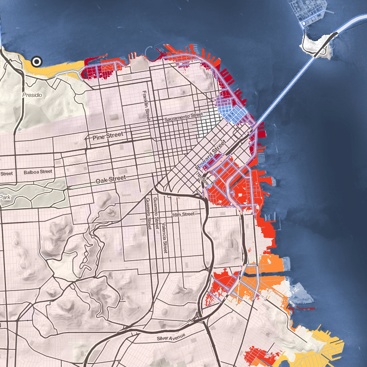
It’s been our privilege to work on one of our largest and most ambitious undertakings ever: collaborating closely with a team of Facebook engineers, designers, and data experts to roll out a global, multi-scale base map for all of Facebook’s billions of users.
Part of what makes the map special is the team’s emphasis on open data to power this map. The primary data behind this map comes from OpenStreetMap (OSM), an open-source, global database of geographic features, often called “the Wikipedia of maps”. Without OSM, building this map would have been nearly impossible. In addition to OpenStreetMap, at lower zoom levels our map builds on the foundation of Natural Earth, another open source curated dataset by and for cartographers (supported by Stamen and others over the years).
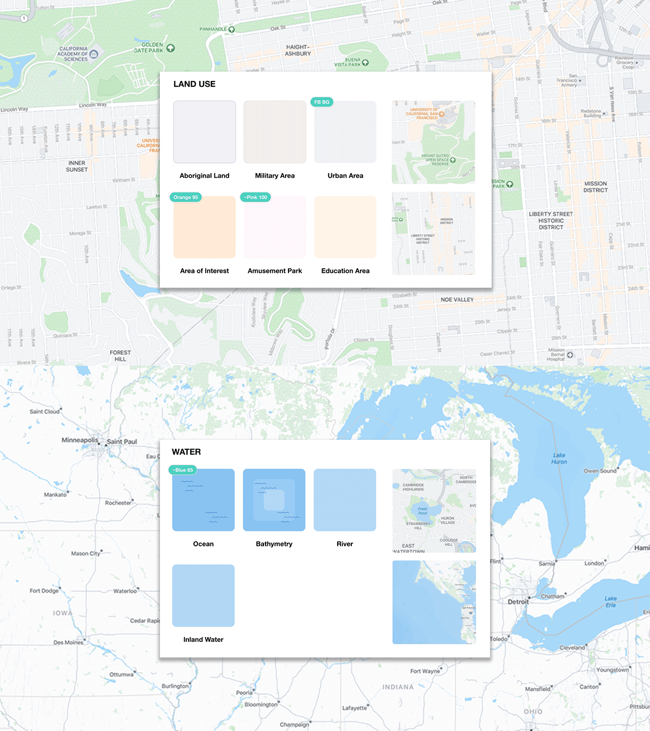
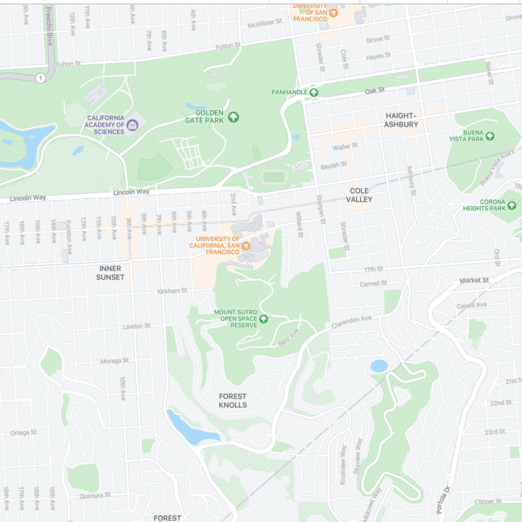
Given the purpose of the map, we wanted the cartographic aesthetic to be fun, engaging and have a Facebook look and feel. We aligned, where we could, our colors with those available in Facebook’s established color system. In doing so, the map sits more seamlessly inside of the larger product experience. The colors we chose for land, water and place labels immediately gives the map a Facebook aesthetic.