
I’ve been using OpenStreetMap (OSM) for over 12 years now, and to this day I’m still impressed and amazed by how far this project has come. The audacity of OpenStreetMap’s core ideals — that volunteers can create and maintain a detailed map of the world, and that this collaborative map would be more democratic and fair than any other — are constantly inspiring, and also frequently frustrating when we as a community have a hard time living up to those ideals.
We often say that OSM is a collaborative map of the world, but in reality, it’s a collaborative database of map features. There is only one database, but there are many possible maps that can be made from that data. But when it comes down to it, there’s still one map that matters most to the OSM community, and that’s the “default” map that you see on the OpenStreetMap website.
One thing that’s always frustrated me about that map is that it doesn’t include native reservations. You can add reservations to the database, (and many of us have been doing just that) but they don’t show up on the default map. As far as I can tell, no one has ever tried to add them. But since OSM is a collaborative, open source project, I have nobody to blame for that but myself. If you don’t like how something works in an open source project, then try to fix it yourself! So let’s try.
I just filed a “pull request” (which is open source speak for “here is a suggested modification to the code that I’d like you to consider”) on the GitHub repository for the default OSM map style. Here’s my pull request, #3521. And here’s the discussion issue to go with it, #3520. It’s just a simple change, but if they accept my request, then native reservations will start showing up on the map. It should look a bit like this:
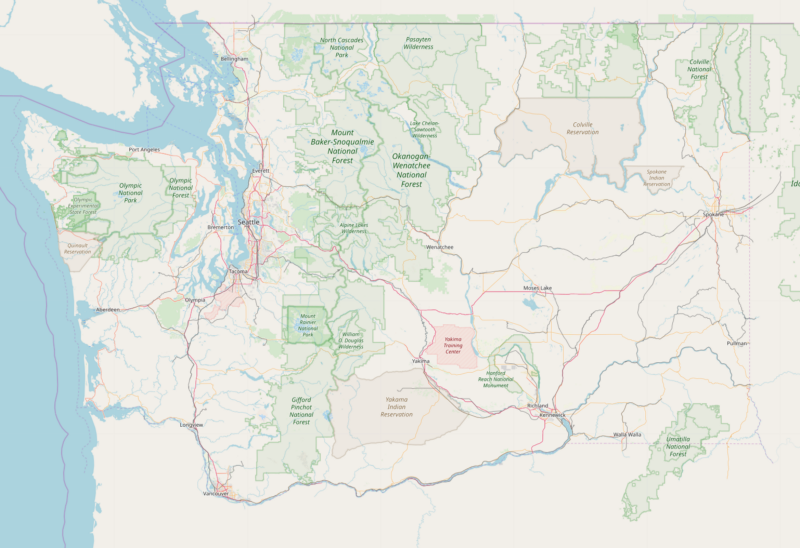
And like this:
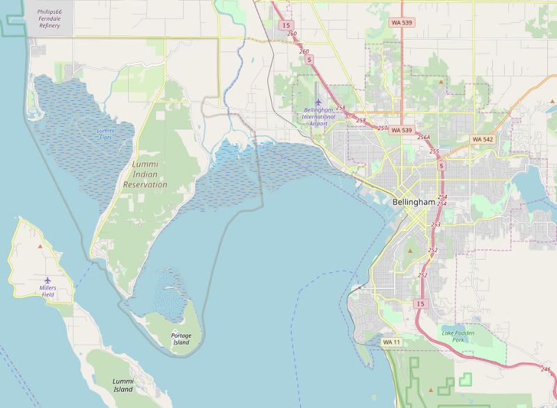
(See the GitHub discussion for more images).
If you feel like you know your way around GitHub and/or OpenStreetMap, please join the discussion and help out.
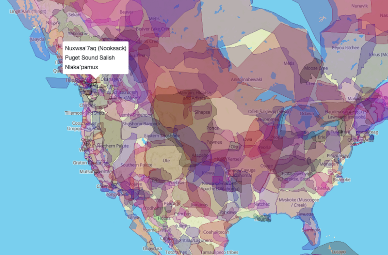
As someone who was born into a settler culture, I’ve lived my whole life on native land. Some of it was “legally” ceded under threat of force and questionable treaties, and some of it remains unceded to this day. These native reservations that should show up on the map are tiny compared to the traditional lands of the native people of North America, but mapping reservations is the very least we can do as a start. To see a glimpse of the full extent of claimed and traditional territory, check out the excellent map at Native-Land.ca.
Today is American Thanksgiving, and I give thanks to the Lhaq’temish (Lummi), the Nuxwsa’7aq (Nooksack), the Duwamish, the Ohlone, the Lenape, the xʷməθkʷəy̓əm (Musqueam), and all the other indigenous peoples who once lived and still do live on the lands that I’ve been lucky to call home.
Hy’shqe!
[crossposted from mappingmashups.net]
UPDATE: It looks like we may need to do some mailing list discussing (thread starts here) and wiki page voting (see the bottom of the page here) before all this is settled. If you’ve ever edited OpenStreetMap, please dive in!
UPDATE 2: Ok, so the tag for “boundary=aboriginal_lands” is now approved for the OpenStreetMap database! Now we could really use a Spanish and Portuguese translation of the wiki page. (Still to come: getting it to show up on the map.)
UPDATE 3: At long last (it’s now March 16, 2019) the style changes have finally percolated onto the public map for all to see! Thanks to everyone who helped with this process. Well done!
UPDATE 4: Later in 2019 I gave a presentation about this topic at the annual meeting of the North American Cartographic Information Society (NACIS). You can watch the video or read the transcript here.