
The San Francisco Parks Alliance (SFPA) began the Blue Greenway project back in June of 2004 with a simple goal in mind: to envision a 13-mile greenway/waterway network along San Francisco’s southeastern waterfront. The Blue Greenway will complete San Francisco’s portion of the Bay Trail, increase public interest and enjoyment of the waterfront, and provide much-needed open space, water access, and a new walking/biking route to San Francisco’s eastern neighborhoods. The project has a new map and website, live today, designed by us, huzzay!
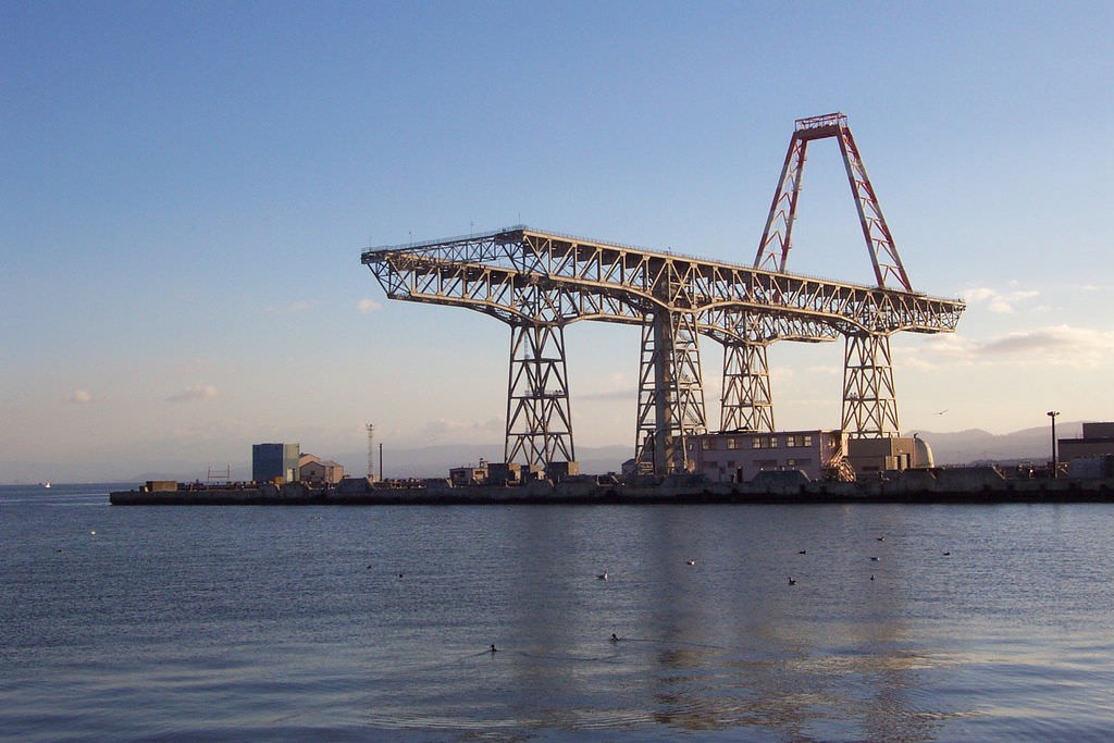
If you’ve ever taken a walk or bike ride along San Francisco’s southeastern waterfront you’re probably aware of its industrial past. The rundown shipyards, decaying docks, and towering steam stacks are all nods to the once busy industrial sector. As shipyards closed and jobs left the area, the industrial zoned land struggled for decades to reinvent itself.
In 2004 the Blue Greenway Steering Committee was formed and they quickly got to work educating the public through community events, conferences, waterfront tours, and public meetings. In 2005, Mayor Newsom started the Blue Greenway Task Force and asked them to develop a long-term vision for implementing the Blue Greenway.
Stamen was asked by SFPA in late 2015 to design and build a website, interactive map included, for the Blue Greenway. The website would serve as a hub for everyone interested in the project. From the community activist interested in attending the next neighborhood meeting, to the weekend kayaker looking for a place to launch his boat. An events calendar, stories from The Ohlone People to Biking the Blue Greenway, and a list of all the parks and open spaces along the Blue Greenway would complete the website.
That last bit was particularly tricky. The Blue Greenway is a collection of dozens of publicly and privately owned and operated businesses, parks, and open spaces, all with their own way of organizing (or, ahem, not) their geo data. Many of the parks and open spaces on the map needed to be individually drawn to ensure they would work nicely together on our map.
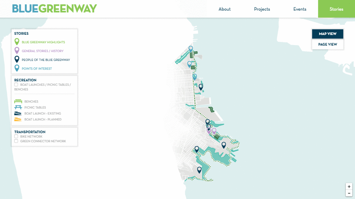
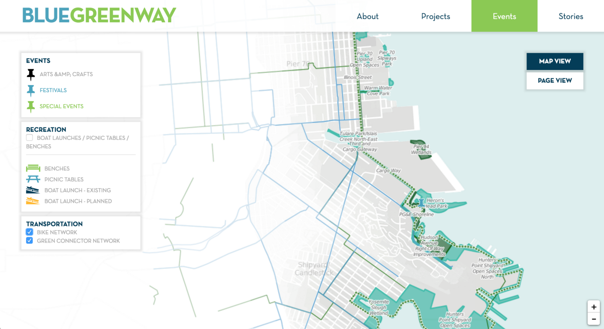
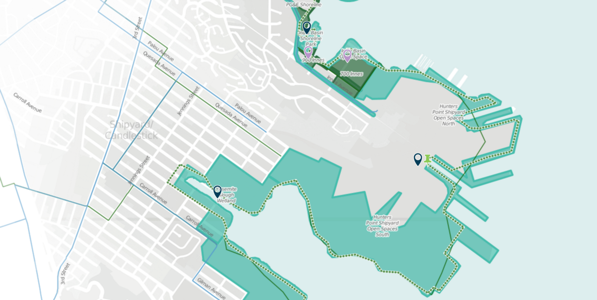
Apart from the parks and open spaces, we also added the bike network, green connector network, locations of boat launches, picnic tables, and benches. These transportation networks fade out on the map as you move away from the Blue Greenway itself, giving you just enough context without distracting you from the primary focus of the map. We designed and built all the map layers using the CARTO platform, which makes it easy for us customize the appearance of the map, and to update the map data as needed.
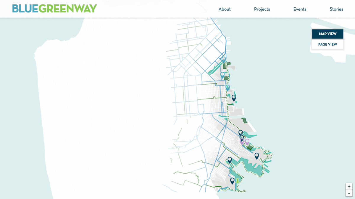
Note that we also customized the labels for each zoom level, showing just the right amount of information without overwhelming the map.
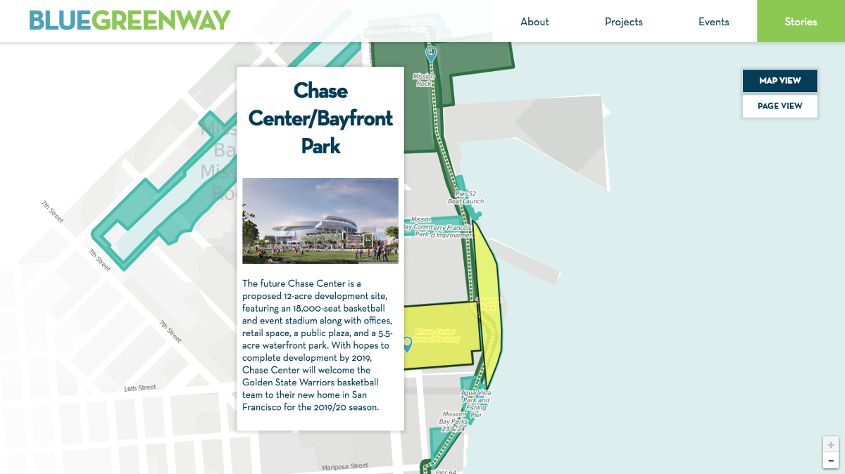
Last but not least, are the individual Blue Greenway projects themselves: Each of the green and blue polygons along the Blue Greenway are clickable, bringing up a pop-up window that tells you what’s going on in each of these projects. The markers and pushpin icons all reveal stories and events that are happening in or near the Blue Greenway.
We invite to you explore the site! Whether you use the calendar view to find events on a given day, the map view to discover what’s coming up in a specific park, or whether you just browse around the site to immerse yourself in the fascinating history of San Francisco’s South East waterfront, we hope you enjoy it!