Ed Ruscha’s Photo Archive for the Getty Institute
Exploring Ed Ruscha's never-before-seen photo archives of Los Angeles, over 50 years in the making
Background
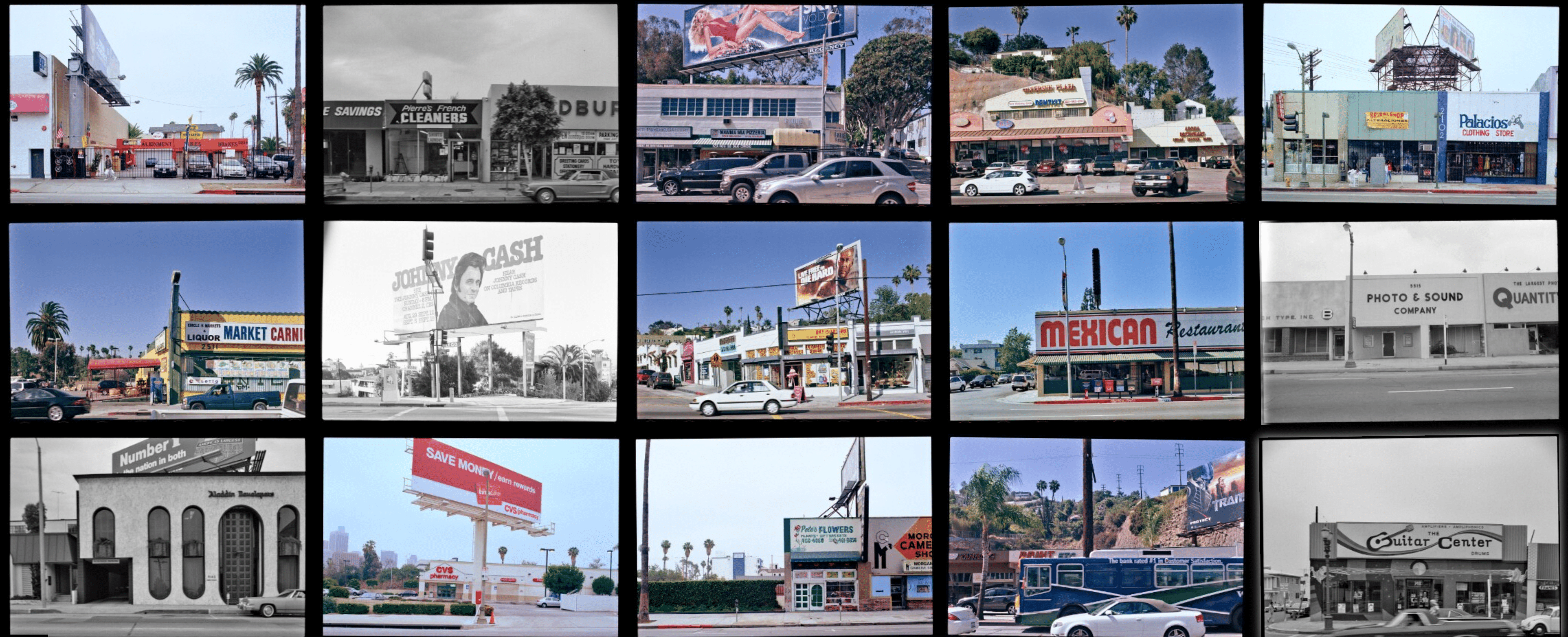
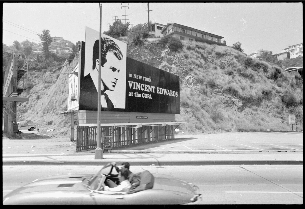
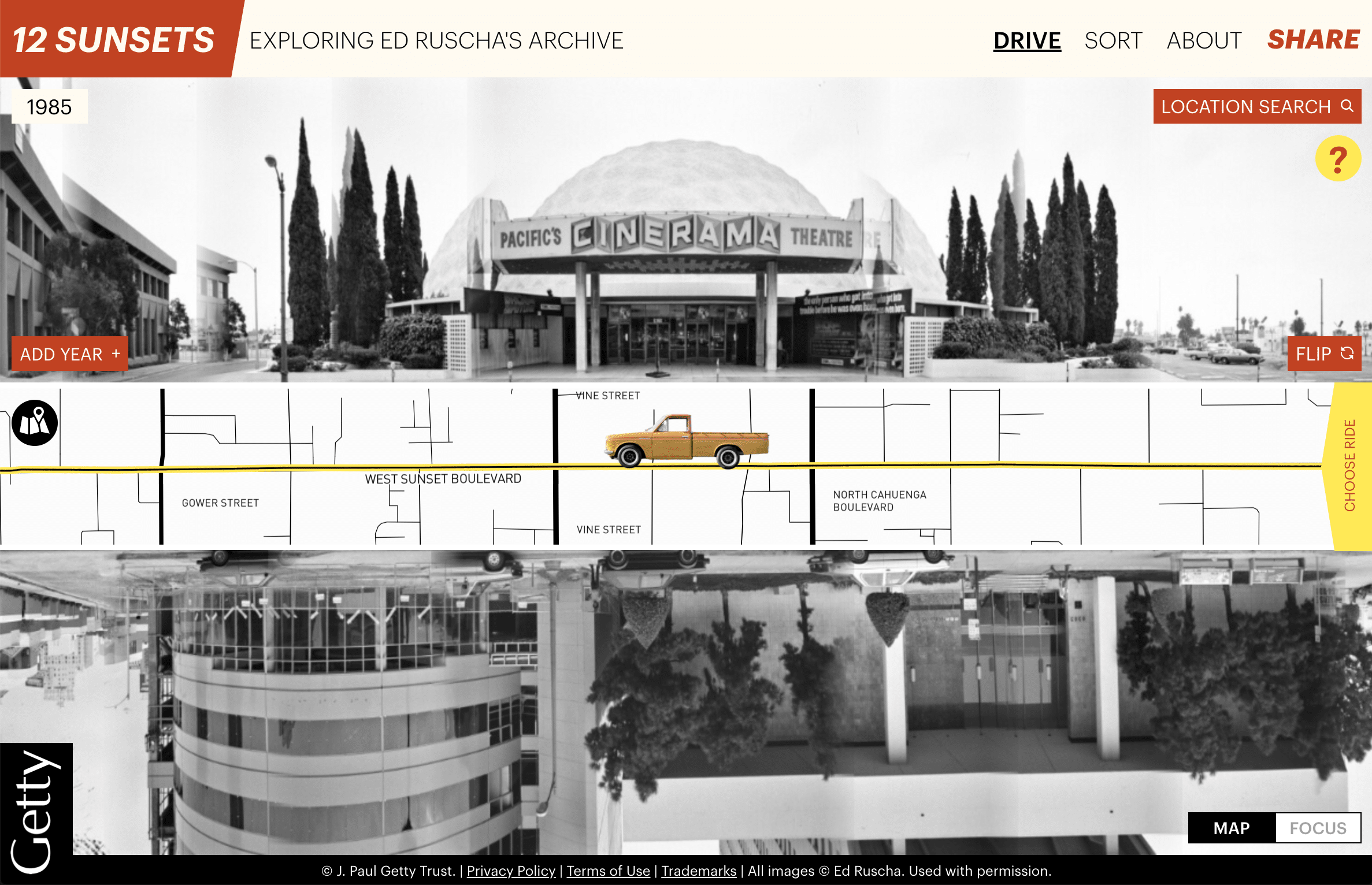
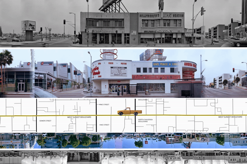
In 1966, Ed Ruscha drove along the Sunset Strip in West Hollywood, Los Angeles. Using a motorized camera mounted on the back of a pickup truck, he methodically photographed all of the buildings on each side of the street. He hand-assembled the photos in the artists’ book Every Building on the Sunset Strip, which changed how people thought about Los Angeles, art and photography.
Ruscha and his collaborators returned again and again to Sunset and various other Los Angeles streets documenting the cityscape for more than fifty-five years. And they continue to record Los Angeles’s thoroughfares today.
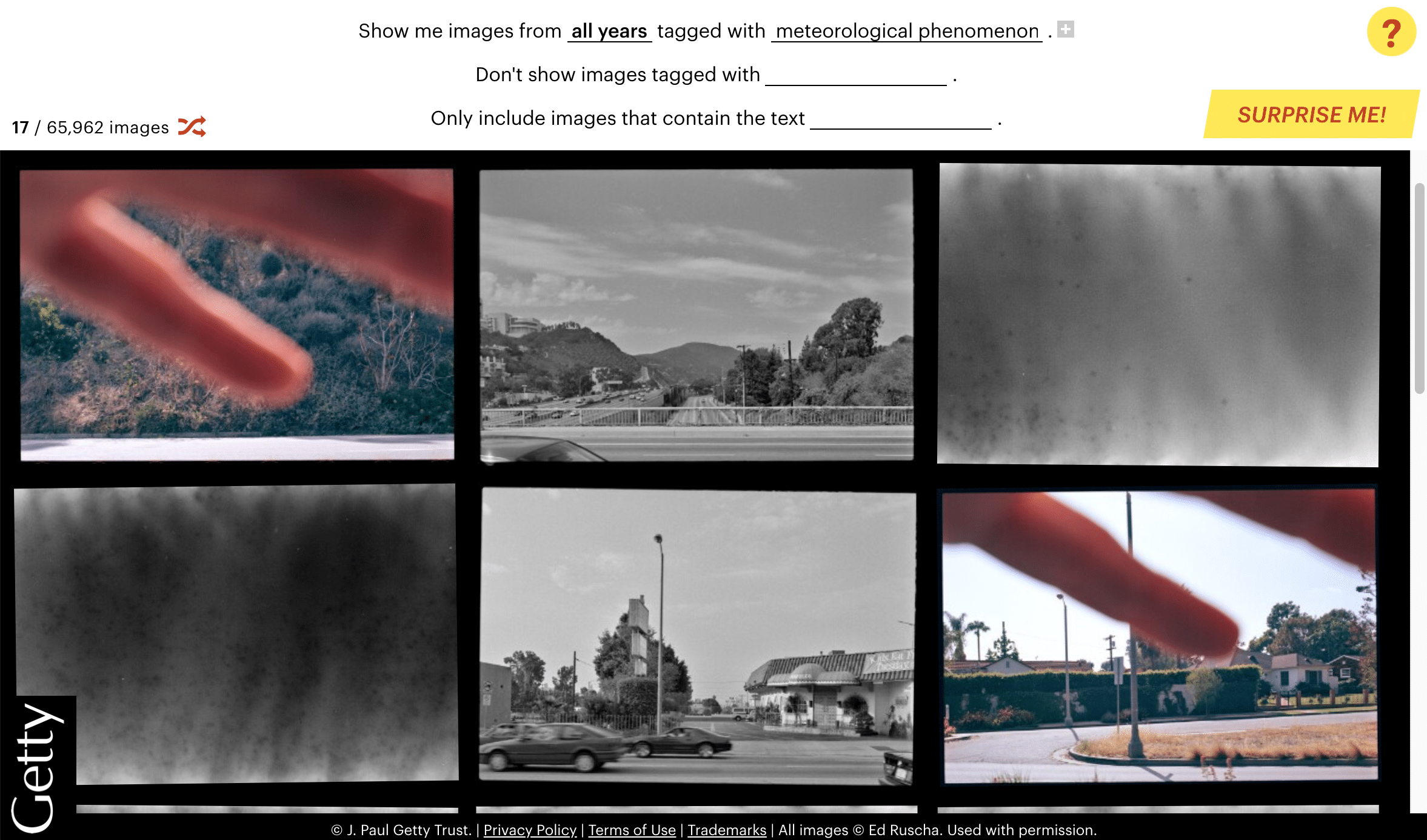
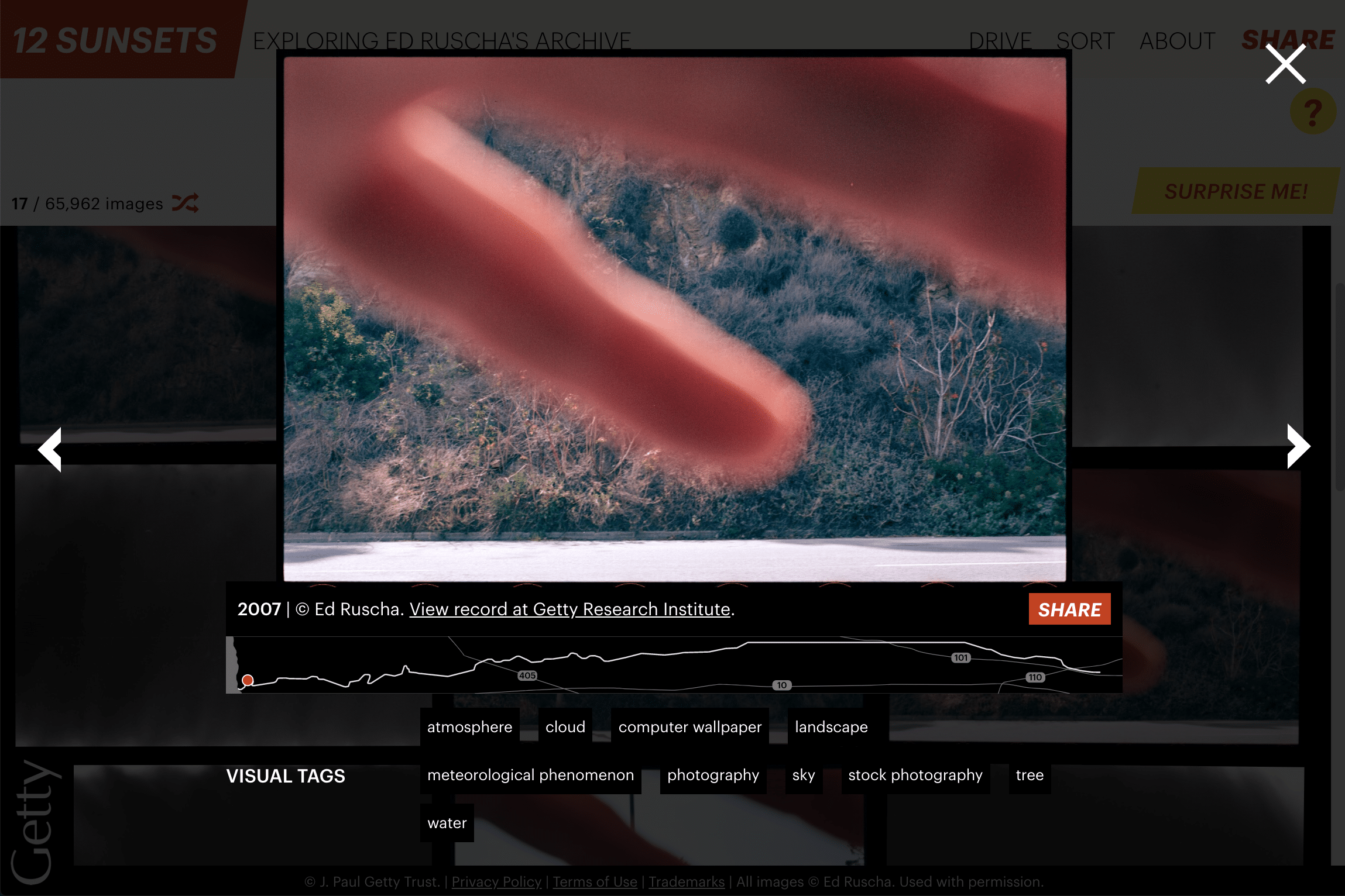
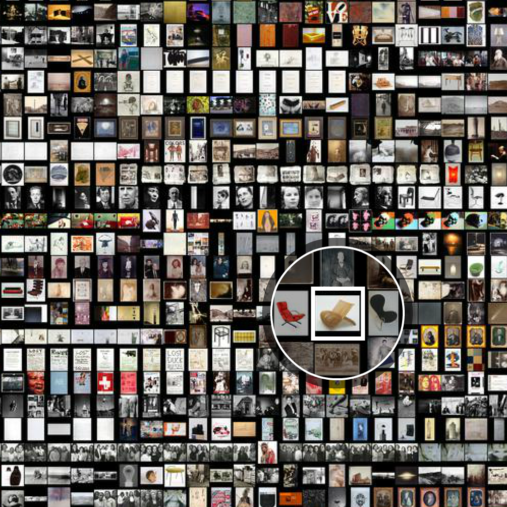
The resulting archive of Los Angeles evolving through time has remained mostly-unseen for decades; it is so vast that even Ruscha and his team have not seen most of the images. The Getty digitized more than 60,000 negatives from this collection of more than a half a million total images, and we’re honored that they selected Stamen to design and build the interactive data visualization that lets people explore this amazing collection.
What we made
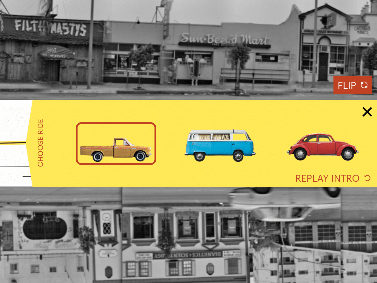
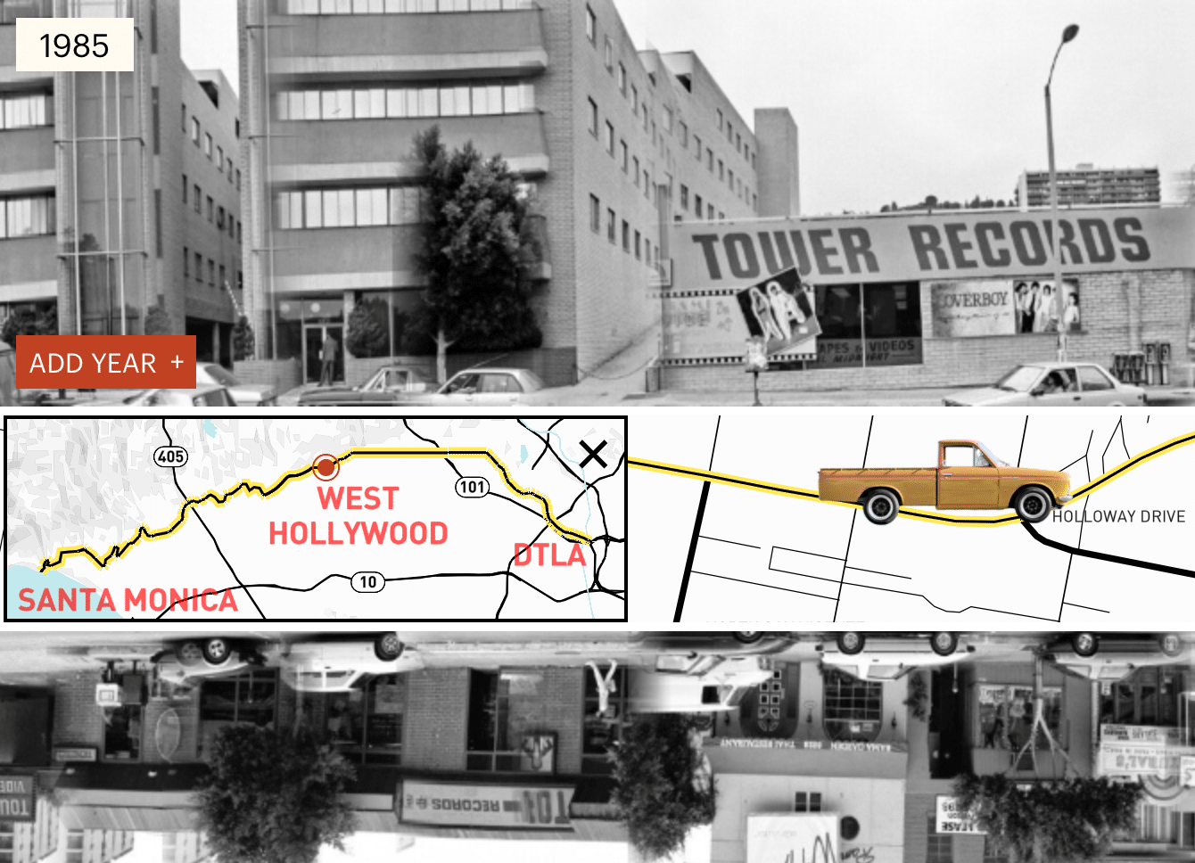
We built a dynamic interface that allows users to experience this vast collection by either “driving” up and down Sunset Blvd or by using a myriad of AI-generated tags to sort through the thousands of photos. The interface features a custom map (with styling inspired by classic Thomas Guides), a “light box” view to inspect a single image up close, and a way to compare multiple years side by side as you drive – there are five decades of images here to explore! You can also search for a location on or near Sunset Blvd and be driven right there. You can even select the type of vehicle you want to drive – whether it’s the very same Datsun truck Ed Ruscha used to capture his photographs, a cherry-red VW bug, or a groovy turquoise VW bus.