
When we launched CaliParks.org in February 2015, we also created a custom basemap especially to emphasize parks rather than the city names and highways that dominate most basic online maps.
We made sure to pull all the park boundaries and names from the California Protected Areas Database (calands.org). That’s the nation’s most complete set of statewide parks data, so we’re confident those are as good as any group of 11,826 things can be. (Yes, California has that many publicly accessible parks.)
But what about what’s inside parks? How can we show the trails and other amenities inside all those parks?
It wasn’t possible to contact the nearly 1,000 agencies who manage our parks and get official data. So we did what many web developers do: We went to OpenStreetMap, the largest and most detailed publicly available map of the world ever made.
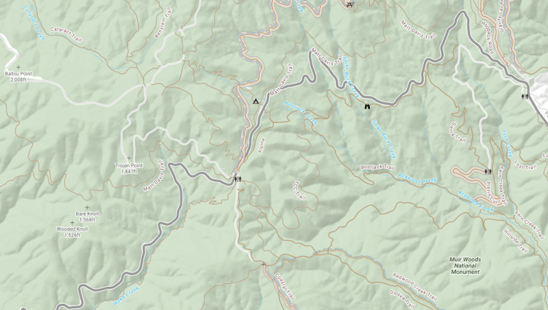
Soon after launch, however, we heard from the folks who manage the Marin Municipal Water District and the Marin County Parks District. In the much-loved (and very much used) lands surrounding Mount Tamalpais, we were showing illegal trails on our map. Some of those trails are more than just illegal: Using them causes erosion that damages habitat, including for endangered coho salmon.
That’s serious stuff. Because there was no quick fix for specific trails, we removed trails data from CaliParks.org sitewide.
From there, we took it as our mission over the summer to research a number of options for dealing with this. In the parks world, unauthorized trails are usually referred to as “social trails” — people make them informally, sometimes to grab a view from a summit or cut across a switchback.
In some ways, social trails are not unlike social media: At its best, the crowd finds the best possible route from A to B. But other times, it’s more like the meme you wish you could unsee: Oh, don’t go there!
So, we joined with Trailhead Labs to attend a hackathon in DC at the Department of Interior in April where solving the problem of social trails in OSM was our chosen mandate, and then we presented some of that work at a “Partners Outdoors” meeting held by the Forest Service in June.
The core challenge with such issues in the past has been that the most obvious “solution” — deleting the trails from OpenStreetMap — is not likely to work long term. The map is made by a diverse group if editors. Some work from experience on the ground. Some edit the map based on aerial photos. Of we delete the illegal trails from the map, they’re likely to get added back by a later editor who imagines the data is simply missing.
So, instead of degrading the completeness of the map, we enriched it by simply changing how the trails are tagged. So they go from simply being “paths” to being “social_paths”, and just like that, anyone who uses OSM can filter out unofficial trails. On the off chance that someone else is using the data for another purpose — perhaps even studying the impact of those social trails on wildlife and ecosystems — they too can benefit.
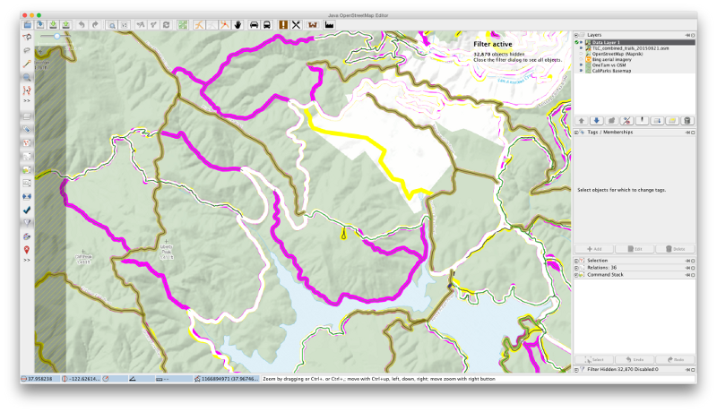
We used some basic tools to make views where data mismatches pop out with potentially illegal trails in magenta:
Now, we’ve brought trails back onto the map, and we’ve also documented in our FAQ how we can continue to improve trails and parks data as users find issues with the data. And, as always, one crucial value to this work is that when we edit OSM, the data gets better not just for CaliParks.org but also for anyone using OSM, including Mapbox.com and, soon, Facebook(for which Stamen is currently developing a new custom basemap).
“Thanks for your work on this and listening to our concerns,” says Matt Cerkel, a park ranger with the Marin Municipal Water District. “It is much appreciated!” Our pleasure!
And we’re thrilled that Matt Segues, Senior Natural Resource Planner at Marin County Parks, will be contracting with Stamen’s parks data partner, GreenInfo Network, to “patrol” all of his agency’s parks in OpenStreetMap.
We plan to continue to publicize the use of the “social_path” tag through social media, the OSM community, and in our work with other park agencies and relevant grassroots groups like Nerds for Nature and Maptime.