
Last Friday I had the pleasure of being hosted by Cooper Hewitt Smithsonian Curators Matilda McQuaid, Andrea Lipps and Cindy Trope at a visit to Cooper Hewitt in New York City. They’ve acquired our watercolor maps into the permanent collection of the Smithsonian! And they’re on display in the galleries. So I called up my New York people and brought them to the museum. You can see them in person now through September 2, 2024.
The show was really strong, with acquisitions of posters, tube seat fabrics, Nike hijabs, and lots of other things that reflected back to us the priorities of the Museum in this changing moment. But of course what really interested me and my guests was the corner room, where our watercolor maps were on as fantastic a display as I’ve ever seen them.

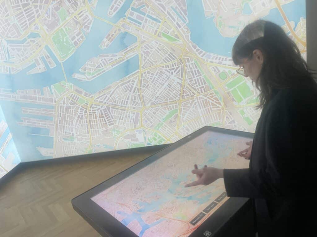
The maps have a natural boundary, which I’m pleased the curators decided to leave in, as opposed to (say) limiting the zooms or making some areas of the world off-limits. For technical reasons, we only rendered tiles when a user requested them by browsing to that place and zoom in the world, and then cached those so we wouldn’t have to render them fresh every time. This feels like a crucial part of the project; it’s a time capsule of what data Open Street Map had at the time as well as what people in the world looked at while the project was generating new image tiles. There’s very little of New York, for example, that hasn’t been looked at. But you don’t have to zoom very far into Bangalore to find missing tiles. Luckily you can zoom way down into the center of Beijing, where the Forbidden City is, or the ruins of the Forum in Rome, which have a feel that I haven’t seen anywhere else in the mapping world.

It’s one of the only maps I know of where different kinds of ruins look different than each other. My group speculated about a kind of map that would look different the more people looked at it, kind of like you know right aware where You Are Here is on an old subway station map because it’s the one place that has been worn away by people’s fingers pointing at it. A big part of why I got into map making (and why Stamen exists) was to play with these kinds of ideas, to insist, loudly, that maps are for more than finding directions to the nearest coffee shop, and that they can engage is in all kinds of questions about behaviors, power, patterns and delight. Sometimes it can feel like we’re further away from that than we perhaps were, and I’m delighted to report that this feeling is still very much alive, and preserved—in perpetuity!—by the Smithsonian.
