
Today we launched CaliParks.org for the state’s Parks Forward Commission. CaliParks.org is the first statewide parks search engine that brings together expert-level park boundary and management data with social media content from Instagram, Flickr, Twitter, and Foursquare.
Our mission was to create a statewide search engine for parks that would show you information about parks regardless of agency, so you don’t have to know (or care) who runs the park you want to visit. You just want to know where it is, what you can do there, and how to get there.
With the definitive California Protected Areas Database (calands.org), CaliParks.org can tell you exactly which of the state’s 11,826 public parks are near you.
With activities data from Hipcamp.com and GreenInfo.org, CaliParks.org will help you find out where you can do your favorite activities, from rock climbing to shooting hoops.
And you can see what people are doing in those parks from photos contributed by more than half-a-million people, updated from Instagram and Flickr daily. Counts of Tweets and Foursquare check-ins within the parks give a sense of overall popularity and use.
Tabulating those numbers in recent weeks reaffirmed a core tenet of this project: Parks are social. And diverse Californians will see themselves in parks. We know because we see them on social media. And showing that creates an invitation to share these public spaces. Indeed, the fundamental design principle for this project is that open data and social media can come together to create deeply useful tools to help people get out and enjoy nature together in their daily lives.
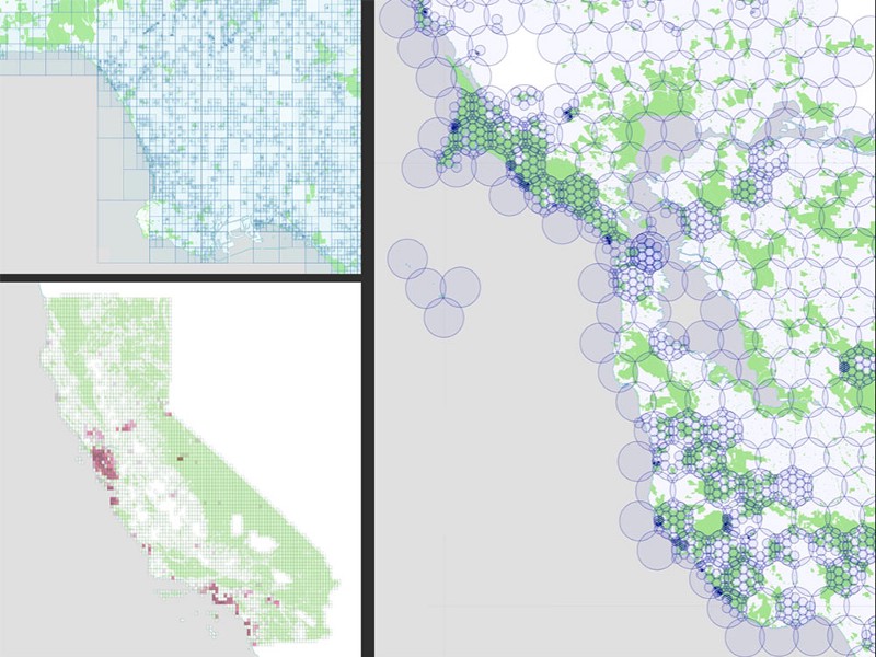
Based on R&D work we’d done to harvest social media posted within every public park in the state (parks.stamen.com), we were engaged by Resources Legacy Fund and the state of California’s Parks Forward Commission, charged with charting the future of public parks in the nation’s most populous state.
The products of our previous research work — complex maps of real-time social media that are beautiful in their own right — became the infrastructure upon which we’ve built a simple, powerful tool.
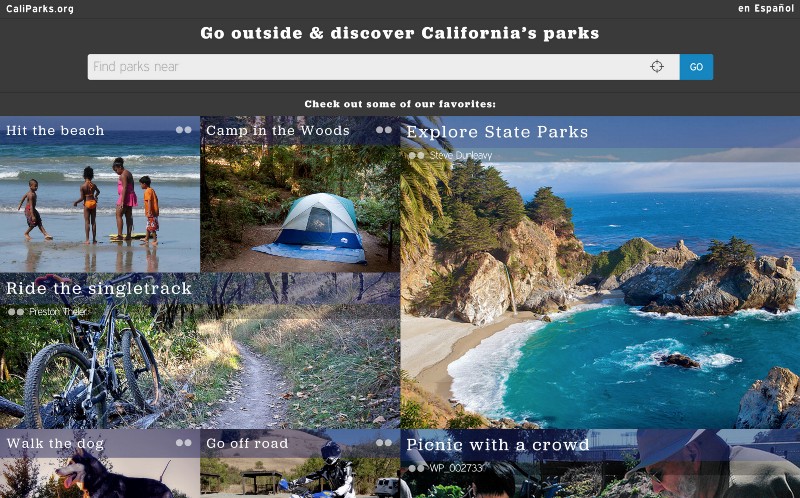
The first view of the site is a prominent search bar where you can enter a location (anything Google can geocode) or hit the “locate me” button to get a list of parks near you. You can also tap one of the “story blocks” to get nearest-first curated lists we’ve assembled around several different themes.
From there, you can narrow and tailor your search to see just the activities you’re most interested in.
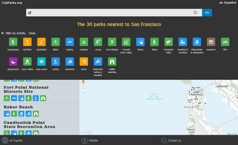
At launch, we have activities data and official park URLs for 816 large wilderness parks, plus key city park activity data for 5,447 urban parks across the state. And we have a web application that’s built for mobile. An interface available in English and Spanish (a big shout-out to Latino Outdoors for help on translation and user testing!). All tied into native routing software available on every smartphone.
But it’s really just a start. There’s a lot more data that could be harvested, and a lot more service to provide to California, and potentially other states and nations!
We especially hope to expand on the key idea that using social media and open data as a content database both radically opens up the parks conversation and also substantially reduces the risk of launching a new application.
A radically open conversation means that sometimes we might hear and see things that make us uncomfortable. But with daily image harvesting, the solution is clear: Head out to the park you love and post some images! (Just make sure your location services are enabled.)
Result: A richer and more engaging view about that park on CaliParks.org.
But more importantly: A richer and more engaging representation of that park across diverse social media conversations.
It might have been safer to build a walled garden: A site where we could control all the content all the time. But securing images for nearly 12,000 parks would be a monumental task.
And if we’d gone down that road, tending that walled garden would do little for the larger conversation around parks in California. And the more effort that goes into a walled garden, the greater the risk: Walled gardens can be beautiful. They also tend to be short-lived.
By tapping into the rich social stream created by hundreds of thousands of people living their lives and sharing their experiences, we hope CaliParks.org can be a key tool in building the parks conversation and community over the long haul.
Now, it’s time to get outside. Find and share your next adventure at CaliParks.org!