
Recently, we worked with the City of Boston’s Office of Emerging Technology to design a prototype curb regulation map, making it easier for Boston residents and visitors to find parking and understand the many overlapping rules and restrictions governing the city’s streets.
For most cities, managing curb use is a major challenge that is often overlooked or deprioritized. In a city as dense, historic, and complex as Boston, there is rarely a single authoritative source for curb rules. Information about parking regulations, loading zones, time restrictions, and accessible drop-off areas is often spread across multiple city departments, inconsistently maintained, and sometimes missing entirely, leaving street signs as the only real source of truth. This makes city management inefficient and leaves residents frustrated and confused.
The City of Boston is tackling this problem with the Boston Curb Lab, an initiative of the Office of Emerging Technology launched in February 2026. Working with a coalition of partners (including Cambridge Systematics, CurbIQ/Arcadis, and the Open Mobility Foundation) Boston is building a modern curb data infrastructure: using AI to scan and interpret parking signs, creating an authoritative and continuously updated database of curb regulations citywide, and publishing it via open APIs using the Curb Data Specification (CDS), an open standard that makes this data accessible to mapping apps, delivery platforms, and other city services.
Stamen’s role in this project was to design a simple, clear map style and an intuitive public interface that gives residents direct access to this new database. We studied a wide range of existing parking maps and apps during our research. One of the key tradeoffs we identified: if you try to display too many curb zones and restrictions simultaneously, the map quickly becomes overwhelming and hard to interpret. Clarity requires curation, but no static curation of the data can meet every user’s needs.
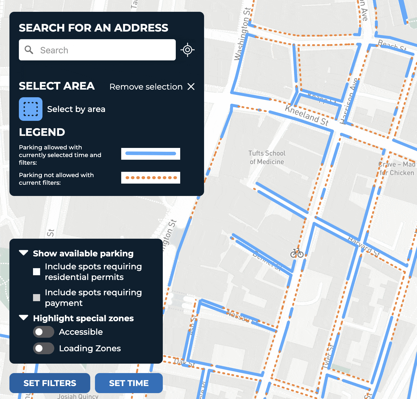
We opted to keep the map’s colors and symbols as simple as possible, leaning heavily on dynamic filtering to give users a direct answer — essentially a “yes” or “no” — based on the time they’re searching and their specific situation. Are you looking for a loading zone? Accessible parking? Do you have a neighborhood resident permit? The map updates to reflect your needs.

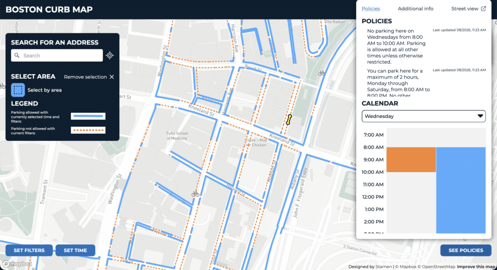
To learn more about a specific location, users can click on any curb segment to see which parking policies apply there. Because many policies only apply at certain times of day, and because multiple overlapping rules can be in effect simultaneously, we include a graphical timeline view showing exactly when each restriction is active.
Users can also refine the map view with filters to specify whether they want to include parking that requires a permit or payment:
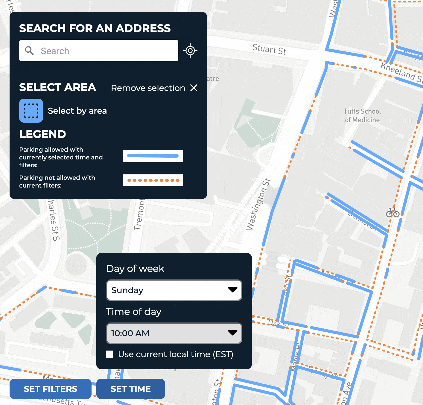
And by setting a specific date and time, users can plan ahead — checking where parking will be available when they arrive for work in the morning, head out for dinner, or attend an event later in the week.
The map initially covered the Chinatown neighborhood, has been expanding citywide as the underlying data becomes available. We also fully expect the design to evolve as more city departments and community beta testers try out the application and share feedback.
We’re excited to continue working with Boston as the Curb Lab moves into its next phases. What inspires us most about this project is the breadth of its vision: a city’s curb space is far more than a place to park cars. It’s a public resource used for outdoor dining, food trucks, accessible drop-off, community events, and more, and it deserves to be managed thoughtfully and transparently. We’re also excited that all of the Curb Lab’s tools will be open-sourced, so other cities can adopt and build on Boston’s work. To follow upcoming developments from the Curb Lab, visit boston.gov/curb-lab.