Next week, cartographers from across the globe will gather in Pittsburgh for NACIS 2023 to share their latest and greatest work in map design, development, and storytelling.
This year Ross Thorn and Kelsey Taylor will have the pleasure of presenting on a range of topics touching several of the projects we’ve been working on this year.
Developing an Open-Source Cartography Toolkit
Wednesday, October 11, 2023 — 9am
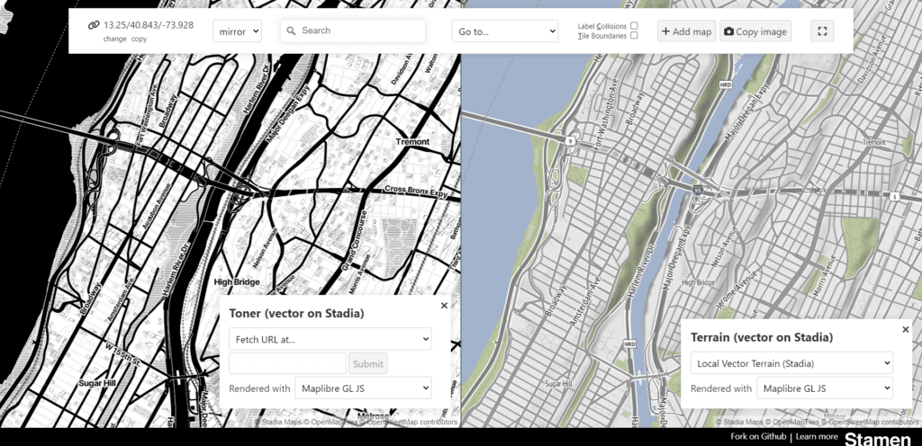
Map design for vector cartography faces a unique set of challenges that make much-existing design tooling insufficient. In addition to translating design decisions into the specification of stylesheets, designers must understand the underlying data, its structure, and how it interacts with other features in the world to create maps. While tools such as Mapbox Studio have made this much easier, there are still gaps. In the past two years, Stamen Design has made a concerted effort to improve and add to its internal tooling for cartographic design. In this presentation, we will discuss some of these tools and how they let us incorporate design systems, view and compare maps, track changes, and create variations of map styles.
Sites of Shame: Telling the Stories of Japanese American Confinement Through Maps
Wednesday, October 11, 2023 — 10:45am
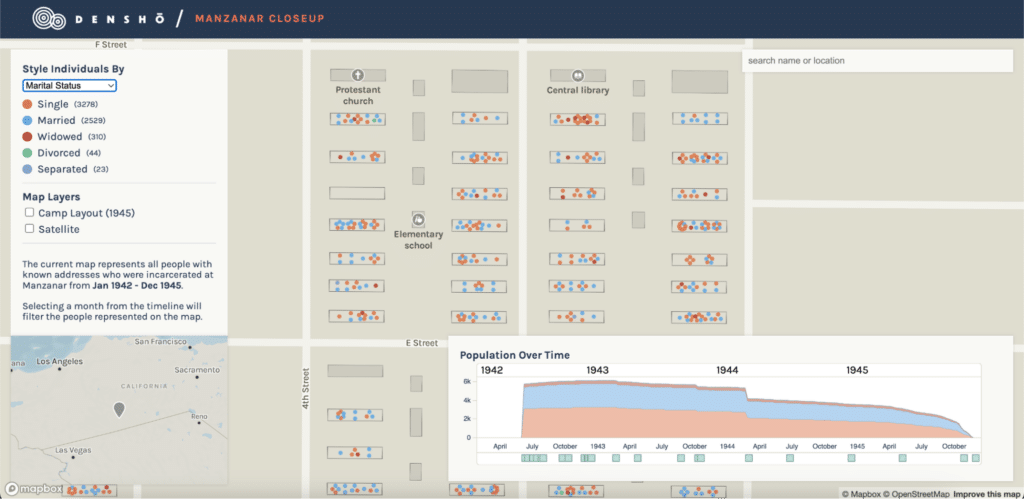
During World War II, over 125,000 individuals of Japanese ancestry, including two-thirds who were U.S. citizens, were unjustly detained without trial in the U.S. In 1996, Densho, a non-profit organization, started documenting their stories. In 2005, they launched the “Sites of Shame” project to map the locations of detention centers, exclusion zones, and the movement of the imprisoned population. This talk explores the collaboration between Stamen Design and Densho, focusing on updating the “Sites of Shame” project and our joint efforts in 2023 to create a detailed map of the Manzanar concentration camp.
Cartography Pro-Tips: Creating Basemaps for Amazon Location Service
Friday, October 13, 2023 — 2pm
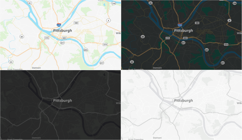
In 2022, Amazon Location Service brought on Stamen Design as a partner to help develop and launch new interactive basemap styles as part of their Open Data Maps collection. Together, we have produced four maps: light and dark versions of a full-color reference map suitable for data overlays, and a pair of more muted map styles appropriate for visualizing more complex data. In this talk, we discuss what makes these maps unique and best practices for making maps using a global set of vector tiles built from OpenStreetMap data.
Capturing the Essence of Los Angeles with Cartography
Friday, October 13, 2023 — 4pm
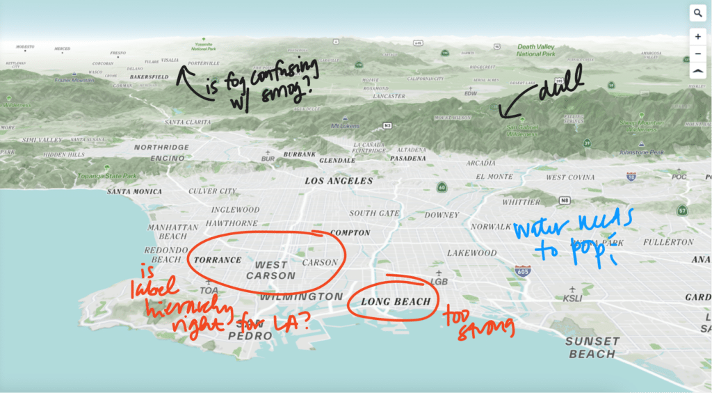
Earlier this year, Stamen Design collaborated with Spherical to design a custom, branded vector tile basemap for their Living Infrastructure Field Kit mapping tool, which allows workshop participants to identify opportunities for community projects in greater Los Angeles. Designing this map meant capturing the essence of L.A. while providing a clean slate upon which participants could dream about positive change. In this talk, we will discuss how we translated soft requirements (how should a map look or feel?) into a beautiful, useful basemap with brand elements, 3D terrain, and detailed landcover data.
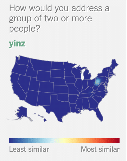
And of course apart from our talks there are so many more we are looking forward to. See yinz in Pittsburgh!
