This post was originally published on stamen.com by Shawn Allen.
We’re proud to announce that Trees, Cabs and Crime will be on display in the U.S. Pavilion at the 13th Venice Architecture Biennale this fall. The Institute for Urban Design was chosen by the U.S. Department of State’s Bureau of Education and Cultural Affairs to organize the pavilion this year, which they dubbed Spontaneous Interventions: Design Actions for the Common Good and features “projects initiated by American architects and designers aimed at bringing positive change to the public realm.”

The Process
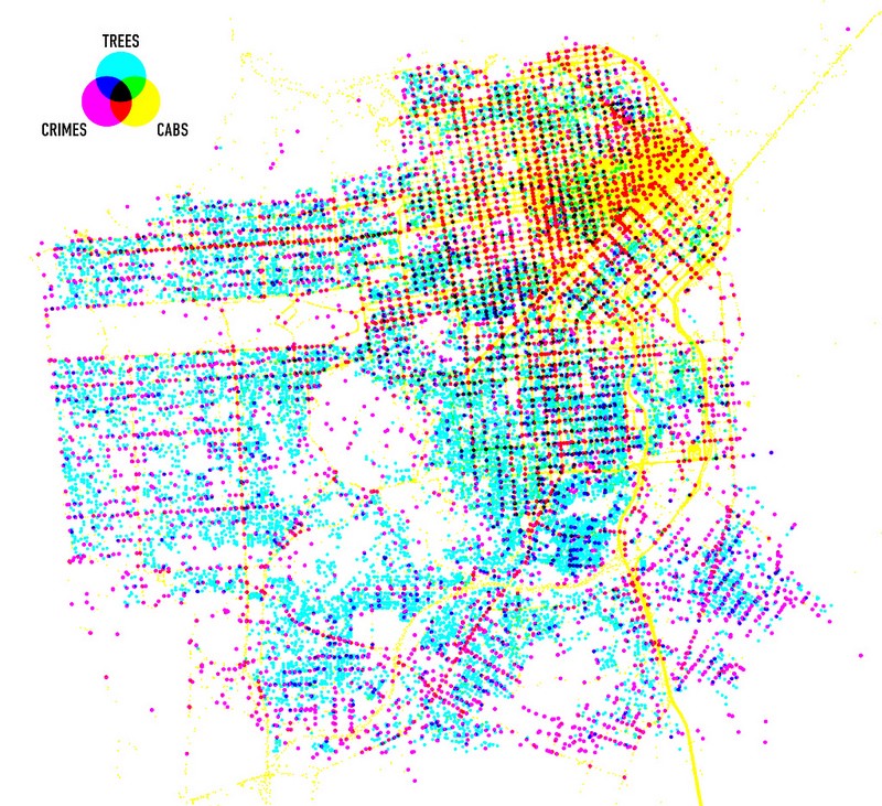
I made the original rendering on a rainy Sunday in February, 2009, using three data sets:
- The locations of trees under the care of Friends of the Urban Forest, a community of volunteers who plant and maintain nearly 1,000 new trees in San Francisco every year.
- A single day of Yellow Cab taxi locations from Cabspotting.
- A week of SFPD report locations from Crime Reports (crime data wasn’t publicly available until later that year, when we launchedSan Francisco Crimespotting).
My goal was to overlay the three data sets in such a way that overlapping areas would produce new color combinations. So, rather than just overlaying each dot on top of one another, I put each data set into its own “color channel” and combined them with subtractive blending, just like what happens in the CMYK printing process:


The resulting image didn’t inspire the a-ha! moment that I’d hope it would, but it turned out to be beautiful nonetheless. And, more importantly, it shows us San Francisco through a lens that nobody had thought to look through before. Without a coastline, streets, or park outlines as reference points, you can still make out the rough shapes of urban activity. You can see that not only is it hard impossible to catch a cab in the Outer Sunset, but that the neighborhood also has one of the lowest concentrations of trees in the city, and that crime occurs almost exclusively on the named streets running east-west, rather than on the numbered streets running north-south:

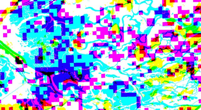
The effect works especially well with differently shaped data. Last year we experimented with it on one of the data themes from VPRO’s Netherlands from Above, and it looked amazing:

Abstracting Awesomeness
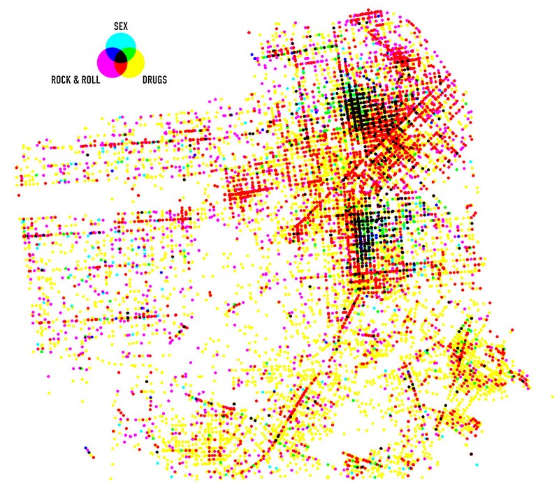
2009 feels like a long time ago, so I’m not too ashamed to admit that I created the original Trees, Cabs & Crime with Flash and a screenshot. Thankfully, though, the IFUD gave me an excuse to recreate the image when they requested a higher resolution copy for printing. So this time around I did it in Python (using Mike’s awesome Blit module) and published the source code on Github. I also made a less serious image using nine years of SFPD reports. As you can see, the Mission and the Tenderloin like to party:

The U.S. Pavilion at this year’s Venice Biennale will be open from August through November. If you’re lucky enough to find yourself in Venice for it, we’d love to know what you thought. And be sure to tweet @stamen if you make something cool with the code!
