
The State of the Map US (SOTMUS) 2025 conference in Boston, MA was yet another fantastic gathering of cartographers, mappers, and map enthusiasts. Stamen was well-represented this year by Kelsey Taylor, Eric Brelsford, and Eric Rodenbeck.
We presented two talks on Stamen projects related to open source tooling with maps. Now that we’re back in the swing of things, we wanted to share some of the highlights from our time in Boston.
Kelsey’s talk
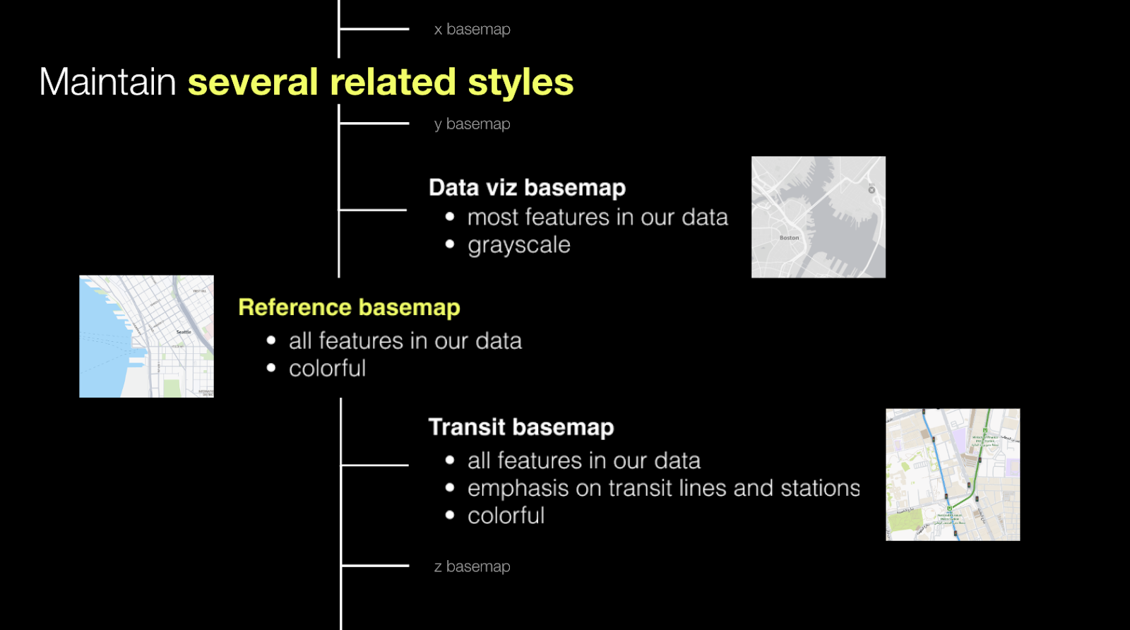
Kelsey presented about one of our core carto tools projects, Map GL Style Build (aka the build system). We use this open source tool in most of our cartography projects to expand families of map styles efficiently to cover all use cases. Check out our slides here and watch her presentation here.
Eric’s talk
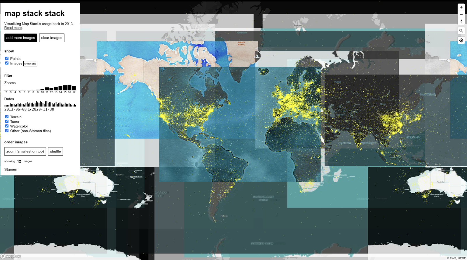
Eric Brelsford presented about the graceful retirement of Map Stack, Stamen’s raster map stacking tool. Instead of sunsetting the tool altogether, we created Map Stack Stack, where users can dig into the 500k+ images created using Map Stack over its 10-year life. Check out Eric’s slides here and watch his presentation here.
Presentations and conversations we enjoyed
As usual, there were many fascinating talks at this year’s conference. Thankfully, most of them are recorded so we can share them after the fact (or catch ones we missed the first time).
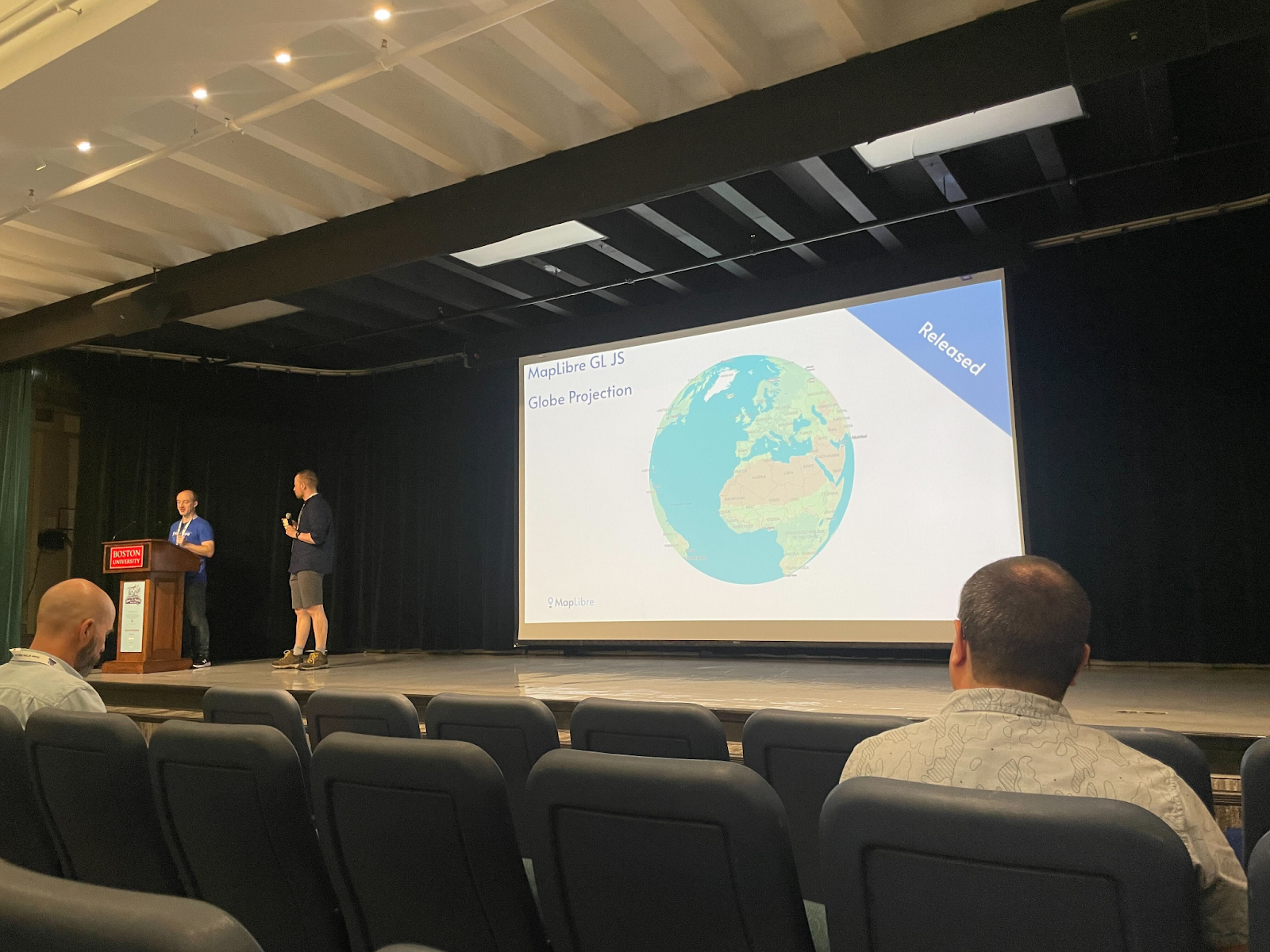
We’re always interested in hearing the latest from our friends working on MapLibre development. Yuri Astrakhan and Bart Louwers shared many interesting updates on progress across their wide-ranging brief. Stamen uses MapLibre across several of our projects and most of our carto tools support MapLibre GL. Watch their presentation here.
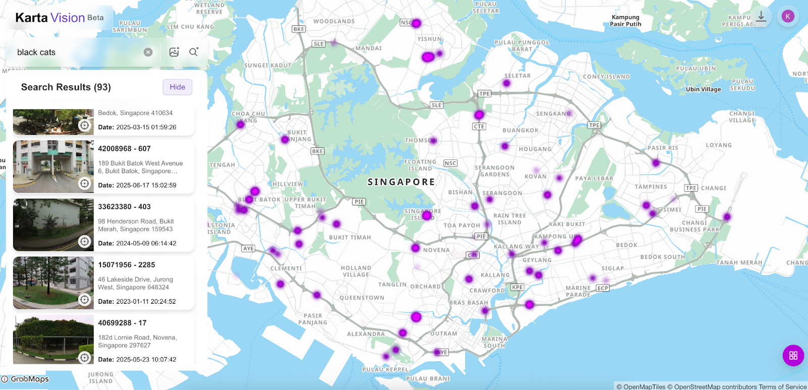
We were also fascinated by KartaVision from Grab, a tool which crowdsources streetview imagery and uses AI to identify searchable items in each image. The level of detail here is impressive – we’re excited to see what this technology and data will unlock for historically undermapped areas. Watch their presentation here.
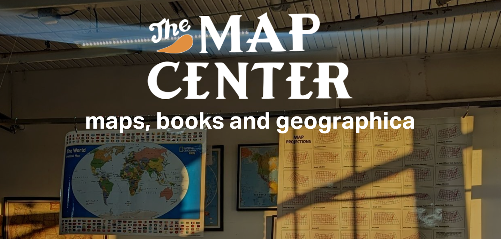
It’s always great to hear how people interact with maps in the physical world, especially with the enthusiasm Andrew Middleton brings to the table. Hearing the ebbs and flows of owning a brick and mortar map store definitely makes us appreciate how easy working in the digital space is by comparison. Watch Andrew’s presentation here. It was also fun to pore over the newest book for sale at The Map Center, Damian Saunder’s Maps on Vinyl (which one of us may have purchased) in person.
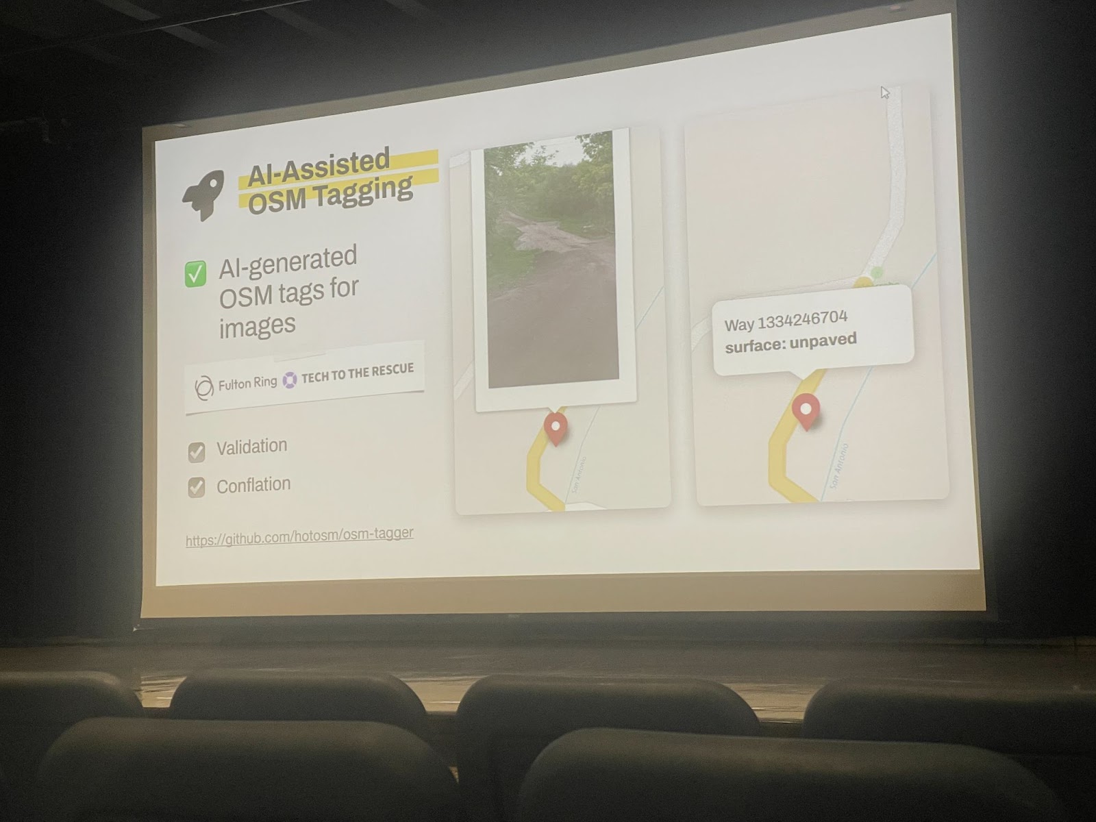
We were really impressed by the OSM Tagger tool from the Humanitarian OpenStreetMap Team, which mixes WhatsApp and AI to create an interface that allows people to easily upload geotagged imagery and describe what’s in it. We’ve long been interested in making it easier for people to contribute to OpenStreetMap, with projects like Field Papers that let you gather geo-tagged information about places using the low-tech medium of QR-encoded printouts on paper. OSM Tagger feels like a modern successor to Field Papers, radically improving the ability of people with very little technical experience to contribute meaningfully to the mapping of their world, using hardware and software that’s already in their pockets. Watch their presentation here.
A few other talks that are worth checking out once videos are posted:
- The other streets: adding NYC Honorary Street Names to visualize communities, on mapping honorary street names in a particular neighborhood in Manhattan and the stories behind those names
- How we mapped the Richmond Water Crisis, about a crowdsourced map where people could report their water status in Richmond during its recent water crisis
Stamens old and new!
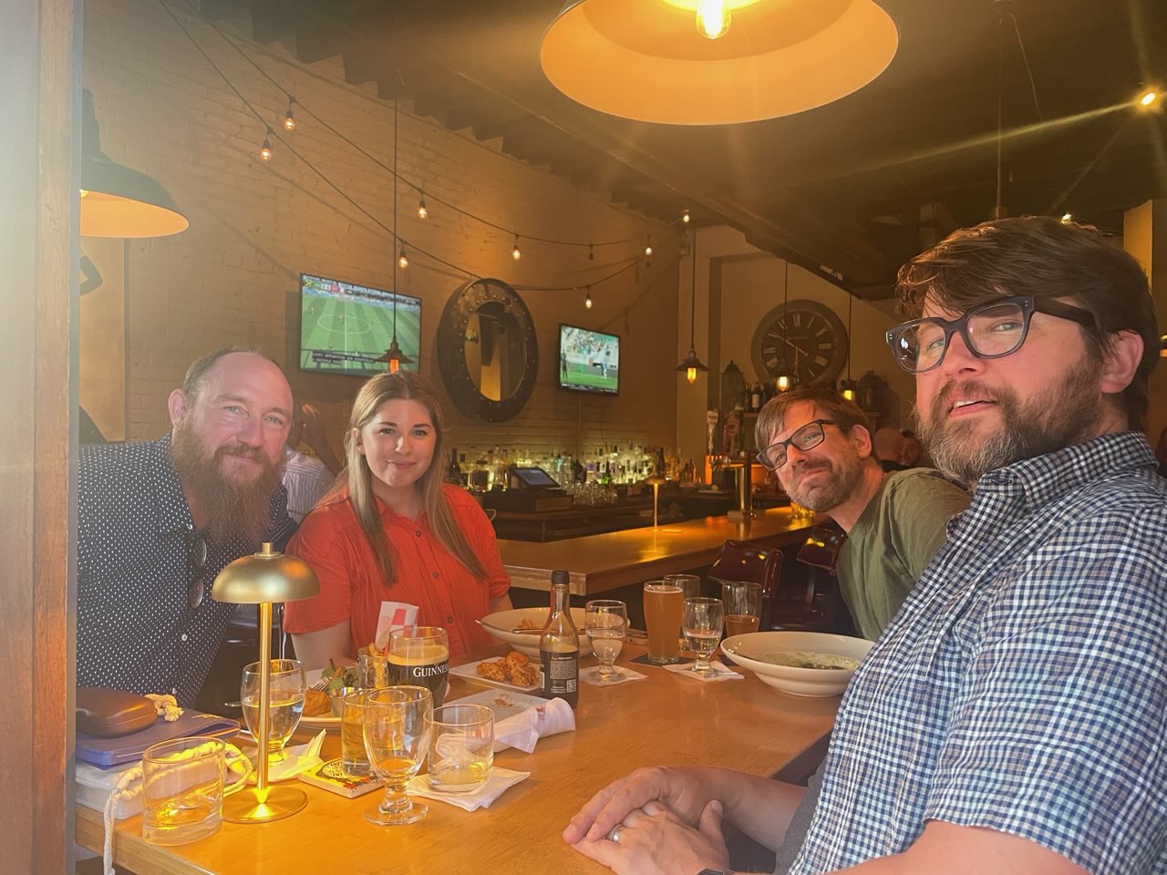
One of the best things about SOTMUS is the community; for all that it’s grown and changed over the years, the geospatial industry around OpenStreetMap is still small enough that you can know many people in it and feel like you’re part of something human. Stamen’s been around for a minute, and it was great to gather current Stamens (some of us around longer than others) to spend time with alums like Mike Migurski and share common experiences over the years.
Until next time
We thoroughly enjoyed the variety of practical and technical presentations at this year’s SOTMUS. It’s always wonderful to spend time with other people in the geo community who are passionate about open source data and tooling. We’re already looking forward to next year — hope to see you there!