
At Stamen, our appreciation and opinions of maps go beyond just our professional work here and often bleed over into our personal interests as well. Our eye for interactivity, color palettes, contour lines, and labels doesn’t stop once we log off at the end of the day. As we covered in a previous post by Ross Thorn and Katie Kowalsky reviewing the map in Elden Ring, many of us here at Stamen also share a lifelong passion for video games.
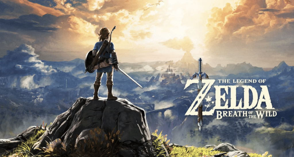
The Legend of Zelda: Tears of the Kingdom releases this Friday and has the gaming world on the edge of its seat! While we anxiously await to play the game and write about the map in another upcoming Cartographers Play post, we wanted to first set the bar by evaluating the map in its predecessor, The Legend of Zelda: Breath of the Wild. We’ll look at how the map in Breath of the Wild holds up as a map designed for play and how it uses and perhaps sets new precedents for cartographic conventions.
Ross Thorn (RT): My name is Ross Thorn and I’m a cartographer here at Stamen! You might better know me from this picture of me with A-list celebrities (yeah it’s just a satellite image composite of the United States, but we’re all in there somewhere).
Alec Burch (AB): Hello! I’m Alec Burch, a designer at Stamen. I don’t have any fancy photos of myself to share like Ross but I can share one of my earliest gaming memories in this official strategy guide for Ocarina of Time of which I spent countless hours with. It should be fun to flip through if you also grew up with this game.
RT: It’s been a minute since we’ve talked about video game maps and I’m excited that we get to do a two-part piece on The Legend of Zelda: Breath of the Wild (hereby referred to as BotW) and its forthcoming sequel Tears of the Kingdom! I referenced my love for the map in BotW in an early podcast episode of Pollinate about playful maps and am excited to critique it.
AB: We’ll use the same criteria as we did in the previous game map review (adopted from Ross’s research on game maps) to examine the interactive, immersive, incomplete, and interpersonal aspects of the map. And there’s so much to cover! Prior to BotW, we’ve never seen the land of Hyrule mapped in such detail in a Zelda game.
Let’s start by examining what we at Stamen spend a lot of time refining in our own work: the interactivity and usability of the map.
Interactivity
RT: In video games, a player can change the map in two ways: by interacting with the map itself through an interface (which I call primary interaction) or by actions done by the player-controlled avatar (secondary interaction). BotW has both and does them well! Let’s first look at primary interaction and the interactions that can be done through the start-menu map.
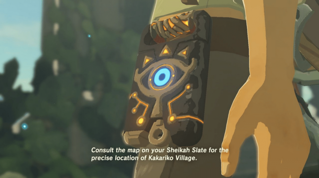
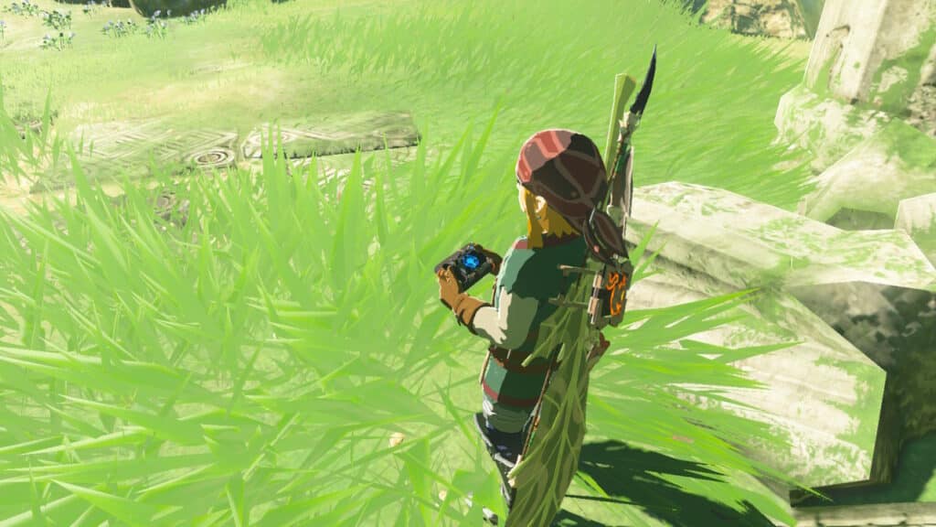
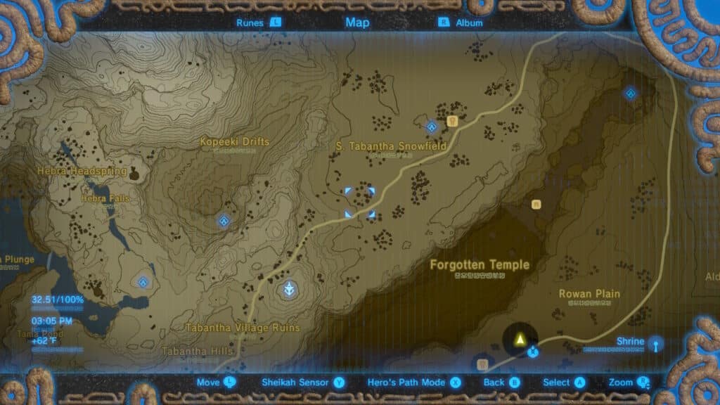
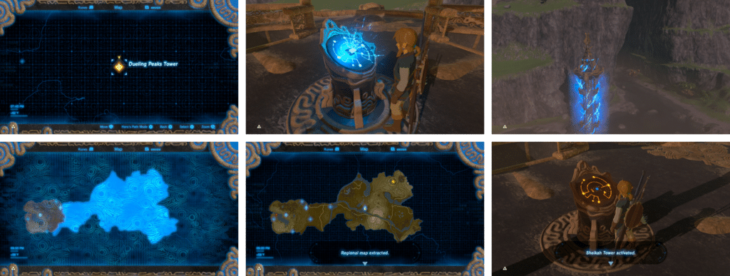
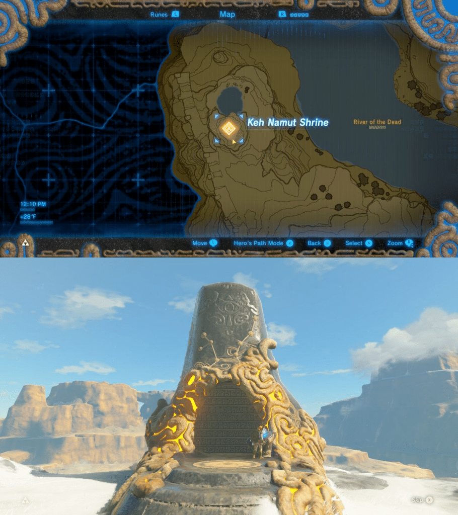
The map is accessible through an in-game item known as the Sheikah Slate, a tablet-like device that Link acquires at the onset of the story. It’s basically the Zelda equivalent to an iPad or a smartphone. It has several functions—from acting as a sensor alerting you to a nearby item to storing the runes that grant Link certain abilities—but it also provides the interface for the map itself and is used to access the Shrines and Towers that aid you in gameplay.
RT: The map smoothly handles the basic map interactions I’d expect. Zooming and panning are fluid and have intuitive controls. The zooming is also docked to certain levels instead of a more freeform zooming, much like if you were to use the +/- controls on a web map instead of scrolling your mouse wheel or a pinch gesture on a touch screen. This isn’t a bad thing, and in fact, the thoughtful limiting of interaction is done well and combined with a slight blur animation to make it look smooth.
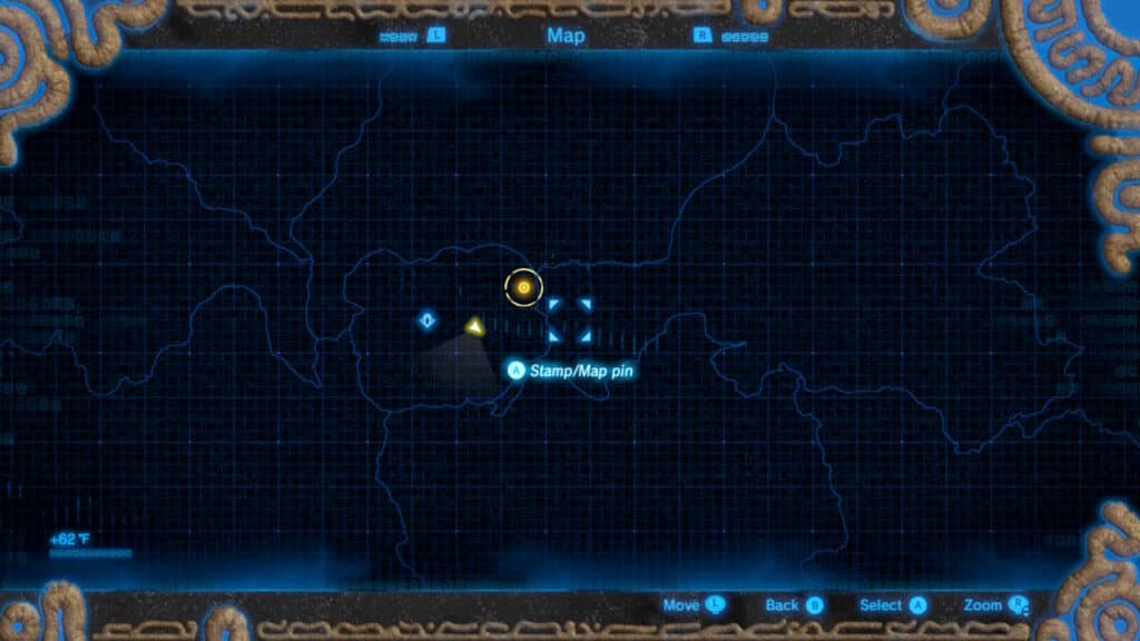
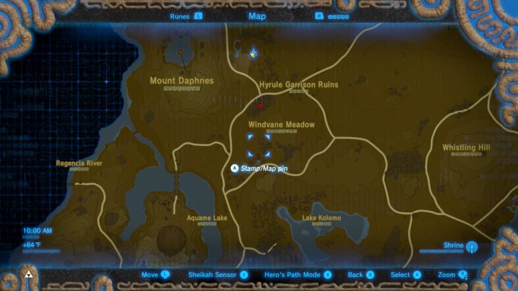
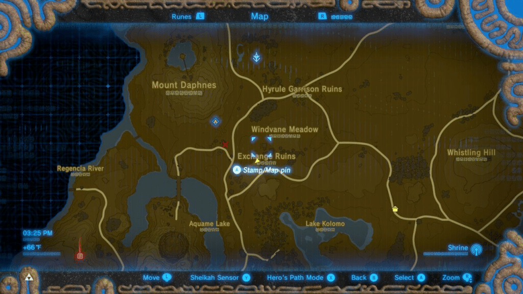
AB: One of my favorite features of the BotW map is the ability to customize the map through markers, which are broken down into stamps and pins in the game. It’s certainly not uncommon for games to allow you to place markers on a map, but I don’t know of many that give users multiple stamps and the ability to place up to 100. You come across so many things to explore in open-world games that it’s easy to become overwhelmed. Anyone who has played an open-world game can relate to getting sidetracked for hours and having the ability to mark interesting features on the map—a little reminder to come back later—is a feature I wish more games like these would embrace.
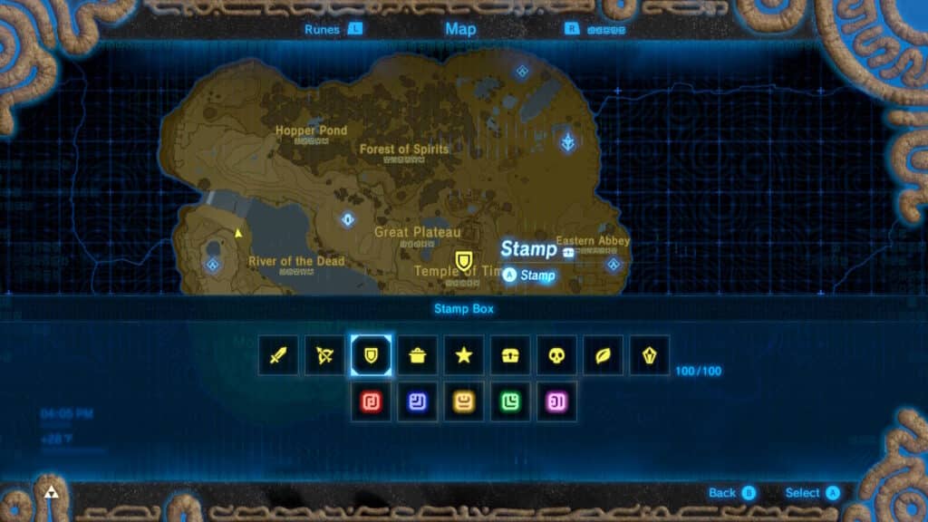
RT: The suite of stamps is great! And they relate to different aspects of the game—chests, enemies, pots for cooking food—but while they are certainly representative of in-game actions, they are never explicitly labeled, so you can assign your own meaning to the stamps you place!
Pins are another type of map marker used differently than stamps as personal guides when wayfinding, which is hinted at with how they work in the game. With regards to primary interaction, you can place them in the start-menu map interface, but they also appear on your mini-map to guide you while traversing the world. They also disappear when you reach them, reinforcing that they’re meant to be one-time beacons instead of the revisitable stamps which remain until you remove them from the map yourself.
AB: The game also has a handy feature where you can edit a pin into a stamp instead of needing to delete the pin then reapply a stamp. That seems like a very basic interaction but when you consider the number of pins you will want to convert into stamps it really does save you a lot of time.
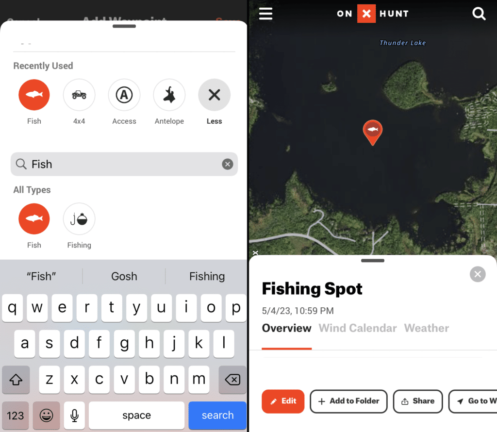
RT: As you said, markers like these aren’t uncommon in games—or in real-world cartography as well! Apps like onX offer the ability to add markers with custom symbols for trail hiking, hunting, or other outdoor activities, empowering the user to make the map their own!
AB: Speaking of parallels to real-world mapping, the map in BotW also leans on other cartographic conventions we use in our day-to-day when designing interactive maps. For instance, when you’re zoomed out and showing the entire map, some information is hidden so the map doesn’t become too cluttered. Labels like those for small ruins or geographic features don’t render until you zoom in. This is a technique we use in real-world cartography for the exact same purpose of preventing information overload and visual cluttering of the map.
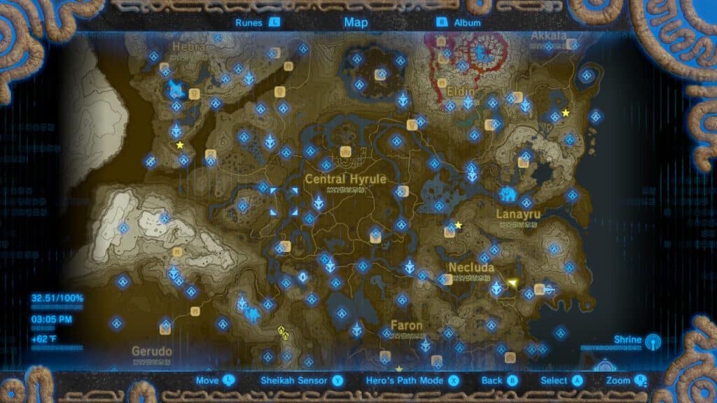
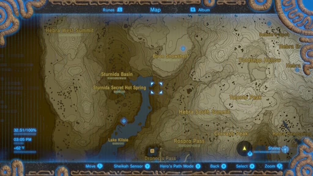
RT: I also chuckled a bit because the map also shows some pitfalls we often see when designing real-world basemaps as well. Showing duplicate labels so close together in a single feature is something cartographers encounter when making web maps, often occurring on large area features like parks or lakes, which is exactly what we see in the labels for Lake Hylia. Not even the advanced technology of the Sheikah people solved the problem of duplicate labels!

SIDE NOTE: Since I brought it up, when we encounter this problem in mapping, we’ll often make a single label point for an area that we label as a point instead of applying a label to an entire polygon that will get duplicated based on the nature of how maps tile geographic data.
AB: So with secondary interaction, you change the map through gameplay. This is another common practice in video game maps, since many game designers use the map as a tool to motivate exploration. This is most apparent through the unveiling of the regional landscape and completion of the map by climbing the Sheikah Towers. We’ll cover this more in the section on incompleteness, but it’s all driven by interaction through gameplay.
RT: For sure. Incompleteness is only possible through interaction and the unlocking of map information is crucial to both. Technically you can also add a specific red X marker to the map whenever you die, but it’s likely you’re not doing this by choice. However, it’s still really useful to see where you last fell to remind you of the dangers you should prepare for if you make your way back there again!
RT: While the changes through secondary interaction and map completion are most apparent through the start-menu map, there’s also a mini-map that is entirely dedicated to supporting navigation goals during gameplay. It’s easy to overlook changes in a mini-map, especially since it’s commonplace and so intuitive, but while you’re making Link ride a horse across an open field, you’re also causing the map to pan across the geography of Hyrule as well. That’s secondary interaction, baby.
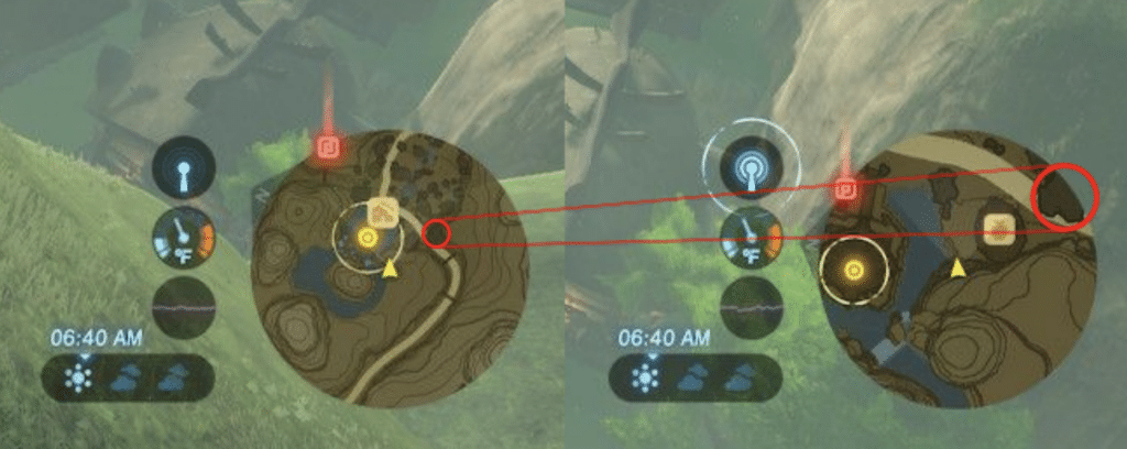
AB: This particular mini-map has some uniqueness to it. When you enter a village, the mini-map zooms in to show more detail of the town—icons for the shops and inns where you can go to resupply or rest up. This reminds me of how real-world navigation apps work, adjusting the zoom based on the speed or road type you are traveling on.
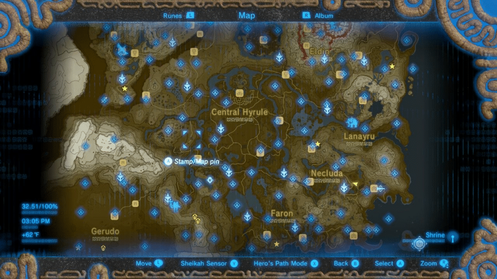
RT: A crazy feature of this map that is worth mentioning here as well is the Hero’s Path downloadable content (DLC), which shows your ENTIRE trek through Hyrule as a bright green line. I thought this was a really cool novelty, but didn’t understand the true value of it until I began trying to find Ancient Shrines and collectible Korok seeds I hadn’t discovered yet. Seeing where you haven’t been in a game where exploration is really helpful for showing where you should go explore!
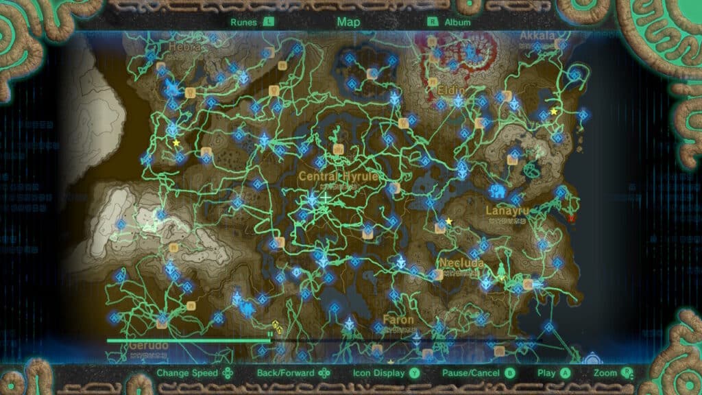
AB: I really love this path feature. I have to admit I wasn’t that interested in playing any of the DLC content for BotW, but this feature alone made me go out and buy it. You can actually go back and watch an animation of the line progress and show your journey in the game so far. I especially love watching the line progress from my early gameplay. I’m surprised how many of the deaths and struggles with geographic obstacles I can remember. It’s similar to looking at an old AllTrails or Strava map recording of hikes I’ve done in the real world. Experiences I’ve had in game are just as real as experiences I’ve had in real life to an extent.
RT: Yes! It’s crazy how much meaning we can derive from our memories of and attachments to fictional realities.
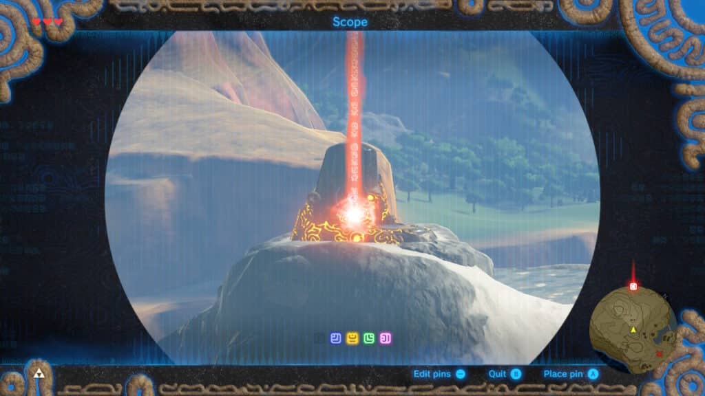
AB: Another powerful way to customize the map through secondary interaction is with the scope on the Sheikah Slate. The scope lets you see off in the distance—which you could probably tell by the name—and lets you drop a pin directly where you are looking in the landscape, where it appears as a glowing column of color and also gets added to your map.
RT: The scope is by far one of the coolest ways to interact with a map that I’ve ever seen and I love that you can add pins to the map in multiple ways. One of the game’s designers, Hidemaro Fujibayashi, gave a talk at GDC in 2017 talking about how they designed the game for “multiplicative gameplay,” a concept that means there are lots of different ways to accomplish a given task in the game.
RT: For instance, if Link needs to cross a ravine, they provide you with a variety of options to solve that: a tree nearby that you could cut and use as a bridge; grass that could be set on fire to create an updraft to help you glide to the other side. Nintendo not only accounts for all the ways a player might try to overcome a challenge, they want players to be creative!
In interaction design, Jakob Nielsen coined this principle as flexibility, and we certainly see it here, as players have multiple ways of accomplishing the same goal through both the start-menu map interface and the scope, with each avenue having benefits for different situations in the game.
Immersiveness
RT: The functionality of the Sheikah Slate is a great segue for us to talk about immersiveness in this map. The scope’s integration between the virtual world and the map feels so fluid and natural! It emulates something like an augmented reality device within the virtual world that seamlessly syncs with the map, immersing you deep in the game and map.
AB: This immersion is bolstered when you play the game in handheld mode on the Nintendo Switch and can use the motion controls to look around Hyrule, as if you’re peering through the scope on the Sheikah Slate yourself. That’s definitely not a coincidence on Nintendo’s part. It’s the benefit of being able to have full design control and coordination between the hardware and the software. And it totally paid off. Have I walked around my house pretending my Switch was a Sheikah Slate? Perhaps.
RT: Oh I definitely have. This playful bridge between the real hardware you hold and the in-game tools Link uses would have elated a young, Zelda-obsessed Ross.
AB: I also want to point out how beautiful the marginalia of the Sheikah Slate is and how the subtle visual details like this further the immersion by appearing as if you are using the slate when playing the Switch.
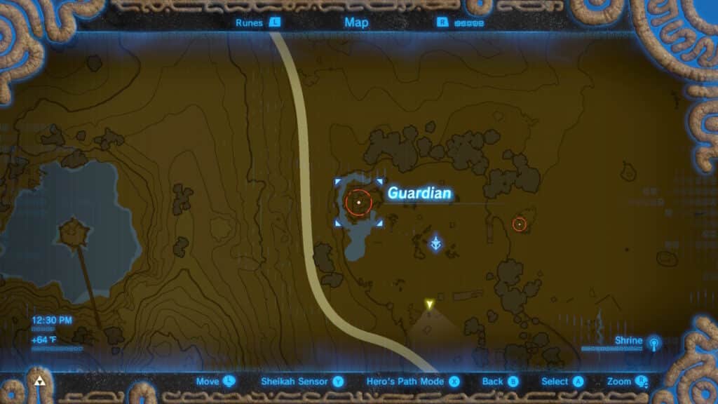
RT: I think it’s so cool that you’re also reminded of the Sheikah technology in the map when you can see hostile Guardian locations around you. Seeing enemy locations is more common in competitive first-person shooter games, but this subtle detail of the Sheikah Slate being connected to the incredibly dangerous Guardians and alerting you of their location is really neat. Especially because the map doesn’t show locations for beast-like enemies that aren’t Sheikah constructs.
RT: As we mentioned, Hyrule has never been mapped to this level of detail in a Legend of Zelda game. The amount of data the map shows is impressive, mainly because it does it so well. Everything from the buildings and roads to elevation and even individual trees is well-designed and fits so well to the vibe and aesthetic of the Sheikah Slate technology.
It’s funny though, when I see such graphical detail in the map, I kind of want that level of detail with interaction as well. This might be the world’s worst nitpick and is more along the lines of the game Suffering From Success because the visuals of the map are so good, but when I saw the canopies for individual trees, I went and chopped a tree down to see if it would disappear from the map. Sadly, that wasn’t the case…but again, this is a “problem” that only stems from my expectations already being exceeded. I do hope one day I’ll find a map that looks as good as this and syncs with real-time gameplay interaction as well. Fingers crossed for Tears of the Kingdom!
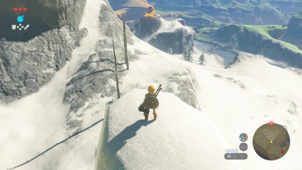
AB: One map feature that is more than just aesthetic is the contour lines showing the topography on the map. Knowing elevation comes in handy for traversing the landscape, especially early on in the game when your stamina is low and you need to be strategic about crossing steep terrain. You can see evidence of this when looking at the line in the Hero’s Path DLC. I would often skirt around a mountain instead of just beelining over it.
RT: I have a real soft spot for contour mapping. Especially if it’s actually important information. When a map is as beautiful as it is useful, that’s truly special and something we strive for in our work. I also bet a lot of players improve their map-reading simply by playing and referencing the map, learning that tightly-spaced contours mean steep terrain and more distance between contours signifies a gradual slope. Bathymetric (water depth) coloring is also present and adds useful information and aesthetic beauty to the map.
AB: It also helps that elevation change is highlighted by different shades of brown, with darker colors representing the lowest elevations and lighter colors on the mountain tops. Combining all of these techniques make the map easier to understand and generally more interesting to look at.
Incompleteness
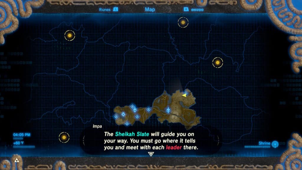
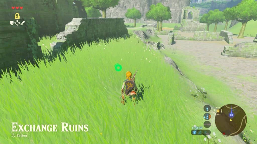
RT: Like we mentioned previously, map incompleteness is used in video games to encourage exploration, which is a major narrative and mechanical theme in BotW. Link has just woken up from a 100-year nap and doesn’t recognize the people and land he once knew. With the help of the Sheikah Slate and some disembodied voice, he’s tasked with piecing together his past and conquering the evil in Hyrule Castle. It’s not a new trope, but it pairs really well with completing a map.
At the start of the game, the map is completely obscured by a textured grid and the faint, amorphous outlines of what appear to be regional boundaries. As you unlock Sheikah Towers and reveal regions of the map, a plethora of geographical data appears to guide you.
AB: Do you think the map designer intentionally made the texture of undiscovered areas look like a map tile grid? It certainly fits with the advanced Sheikah technology motif, but it’s another funny parallel with how real-world web mapping software chunks geospatial data into tiles for rendering it on devices.
RT: Oh, good eye! Maybe it’s the reason why we have duplicate labels on Lake Hylia! Regardless, the swirly blue and black pattern and the grid make for a great “undiscovered” area texture that isn’t a traditional fog view. The hidden areas beg to be discovered and the entire introduction of the game does a great job at showing how to do that.
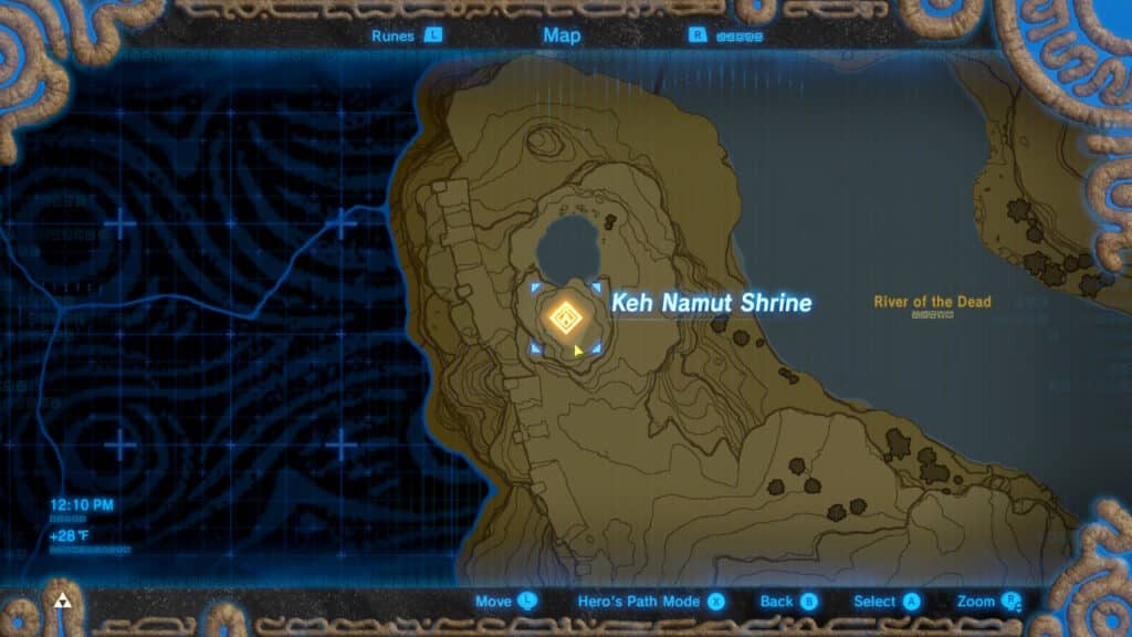
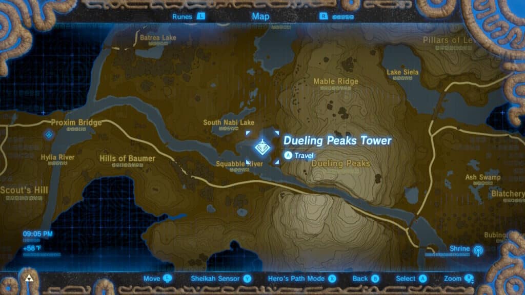
RT: A key part to exploration and completing the map is through unlocking Sheikah Towers, tall structures that Link can climb to download map data for the region and get a good view of the surrounding landscape.
AB: This is where the scope and markers become really powerful. As soon as you enter a new region it’s important to get to the tower to access data for that region of the map. And since the Towers offer a great vantage point you are able to locate and mark numerous other Towers once you scale the first one. Even if you aren’t going to clear every Tower you mark right away, having them located is only going to help once you do need to clear them.
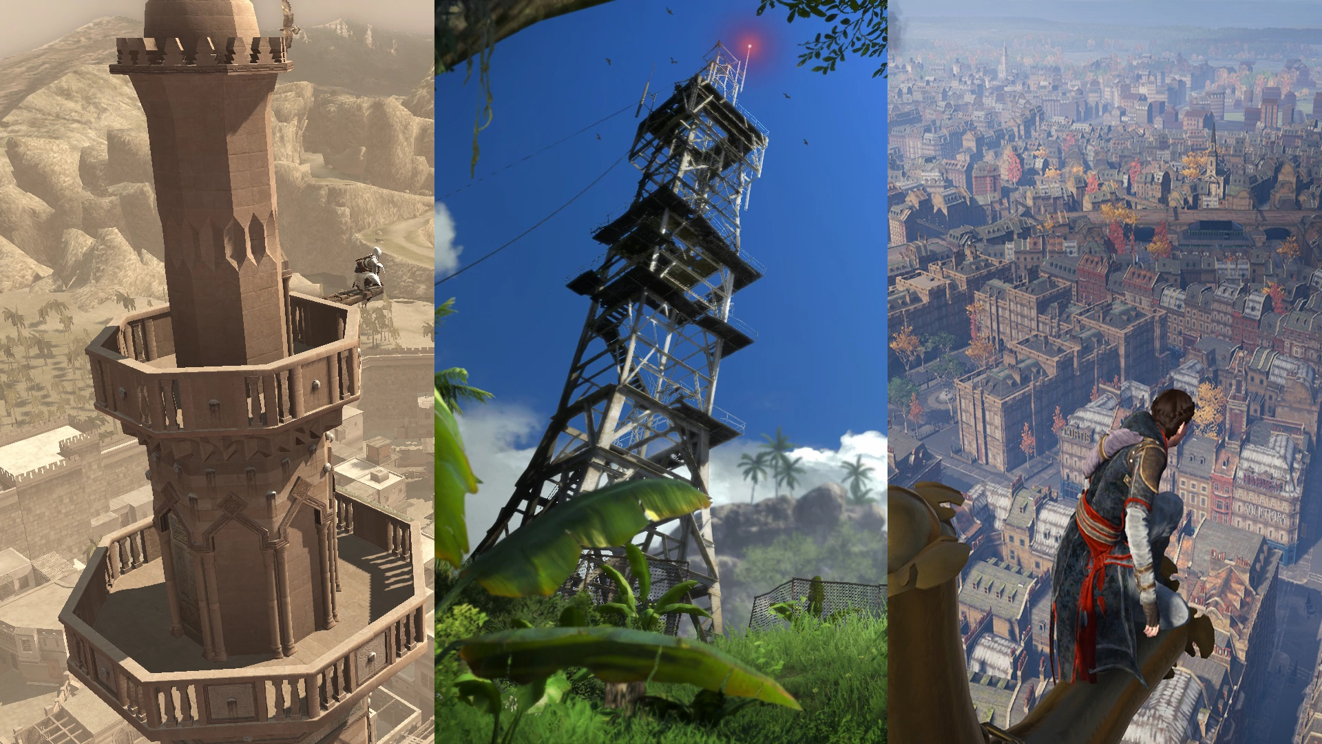
RT: Definitely. And they’re easy to spot in day or night due to the glowing patterns that decorate them. The inclusion of Towers as vantage point locations is another mechanic that’s been done before. It seems like some folks have grown tired of this due to their overuse and lack of innovation. Sometimes dubbed “Ubisoft Towers” due to their repetitive presence in games like Assassin’s Creed and Far Cry, most towers seem to offer very little beyond the populating of the map. And while I’m all for gameplay actions that complete a map, they can definitely seem like tedious work for minimal payoff.
AB: I’ve definitely experienced some fatigue with this trope in other games. But the Sheikah Towers in BotW integrate subversively well with other game mechanics that push vantage points like these into fresh design spaces. Some of the towers are gated by enemies or obstacles that you can’t overcome until you unlock certain abilities, making it more of a meaningful challenge to reveal the map in certain regions.
RT: Also using your glider to fly across Hyrule is also a major aspect of travel. Not only are you immediately able to glide from an elevated platform towards the destination you’ve scoped and pinned, but unlocking the Towers allows you to fast travel back to them at any time with the same promise of having the high ground to expedite your travels. Combining the gameful challenge of unlocking the tower with with lasting utility the tower has for the rest of the game is what makes these stand apart from other implementations of vantage points.
AB: When we talk about incompleteness with the map most things, like the regional information from the towers, only have two states: things have either been discovered and appear on the map or they have not been discovered and they do not. The topographic and landcover data is an example of this and it’s also seen in some named places only showing up on the map once you’ve actually visited them.
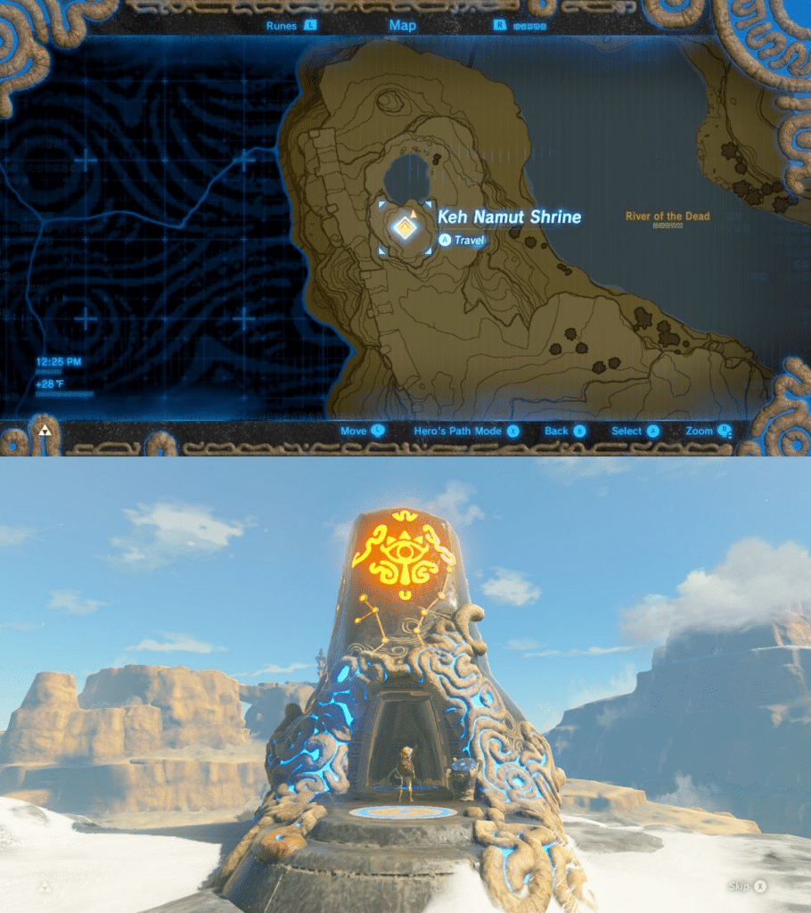
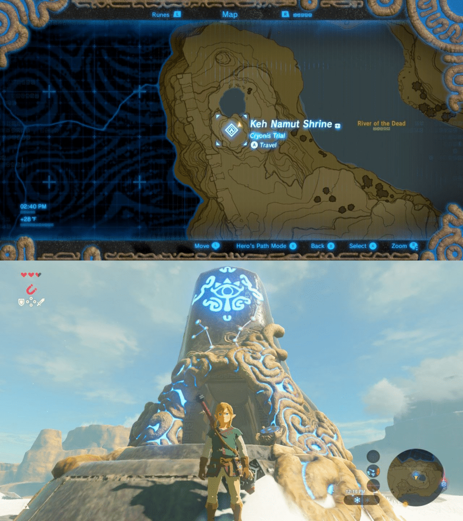
AB: One really fun exception to this binary completion are the icons for towers and shrines. Since both of these have an interactive component (towers need to be scaled and unlocked; shrines have puzzles that need to be solved) Nintendo created an additional icon state for locations that have been discovered but not completed.
To indicate this incomplete state, a portion of the icon glows orange and upon completion the icon changes to blue. You can also see this color change on the towers and shrines in-game. Designing the in-game locations to share the same design language as the map markers is a really nice touch.
Interpersonal
RT: Just to mention it briefly, a map in a multiplayer game is best when it supports interpersonal communication. Play (both within and apart from video games) is often based on social connection and it’s how we as humans learn to communicate at a young age. BotW (like most Zelda games) is a single-player game and its map doesn’t support the interpersonal pillar of playful maps. But that’s okay! Charles Pulliam-Moore says it well in the recent New York Times article on the game series by stating that “Zelda is a very solitary and exploratory and very lonely franchise. And I say that in a good way… [W]e live in an era of multiplayer games where…your gameplay is shaped by what other people are doing. And the Zelda franchise is very different… it’s you by yourself and you are embarking on this journey.”
So we won’t be judging the map based on its lack of interpersonal support.
Final Thoughts
RT: Despite the waterfall of praise for the map above, we actually tried to be critical of the map in Breath of the Wild. But it is incredibly good. It’s hard to find any shortcomings where it doesn’t serve the player elegantly and even harder to reign in my excitement to use the map when I replay the game (even after 6 years)!
There are a few nitpicks I could argue (like if you chop a tree down it doesn’t disappear on the map or the duplicate label issue), but any point is only built on the fact that the rest of the map transcends my cartographic expectations in so many ways and I want it to in other ways as well.
AB: I particularly enjoyed the mechanics given to players to build your own map experience though custom map marker placement and how the game constantly mixes up repetitive tasks needed to complete the map by introducing new obstacles, enemy types, and player abilities.
RT: Overall, the levels of intuitive interaction and the perfect blend of beauty and utility is nothing less than exemplary cartography. And I mean cartography at large. It’s groundbreaking not just for game maps, but for any map I’ve ever used. Maybe it’s bold to say, but Breath of the Wild is one of the best maps of the modern cartographic era and will surely influence the future of video game and real-world maps alike. I feel very comfortable giving this game map a perfect 10.
Score
Interactive: 10/10
Immersive: 10/10
Incompleteness: 10/10
Overall: 10/10
We hope you enjoyed this thorough analysis of the map in The Legend of Zelda: Breath of the Wild! We’d love to hear your thoughts on the map as well, so please Tweet at us (as nicely as you can)!
Stay tuned for our review of the map in The Legend of Zelda: Tears of the Kingdom and see how it measures up to its predecessor!