
Today we’re excited to announce that Stamen worked with the United States Conference of Catholic Bishops (USCCB) to release a map of dioceses and other administrative regions in the US.
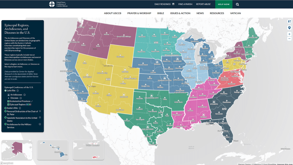
The map is the first official and freely accessible interactive map of Catholic dioceses in the US.
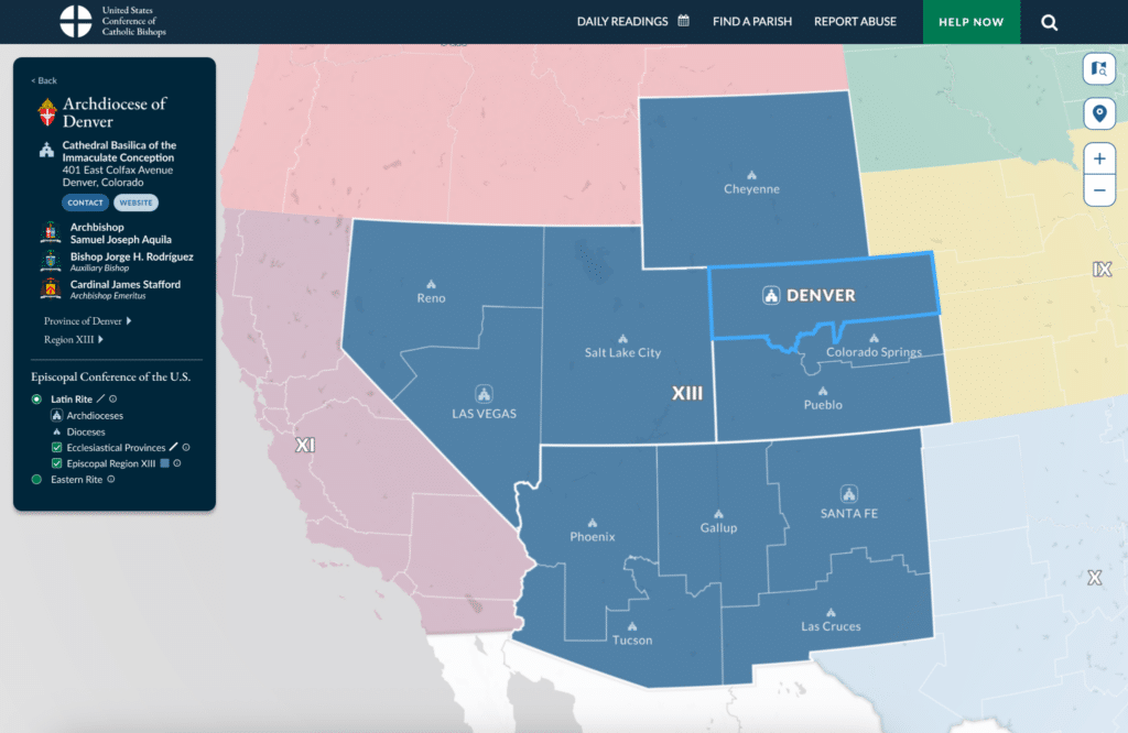
In the Latin Rite, dioceses are the building blocks of the administrative boundaries of the Catholic Church. Dioceses are combined to form provinces, which are combined to form regions. Each diocese is overseen by a bishop. Archdioceses, which are generally dioceses in large metropolitan areas, are overseen by archbishops, who also lead the rest of the province to which that archdiocese belongs. This map features only administrative units that are part of the US Conference, which covers the 50 states, the District of Columbia, and the US Virgin Islands. Note that this map also features Eastern Rite churches, which have their own administrative divisions worth exploring.
Prior to the release of this map, it was not a simple matter to determine which diocese you lived within or were moving to. Without this knowledge, it was not straightforward to figure out which bishop or archbishop to contact in the case of a matter or complaint that would need an official’s attention. Our aim with this work is to make it easy to find your diocese and the information about relevant people within that diocese.
Because this information has not always been easy to track down, USCCB hopes that this map can educate those who are interested in the structure of the church and how the various rites intersect.
Completing the dataset
As we prepared for this project, we were happy to find that there are a few unofficial and freely available spatial datasets that contain some of the relevant boundaries, such as these files and this project that includes some code for generating the data and an interactive map.
The official data related to contact information and boundaries is in the Official Catholic Directory, which is a paid product. To get a sense of the directory you can see this sample page for the Archdiocese of Denver:
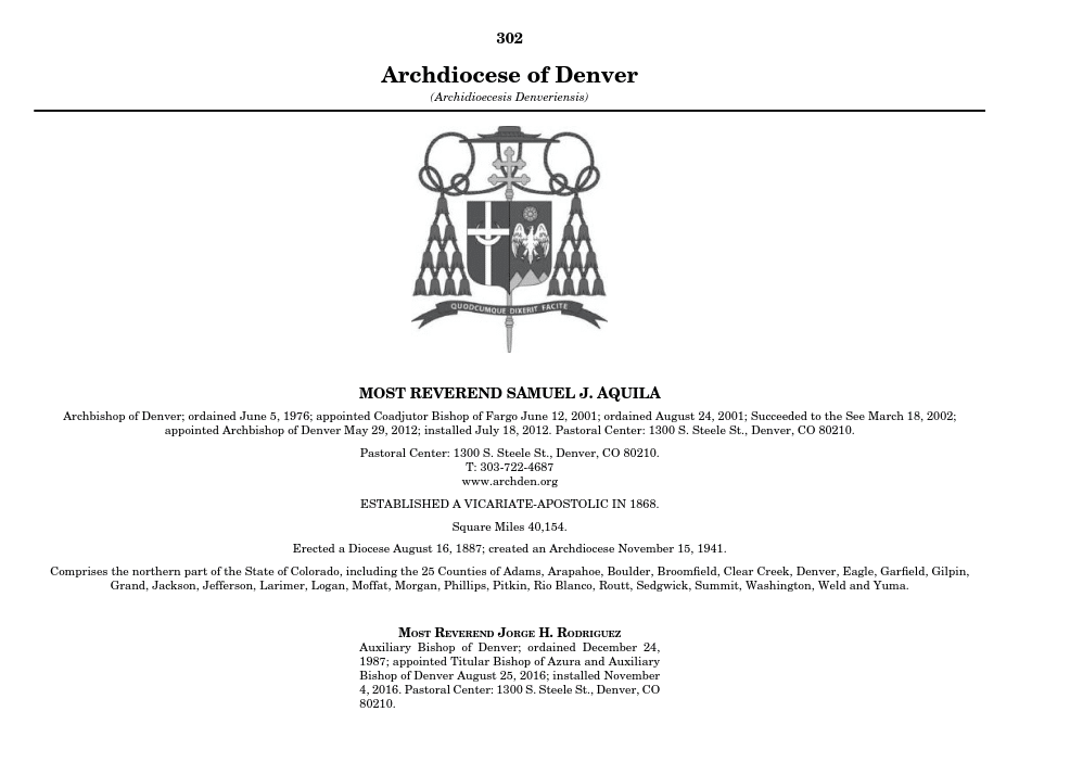
Looking at the above screenshot, the “Comprises…” section indicates which counties make up the diocese and is particularly useful when trying to draw the extent of a diocese. Depending on the diocese, this text either contains county names within states or entire states.
Our work builds upon prior work by the Center for Applied Research in the Apostolate (CARA), which publishes a print map of dioceses. With their assistance and through conversations with CARA, we were able to create a new dataset that accurately depicts the administrative boundaries of the Catholic Church in the US.
Essentially, once we had a crosswalk mapping counties to dioceses (and provinces and regions), it was a relatively straightforward process of joining counties via the crosswalk and dissolving each region.
This data (and the aforementioned mapping projects) cover the Latin Rite, which is the largest church within the Catholic Church in the US. However, there are numerous other churches in the Eastern Rite such as the Byzantine Church, which is also made up of regions similar to dioceses called eparchies. The boundaries of these eparchies are independent of and unrelated to dioceses’ boundaries. We wanted to include these in the map, too, and we had to put together boundaries for these eparchies using the OCD. Many churches have an eparchy that covers the entire US or US and Canada. Some are split up by state, and some have divisions within states (at the county level) such as these eparchies that split Ohio and Pennsylvania:
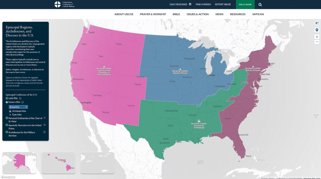
To our knowledge, these are the most accurate online and freely accessible maps of the Eastern Rite’s eparchies.
Modernizing the map
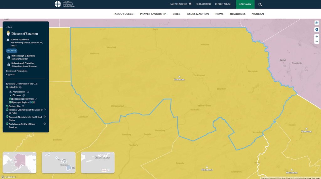
From a cartographic perspective, we wanted to show the nested hierarchy of diocesan data without having to interact with the map too much. Different symbols distinguish archdioceses from dioceses, while thick boundaries distinguish provinces from colorful regions. You can understand how a particular diocese fits within its corresponding province and region in the information panel on the left.
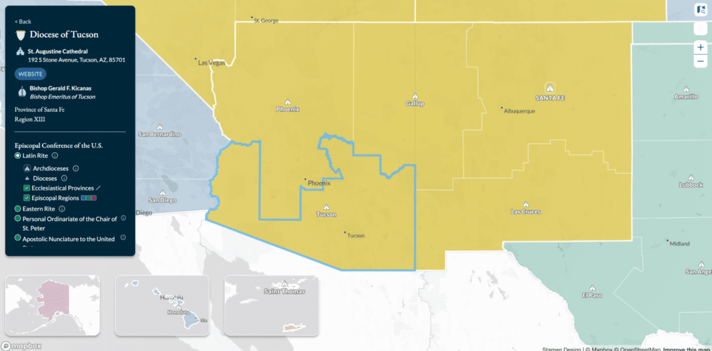
USCCB has colors in their brand guidelines that carry important meaning from Catholic traditions, which we sought to carry through in the map and interface alongside clean, modern design. We also wanted to integrate symbology used to represent dioceses and bishops into the interface, which you can see in the information panel on the left when a diocese is selected. Each diocese has a crest, while each bishop has his own coat of arms, both featuring specific design elements that date back to the 11th century (read more fun details about ecclesiastical heraldry here).
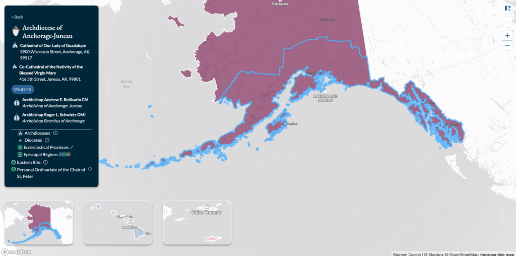
In order to show all regions covered within USCCB’s jurisdiction at once, we have included three inset maps for noncontiguous areas: Alaska, Hawaii, and the US Virgin Islands. Selecting a diocese within one of those areas flies the main map to that location for easier viewing.
As a 2000+ year old institution, the Catholic Church covers most of its members within the diocese → province → region hierarchy in the US. But any institution with such a lengthy history will undoubtedly have exceptions to its primary organization. Our map includes:
- The Personal Ordinariate of the Chair of Saint Peter, which includes converts from the Anglican Church to the Catholic Church in the US and Canada
- The Apostolic Nunciature to the United States, the diplomatic mission of the Holy See to the United States
- The Archdiocese for the Military Services, which includes all Catholic members of the US Armed Forces
While these subdivisions do not depend on geography in the same way as dioceses, it was important for us to include their contact information as part of this project as well.
In nuce*
We hope you found our exploration of this new map of Catholic Church boundaries in the US useful. It’s been a pleasure getting familiar with this data and finding ways to represent these areas in an engaging and accessible way. Check out the map, and please get in touch–we would love to hear about your data and think about how to make new tools with it.
*Latin for, “in a nutshell”