
By Eric Rodenbeck and the Stamen Design team
One of our favorite conferences of the year is the annual meeting of the North American Cartographic Information Society (NACIS, for short). It’s an eclectic community of academics, professional cartographers, artists, activists, and many other stripes of fascinating creative people who share a love of maps. And this year, the NACIS annual meeting is in one of our favorite cities: Minneapolis!
We’ll have five members of the Stamen team in attendance and speaking (probably a record for us, we’re not sure) and we’re preparing an exciting and varied lineup of presentations to share with you all.
Here’s the breakdown of where to find us during the conference & what we’ll be doing, plus directions to our happy hour:
Wednesday afternoon:
On Wednesday October 19th, we’ll be at Practical Cartography Day, where Stephanie and Kelsey will be presenting in the 3:30pm session about some of our new open-source map design tooling:
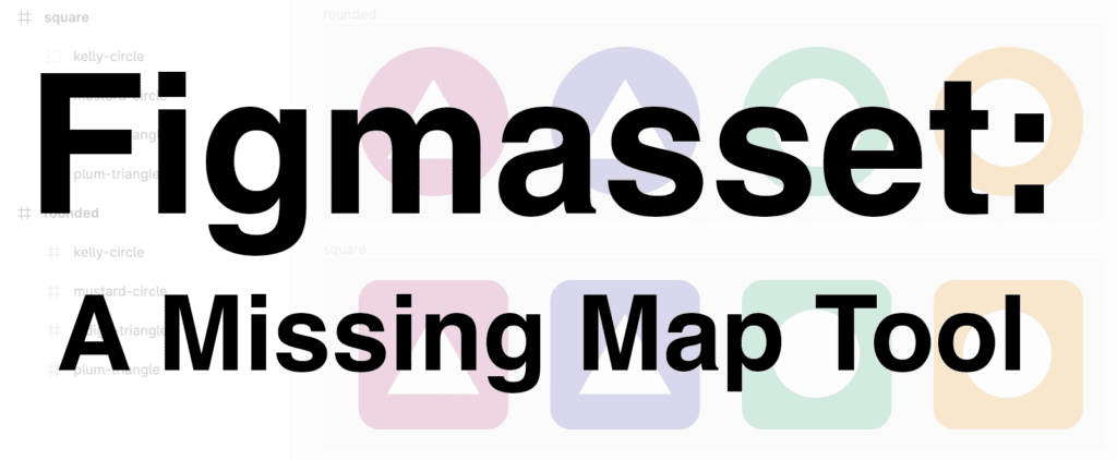
Figmasset: A Missing Map Tool
Stephanie May & Kelsey Taylor
Anyone who has ever designed map icons for web maps knows the challenge of simultaneously needing to see what you are creating up close, and within the context of the map. Figmasset bridges this impossible gap, allowing designers to create vector graphics in Figma, export them in seconds to a sprite sheet consumable by Mapbox GL, and view them on a map. It has never been easier to design custom road shields, points of interest icons, or map markers. In this interactive workshop, we'll show you how it's done.
Wednesday night:
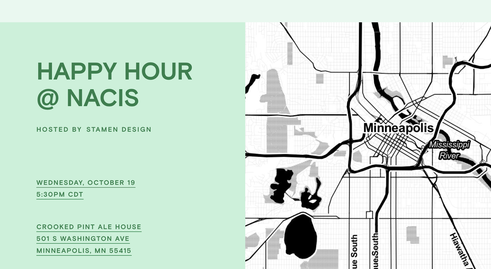
Right after Practical Cartography Day wraps up, join us for a happy hour at the Crooked Pint pub, kitty-corner from the conference venue, at 501 S Washington Ave. Please RSVP at bit.ly/stamen-nacis-2022 so we know how many people are coming.
Then hustle back to The Depot in time for the keynote presentation at 7pm!
Thursday morning:
In Thursday morning’s 10:40am block, we’ll have Stamen cartographers presenting in two simultaneous sessions, so you’ll have to make a difficult choice:
In the session “Cartographic Narratives”, Kate Leroux will be sharing about the ways cartographers are represented in video games in her presentation “I Want to Be a Cartographer When I Grow Up!”
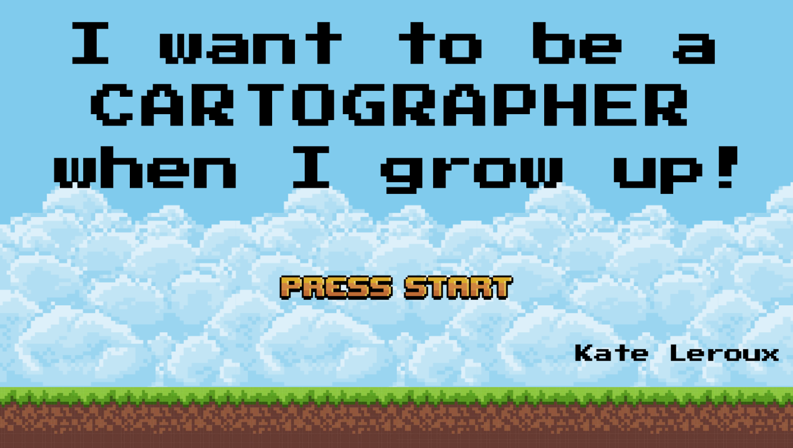
I Want to Be a Cartographer When I Grow Up!
Kate Leroux, Stamen Design
Cartographers often appear in video games, helping players gain new pieces of the world map. What are these representations teaching kids (and adults) about who cartographers are? In this talk I'll share my analysis of the ways cartographers are represented in popular video games.
Meanwhile, in the “Maps in Any Medium” session (also at 10:40am on Thursday) Ross Thorn will talk about his experiences launching Stamen’s new PLN8 podcast, which is nearing the end of its first season of episodes.
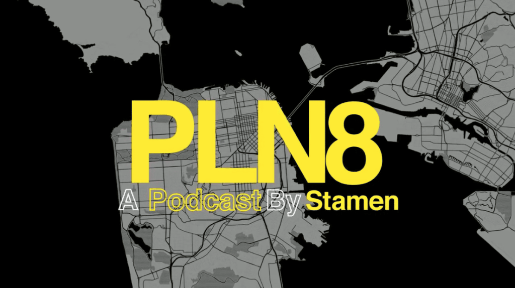
So You Wanna Start a Mapping Podcast
Ross Thorn, Stamen Design
Everybody loves maps and (almost) everybody loves podcasts! But there is a bit more to starting a cartography podcast than simply buying a nice microphone, pressing "record", and spitting your hottest map takes. In this talk, I'll talk about our first year of podcasting at Stamen, including some general podcast tips, our specific approach to the format, the hurdles of starting (and continuing) a podcast, and the cool themes that have surfaced while speaking with some of the brilliant folks in our field.
Thursday afternoon:
For Thursday afternoon’s 4pm block, you’ll have another tough choice to make (but luckily all NACIS presentations will be recorded and available online a week or so after the conference).
In the “Map Design II” session, you can hear me (Eric Rodenbeck) talk about the useful and fascinating connections between the geometric concept of The Golden Ratio and the practice of cartography.
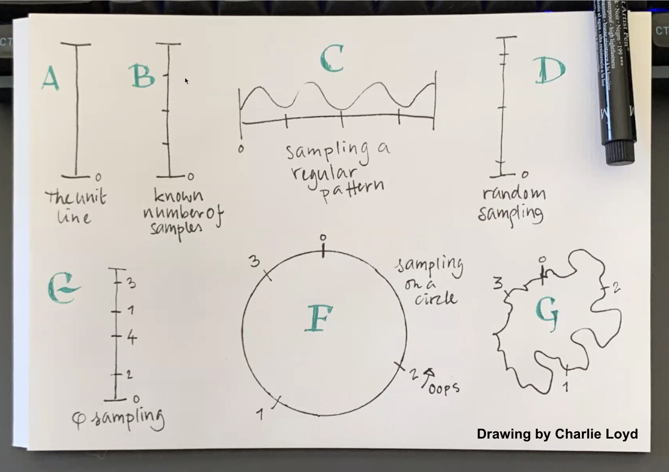
Cartography & the Golden Ratio
Eric Rodenbeck, Stamen Design
The Golden Ratio is a fundamental property of geometry. Its use in architecture over the centuries is well known, and it's also used by plants to efficiently distribute seeds & leaves for optimum growth. At Stamen we've found it useful in our cartographic practice. You can use it any time you want to sample in a well-dispersed way, when the number of samples isn’t known ahead of time. The Golden Ratio is a way of ensuring that you're doing the most with the least when you don't know how far you have to go. This talk will examine the practical and metaphorical uses of the Golden Ratio for mapmakers & designers & doers.
At the same time, in the Web & Mobile Cartography session, Stephanie May will be sharing our answer to the question “What is Vector Tile Cartography?”
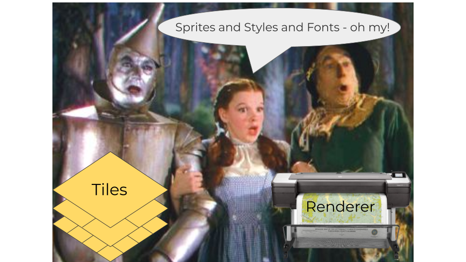
What is Vector Tile Cartography?
Stephanie May, Stamen Design
Anyone who has made a map in Mapbox Studio has worked with vector tiles, but how many have considered the role for cartography not just in styling the data available in pan-able, zoomable maps, but also structuring the tiles themselves? As more and more companies build their own vector tiles internally to incorporate into mission-critical, customer-facing applications across the Internet, we have found a niche in advising clients on how to streamline and tailor their mapping stacks. It comes down to combining cartographic and software engineering fundamentals in a way that harmonizes good data architecture with principled information design, which for cartographers means learning to speak the language software engineers understand.
We’re looking forward to meeting many old and new friends in person after a long time. I’m particularly excited because this is actually my first NACIS conference! I’m very curious to experience this community that my teammates have been raving about all these years. As they say, “NACIS is nicest.”
If you see any of us at the conference, please don’t hesitate to say hi! We’ll also be active on our social media accounts, in particular @stamen on Twitter, but also (variously) at @mizmay, @RealRossThorn, @KelseyETaylor, @kateler, and the #NACIS2022 hashtag.