
When creating a map, the data that goes into it is just as important as the styles we apply to that data. Data and design are equal partners in the cartographic process, as we’ve often advocated as part of our philosophy of Full Stack Cartography.
That’s why we are so excited to share that our partners at Stadia Maps have been working hard to update the underlying data that we use in our own Stamen Terrain and Stamen Toner basemaps. The focus of the recent updates has been an overhaul of water features like rivers, lakes, and coastlines, making them smooth and simplified seamlessly across zoom levels.
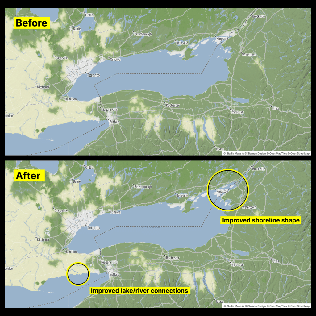
Making maps that look great and have the right level of detail across zooms from the global view all the way down to street level is a unique challenge of our modern world of online mapping. And those of you who are familiar with this process know that cartographers often will source data from different providers or different data sets to find the appropriate level of detail at each zoom. Specifically, the combination of carefully simplified Natural Earth data at low zooms and hyper-detailed OpenStreetMap data at higher zooms is the bread-and-butter of open source basemaps.
Unfortunately, the result of this is that there may be distracting jumps in detail as you try to zoom in and out smoothly on a map (and this is a problem with most basemaps when you start looking at them closely). Lakes and coastlines dramatically change shape as new detail is added, or whole river networks will suddenly appear or disappear abruptly.
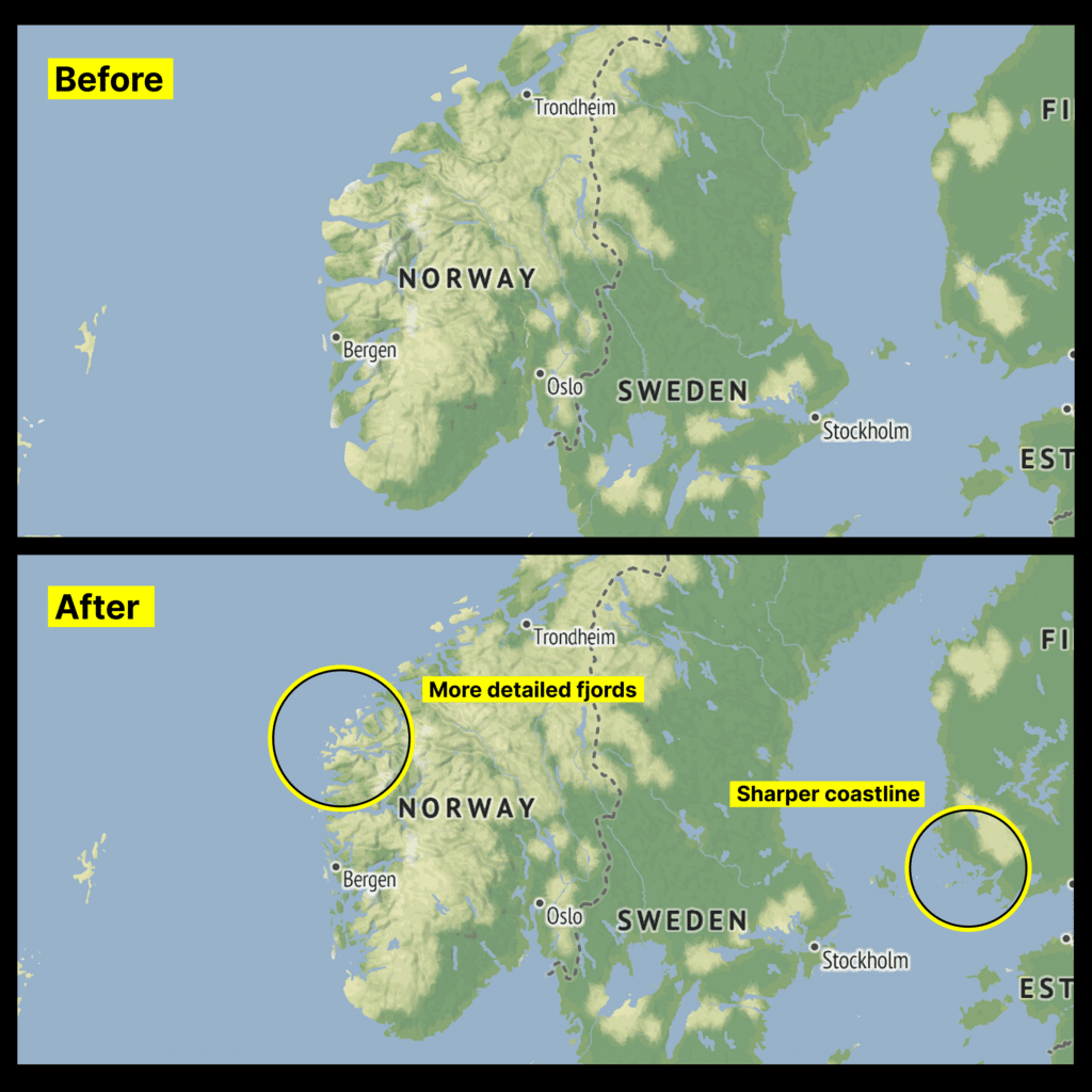
In Stadia’s recent updates, they’ve switched their base geographic data to use a single source of truth with a continuously varying algorithm that has just the right level of detail at every zoom, which makes for more seamless blends between zoom levels. It shows clear detail without adding too much unnecessary data to the map tiles, creating a much more pleasing look at some of the zoom levels we found most frustrating in the past, with no loss of performance.
In these screenshots you can look at the previous version of the map and compare the newer, sharper prettier coastlines that really helps a map like Stamen Terrain to feel rich, detailed, and polished.
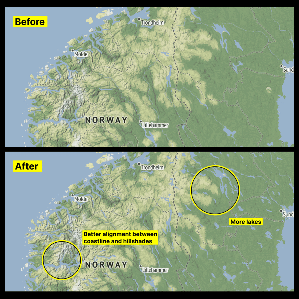
You can read more about the technical details on Stadia’s own blog post: Revisiting the Cartography Behind Stamen Terrain.
It has been a few years since we migrated our basemaps off of our own infrastructure, and partnered with the experts at Stadia to support a robust and frequently-updated backend for our maps, and we could not be more pleased with how it has been going. Stay tuned for more ongoing improvements to our maps!