
Since 2011, Stamen has provided free custom-designed basemaps for the whole world, for anyone to use, for any purpose. Long after other map providers went out of business, started requiring API keys, or charging for usage of their maps, we kept providing our maps for free. Why did we keep doing it, years after others gave up? It’s because we truly believe in the value of open data and want to give back, especially to the OpenStreetMap community who created the data behind our maps. Providing our basemaps for free also has benefits for us: it helps people find us and hire us for our expertise in custom cartography and data visualization.
The needs of map makers and available map making technologies have evolved as the market has grown. Long deferred maintenance and modernization demands for Stamen’s maps require that we make a significant change. To ensure we can meet a quality standard for map design and service that the market needs going forward, these map tiles will not be hosted by Stamen any more.
Please read on for details on how you can keep using the tiles moving forward, and how they’ll be improved.
We’re committed to as smooth a transition as we find possible, because we’ve seen how damaging it can be to suddenly turn off services that others depend on. We remember back in 2016 when Mapquest shut down their free map service, causing thousands of websites across the internet to break. They tried to warn their users, but since they weren’t requiring keys or tokens or user accounts, they had no direct way to reach out. Lots of people switched over to Stamen tiles at that time, including our then-brand-new global Terrain layer, trusting that we would be different, but now we are in a very similar boat. Like Mapquest, we have no way to reach out to everyone directly. Unlike Mapquest, we’re not going away.
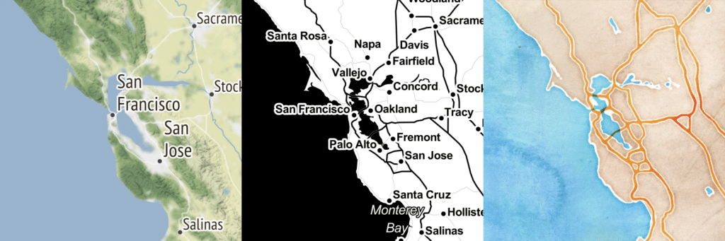
The Stamen map tiles were built as a free service with no user accounts, very much by design. We wanted to make the service truly free for all. This has also meant we had no ongoing funding source. Over the years we’ve posted donation links, written to major donors, and tried all manner of ingenuity and heroics to stay true to our ideals, but haven’t found any way to make the service pay for itself. All the while we’ve remained continually amazed that even as the service has become more expensive and less performant, the striking designs of Watercolor, Toner, and Terrain tiles persisted. We still can’t help but marvel at how many people use them, and love them as much as we do.
But supporting and maintaining a heavily-used service, even at a minimal level, takes resources we’ve never really had: dedicated staff time for customer service, tech support, routine maintenance, and data updates, plus $$$ to pay the cloud services bills. All of this costs us upwards of $100k/year. It’s a totally different business model than the rest of the work Stamen does, and needs a different set of skills. We’re dedicated to keeping this service affordable and accessible, especially for users in the public domain, but for very heavy users, we can’t continue to keep it available for free.

We’ve connected with Stadia Maps, who appreciate the value of these iconic designs, and are equipped to provide reliable tile services. We’re partnering with Stadia to move our tiles to their servers, and working closely with them to make sure that our beloved map styles keep running well into the future, and better than ever. They’re experts in running well-maintained map serving infrastructure. For most users, switching over will be as simple as setting up a Stadia account, and changing a few lines of code. For most non-commercial customers, there’ll be no service disruption, no tracking, and the price tag will continue to be free. Stadia Maps specializes in supporting a diverse clientele of folks who needed a better solution when their providers became unaffordable or went closed source. Read more here.
We love that Stadia’s current offerings are built on modern open-source projects like OpenMapTiles and Maplibre, using data from OpenStreetMap. They run their own tile servers and Content Delivery Network (CDN), and are dedicated to privacy and flexibility. They need to track usage in order to control cost, but have no interest in tracking beyond that.
We’ve also partnered with Stadia because using their vector tile stack, we can rebuild and host our most current client offerings, including Stamen map tiles, while making sure that the people who rely on our tiles can finally have updated data, more stability, and customer support. For those who depend on our basemaps because they’re free, Stadia offers a generous free tier for non-commercial use.
But wait, there’s more!
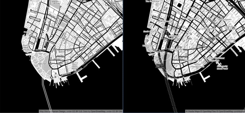
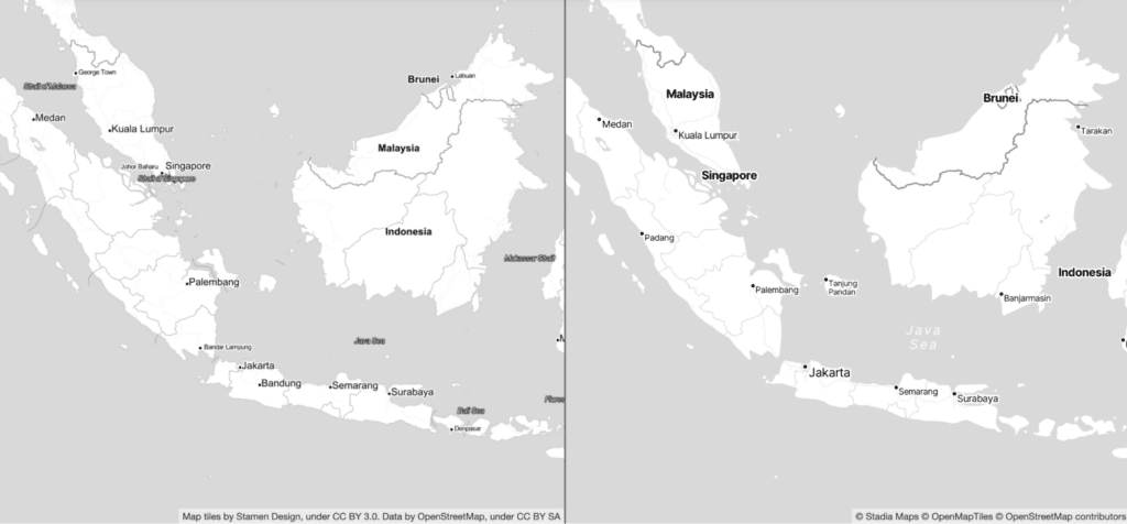
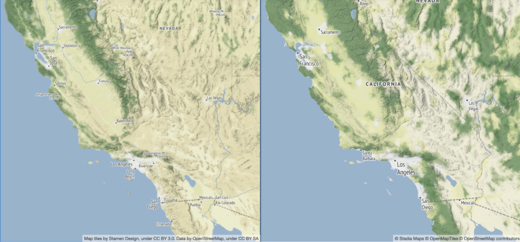
We’ve been working hard over the past few months and are really proud of what we’ve created. We’ve painstakingly recreated the look and feel of our classic Toner and Terrain families of styles as GL-based vector maps.
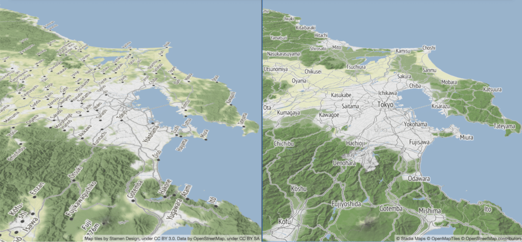
(old rasters on the left, new vector styles on the right)
These newly rebuilt styles will be available as tried-and-true raster endpoints in the next two weeks, in all the original “flavors” of Stamen Toner and Stamen Terrain. Stadia’s migration guide has simple instructions for porting your project over, compatible with all the mapping libraries you know and love.
You’ll also have the option of switching to vector versions of these styles! Vector maps have many advantages over the old raster maps, supporting smooth zooming in and out, tilted viewing angles, and text that rotates so it’s always readable even if north isn’t “up”. Vector maps are also much more performant than rasters, requiring much less bandwidth to render. Vector versions of the same map will make 60% of the tile requests of a raster version, making them a better choice for maximizing affordability too.
The one exception to this vector style modernization is our Watercolor style, which is much more challenging to recreate and serve in a vector tile stack (contact us if you’re interested in helping out!). Watercolor raster maps will now be served by Stadia’s servers too (and you’ll have to migrate your URLs to continue using Watercolor) but that style won’t be getting any of the data updates that Toner and Terrain have received.
We plan to keep going with these vector styles, and build more of them. We’ve been developing an increasingly powerful set of cartographic tools and workflows to support our client map design work, and we’re excited to demonstrate the capabilities of these tools on these new modernized vector tiles. We’ll be able to port these styles to use different tilesets, and remix them in many ways that weren’t possible with our old raster styles. We intend to keep creating all of our styles in ways that make them compatible with open source software, native to OpenStreetMap, and available to remix and build on within your favorite platforms and tools.
Of course for those who want the original recipe Stamen Map Tiles, those won’t disappear just because we aren’t serving them. Watercolor in particular has been archived by the Cooper Hewitt, Smithsonian Design Museum as part of their permanent collection. You can read more about that here. You can also still access the deprecated code repositories for the original Toner and Terrain raster tiles. We know of at least one group of people working to revive a raster renderer for Toner, so if that’s interesting to you we’ll put you in touch. Also, finally, if you want to grab a copy of all the existing cached tiles from our buckets on AWS to host them yourself, reach out to us and we’ll give you instructions.
Whew. Thank you for sticking with us to the end of this post, and for all of you who have been using our map tiles for over a decade. We’ll do everything we can to make this transition happen smoothly, and we’re confident that the legacy of our Stamen map tiles will live on and flourish for many years to come. Stay tuned to our site and to Stadia Maps for further updates in the coming months, and don’t hesitate to reach out to us if you have any questions!
Happy mapping!