blog/Open Source

Our Brilliant Friend: Stamen and OpenStreetMap through the years, part 3

| 08.01.25

A personal history of OpenStreetMap, seen through the eyes of Stamen Design by Alan McConchie and the Stamen Design team Recap Back in 2021, we wrote a two-part blog post about the history of Stamen Design and OpenStreetMap (“OSM” for short), and the twists and turns of Stamen’s close relationship with the OSM project over...

Stamen at State of the Map US 2025

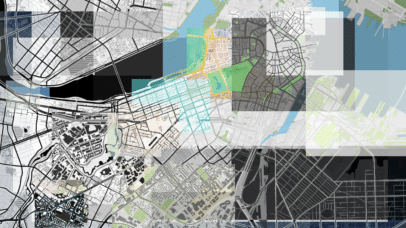
The State of the Map US (SOTMUS) 2025 conference in Boston, MA was yet another fantastic gathering of cartographers, mappers, and map enthusiasts. Stamen was well-represented this year by Kelsey Taylor, Eric Brelsford, and Eric Rodenbeck. We presented two talks on Stamen projects related to open source tooling with maps. Now that we’re back in...

Debugging 101 with Stamen Carto Tools (and other tools we like)

| 04.30.25

In vector cartography, the map is only as good as the data that powers it. If we don’t understand what’s going on in the underlying data, we’re pretty limited in our cartographic approach. A major part of this work involves parsing vector tile data, determining how one dataset compares to another, and diagnosing bugs encountered...

Refreshed global basemaps for Amazon Location Service

| 12.19.24

In March 2023, we shared the initial release of a set of global basemaps we designed for Amazon Location Service. In 2024, we undertook a design refresh to improve upon the original release, adding more detail and contrast to the suite of maps Amazon provides. To celebrate the release, we are excited to walk you...

Highway Shields On the Open(StreetMap) Road

Maps are fascinating things that show us a world that is both deeply personal and excitingly unfamiliar. As professional cartographers, we understand the joy of browsing parts of the world where you’ve never been before, but we also know that the first thing people usually do when they see a map is to find their...

The Many Lives of Null Island

| 07.23.24

Last year we rebuilt our well-loved Stamen basemaps from scratch, re-creating them on a totally new tech stack in partnership with Stadia Maps. This was a bittersweet and challenging process, trying to build new styles that matched the aesthetics of the old maps, while still giving us a fresh start to keep these maps running...

Refactoring a dataviz website to create an extensible application

| 02.21.24

The Max Planck Institute hired Stamen a few years back to create a website to visualize increasingly complex urban transformations due to immigration for a project called Superdiversity. The site we created contains multiple interactive charts of census data to enable better research, analysis, and discussion of this novel phenomenon. Because diversity patterns in cities...

Stamen x Stadia series: Terrain behind the scenes

| 10.17.23

When we started thinking about how to recreate Stamen’s iconic Toner and Terrain raster styles with vector data, Toner seemed like it would present the bigger challenge. Achieving the right hierarchy and visual balance of that style felt like a monumental task to me, an ardent admirer of Toner for many years. Terrain was less...

Stamen x Stadia: harnessing modern vector cartography

Not long after Stamen created our first Toner, Watercolor, and Terrain styles, a new technology came along: vector maps. Though it still used the paradigm of dividing up the world into map tiles, vector maps divide up the data into pre-processed chunks instead of the map itself. In vector cartography, the map is drawn dynamically...

Stamen x Stadia: familiar maps, brand new data

Since 2011, Stamen has provided basemaps built upon OpenStreetMap (OSM), but it’s been several years since we updated the underlying data in them. We received a grant from the Knight Foundation a few years after their release to refresh Toner and Terrain, but it’s no small feat to keep a worldwide map updated with the...