After three years of limited conference attendance, we had a blast at State of the Map US this year! The conference was held in Richmond, Virginia, so a long trip for those of us on the West Coast, but close to home for others, now that we are fully remote. It was great to come together and connect with everyone.
The talks we had accepted and added to the program this year were:
- Why do Full Stack Cartographers Love Open Source?
- A New Home For Field Papers
- Have you checked your vector tiles lately? Techniques for cartography-driven tile engineering
- Cartography Protips for Amazon Location Service
We also had a hand in another presentation about the status and future of MapLibre Native (presented by Stamen collaborator Steve Gifford from Wet Dog Weather). We’ll talk a bit more about each of those presentations below (and we’ll include links to the videos when they’re available!)
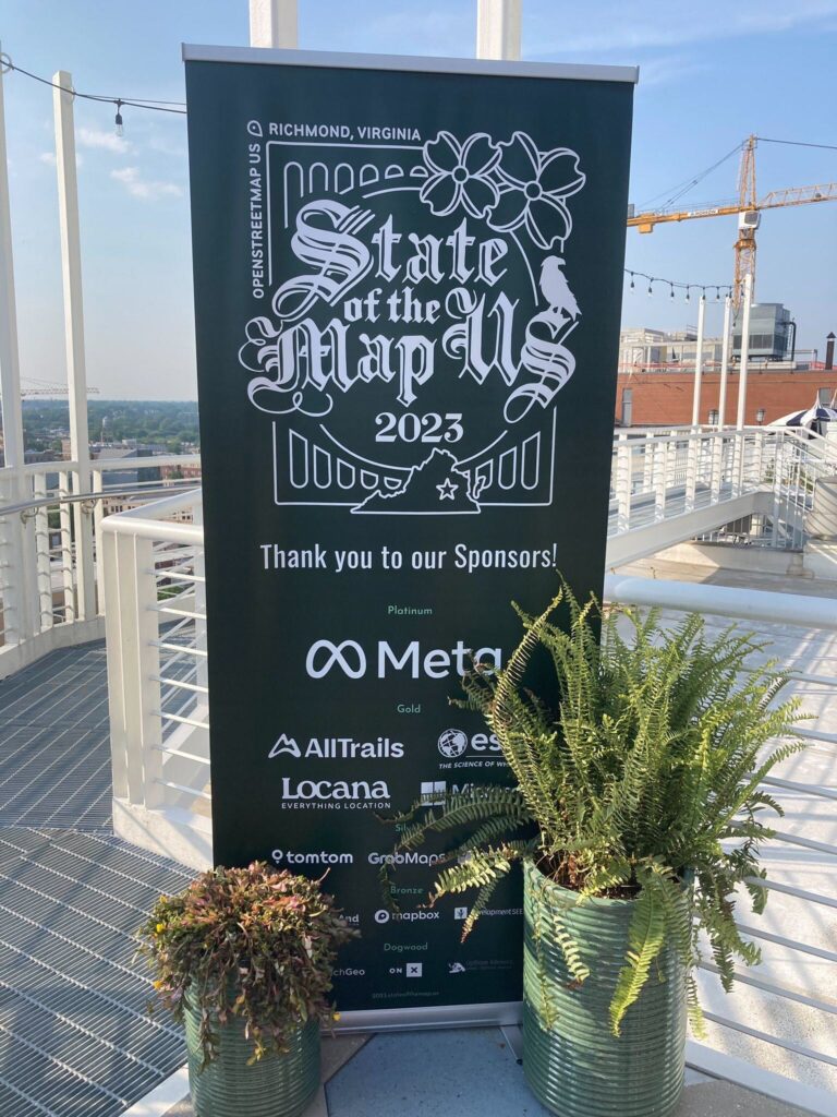
Stamen was also a proud sponsor of the conference, and we’d like to thank all the other sponsors and the organizers for their help in making this excellent conference happen!
Full Stack Cartography!
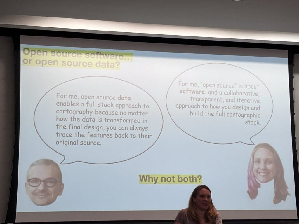
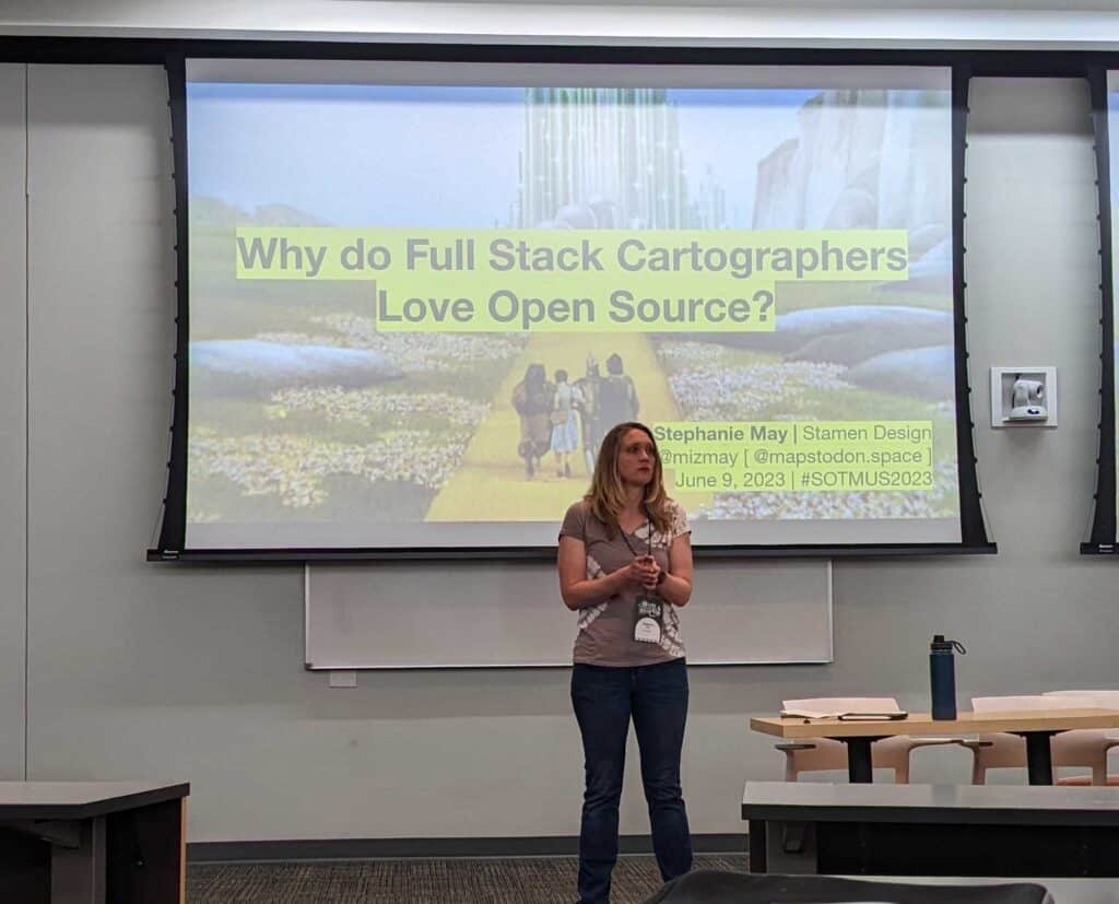
We kicked things off on Friday with “Why do Full Stack Cartographers Love Open Source?” In the very first session of the conference, Stephanie May warmed up the crowd by pointing out that regardless of whether you are talking about open source software or open source data, open source means we can build repeatable, iterative workflows around how we curate and design maps that fit within the pipelines and cloud services that define the online maps we use every day.
As many have learned the hard way, creating a basemap from OpenStreetMap data is not simply a matter of ingesting and transforming the planet file, nor is it a matter of adapting an open source schema or set of well-curated data and publishing vector tiles. Maybe someday! These days, there are too many schemas and data sets to choose from, and no perfect right way or single path.
Open source projects, collaborative and transparent by design, are better suited for interdisciplinary collaboration in the cloud, across data transformation, software services integration, and production cartographic design and development.
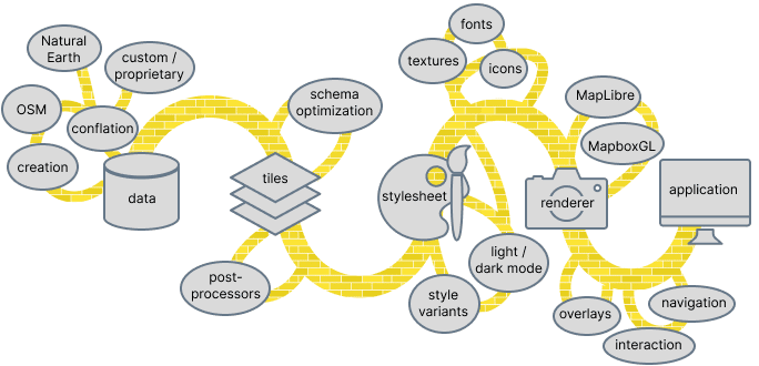
At Stamen over the past several years, we’ve carved out a niche as “Full Stack Cartographers”, e.g. the ungent that enables the efficient development of basemaps that are beautiful and performant – check out some of our work examples; the results speak for themselves.
What doesn’t speak for itself is the true value of open source. Our work is made possible by the careful and hard-fought efforts within open source projects like OpenStreetMap to align on core principles that allow us to pick up and make sense of what the project produces, no matter how large or complicated.
By a similar set of forces, our talks at this year’s State of the Map are all riffs on this core theme. Stamen has a long history of participating in OpenStreetMap, even as the community and our own cast of characters has changed. In this new era, we’re taking stock, as is everyone these days, of what’s changed, what’s next, and how we can give back.
Field Papers!
Later on Friday, “A New Home For Field Papers”, was about a project started by Stamen in 2012 to make it easy and relatively painless to upload field data collected on paper maps directly to OpenStreetMap.
While Field Papers remains a popular tool, OpenStreetMap has grown into a much more sophisticated, international network of diverse communities and complex stakeholders. Stamen has also changed in the last ten years: we ran out of program support for the tool, plus the original developers have long since moved on. Particularly over the last five years, we’ve been lamenting how little we could effectively do.
Big thanks to OpenStreetMap US, and particularly Quincy Morgan, our co-presenter, who, along with Jess Beutler and Maggie Cawley, saw the value of this legacy project and worked with us this past spring to take it over. You can read more about the legacy of Field Papers and the work to transition it here. At the conference, it was great to confirm how many people are still using the service.
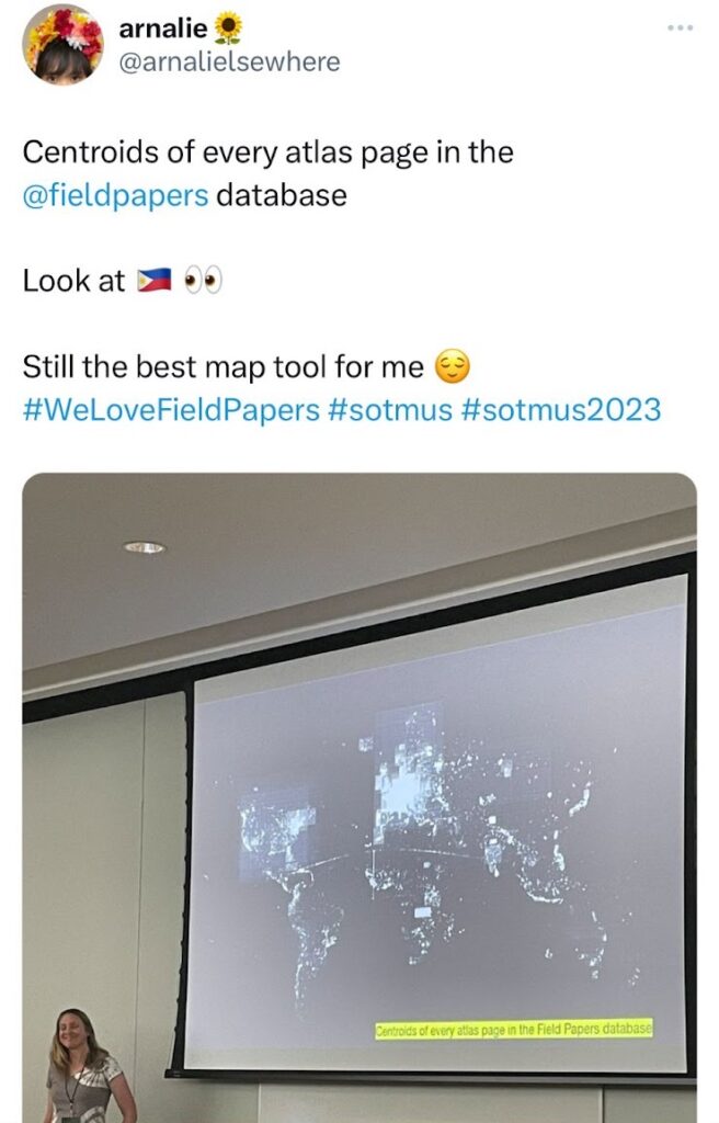
Field Papers is one of the in-house projects featured on OpenStreetMap US’s newly designed website! (See it in action here!) Please show your support by getting involved – as a user, developer, or funder of future work mapping the uncharted, undercharted, ever-changing world.
Have you checked your tiles lately?
Slides: Have you checked your vector tiles lately? Techniques for cartography-driven tile engineering
In our first talk on Saturday afternoon, Damon Burgett and Alex Parlato showcased a variety of tools and techniques we’ve developed at Stamen for optimizing tile data and for enabling our cartographers to work closely with tile engineers to tailor the data that drives our map styles.
Metaphorically, the process of curating raw data into vector tiles is like packing your bags for a trip: the more you know about your itinerary and what you’ll be doing on the trip, the more efficiently you can pack your bags to avoid bringing too much unnecessary stuff. Similarly, if you are a vector tile engineer creating a set of tiles, if you know what features your cartographers will need in their final designs, and if you know how your end users will be using the map, you can “pack” your tiles with only the data that is necessary. This makes for better performance, too: at each zoom level, vector tiles should include only the features, attributes, and spatial resolution necessary to render the map; any additional information in the tiles simply degrades performance with no visual benefit.
To figure out what information can be removed from a tileset, our tools can compare the differences between what a tileset contains and what a stylesheet actually references, and create a variety of visualizations showing the potential size savings.
Usually at Stamen we’re using these tools on our clients’ map tiles, but for the purposes of this presentation Damon and Alex demonstrated our techniques on the OSM Americana style, an ambitious project to create a map style inspired by the unique designs of classic printed US road atlases. It was great to meet some of the developers of OSM Americana at the conference and share ideas and observations!
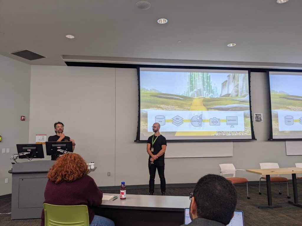
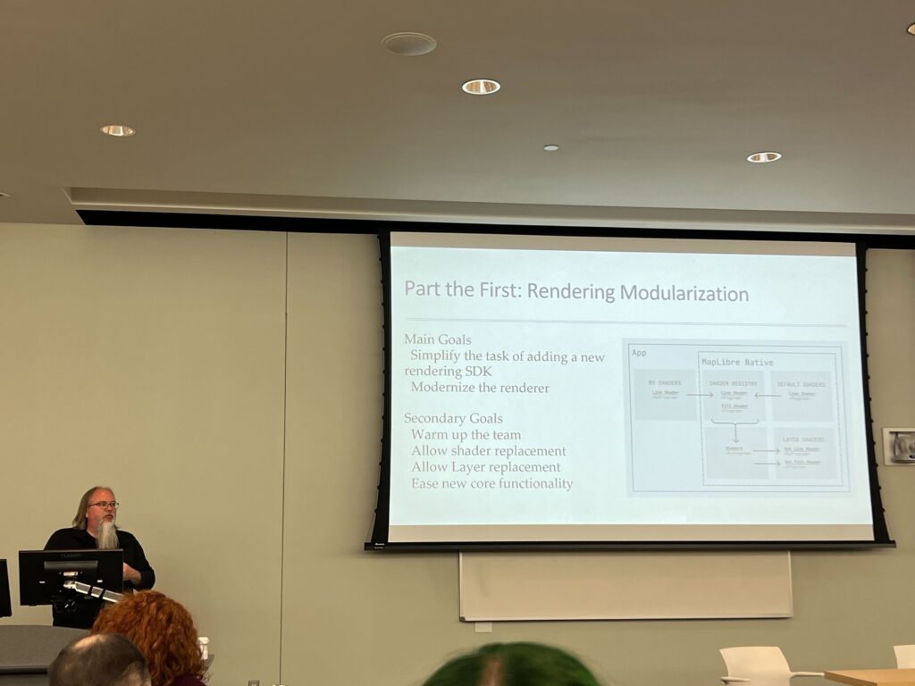
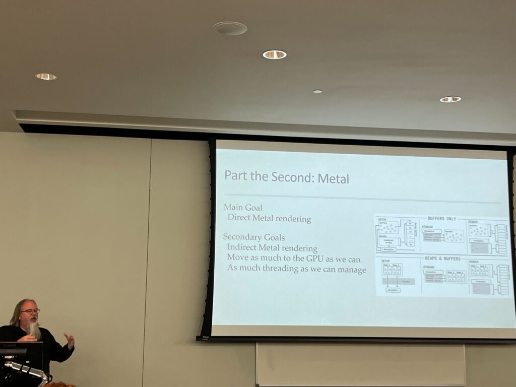
MapLibre Native: Status and Future
Amidst all the other talk of tiles and data and styling, our work was featured in a talk given by Steve Gifford about the progress he’s making on modernizing the code base for MapLibre Native, an open source map rendering library. Stamen helped get this effort off the ground earlier this year by spearheading a planning effort ahead of the current work to redevelop and modernize the mobile code bases.
Steve walked the audience through how the first phase of the work is going, which involved reorganizing the code to allow for future changes. He also forecasted the second phase: modernizing the render libraries.
In keeping with our theme across other talks, the bottom line is that developing with OSM is made possible by the ongoing support and immense contributions of the global OpenStreetMap community, and means that the success of what we build and create is inextricably linked to the ways in which OpenStreetMap must continue to thrive.
Maps for AWS!
Slides: Cartography Protips for Amazon Location Service
This past year, Amazon Web Services (AWS) partnered with Stamen to create a style for the vector tiles they were creating.This is something we could do effectively only because they brought us in early, and collaborated with us on defining the product goals for the map styles they wanted us to produce for the Amazon Location Services Open Data Collection.
AWS wants to use OpenStreetMap data in products for developers in the AWS ecosystem, and in the spirit of open source, be transparent and straightforward about how they got there. Luckily, Stamen alum Seth Fitzsimmons understood from his many years of involvement with OpenStreetMap that this is much harder than it sounds.
As Kate Leroux, Seth, and Stephanie May described in our final SotMUS talk, using OSM data purposefully and selectively requires understanding deeply both the data, and what the map you are creating will be used for.
This may not be an intuitive perspective if you are here as a mapper, and therefore conditioned to push for data completeness, e.g., getting as much stuff on the map as possible. A worthwhile goal! And one that is reflected in the default OpenStreetMap basemap. But if you are willing to consider the cartographic perspective that maps are clearer if they are designed for a purpose, suddenly impossible projects are accessible, maintainable and elegant, no matter the budget.
And best of all, you can credit OpenStreetMap in more ways than one – in the literal sense, by honoring the license, and with it, the contributions of millions of users, but also by showcasing the flexibility and durability of the project.
In closing
Stamen has been attending State of the Map conferences for over a decade, and we love the ongoing spirit of open sharing and of ideas and building on each others’ work. We’re always delighted to see Stamen work referenced in other talks at conferences like these. This year, for example, we were pleased to spot our “Invertorator” tool showing up in a five-minute lightning talk by Bradley Andrick from Element 84, about using CSS overrides to create a dark-mode version of the OSM default map style. Cool stuff!
Whether you were there in person, or just in spirit (like our Lead Cartographer Alan McConchie’s virtual cameo in our Full Stack Cartography presentation), we hope to see you at next year’s conference for more innovation in OpenStreetMap cartography!