
At Stamen, we love OpenStreetmap. I mean we REALLY love it. We’ve used it in several of our mapping projects. We want to share our enthusiasm for OSM and continue to foster a culture of map knowledge-sharing and collaboration. And with that…
We are pleased to announce the first ever OpenStreetMap Oscar awards! While awards in the OSM community have been given in the past to members, projects, and organizations, we’ll be giving out awards to the true stars of OSM: the data! That’s right! We’re celebrating the tags, keys, values, and features that make our maps. We hope this light-hearted competition encourages you to peruse the open geographic data repository and engage with the community!

What is OpenStreetMap?
OpenStreetMap is a collaborative database of geographic data for the entire world. A fitting way to think about it is like the Wikipedia of mapping data: anyone can make an account and add/edit features to enrich the map. Anyone is then free to download and use this data in accordance with their licensing! For example, companies like Strava and Apple use the data to build their mapping applications. Countless other organizations and individuals pull the data for a variety of personal and professional uses as well.
For more information about OpenStreetMap check out the following resources:
- A Concise Introduction to the OpenStreetMap Project, a presentation by Steve Johnson that gives a succinct overview of what OSM is!
- OpenStreetMap FAQs
- OpenStreetMap Beginner’s Guide
If you want to learn more about mapping in OpenStreetMap, cartographer Ross Thorn did a livestream mapathon, demonstrating how to use OSM and how to explore the data!
And the OSM Oscar goes to…
The results are in! Without further adieu, here are the winners!
Best Transportation Tag
This category is dedicated to the tags that help us get around.
- highway=footway **WINNER**
- crossing=unmarked
- highway=busway
- railway=station
- interval=*
This tag is used for mapping minor pathways which are used mainly or exclusively by pedestrians. It’s crucial for pedestrian routing, which is something that makes OpenStreetMap truly special! Congratulations, highway=footway!
Best Infrastructure Tag
This category is dedicated to the tags that support societal structures.
- power=line
- building=yes
- amenity=parking
- addr:housenumber
- lit=yes **WINNER**
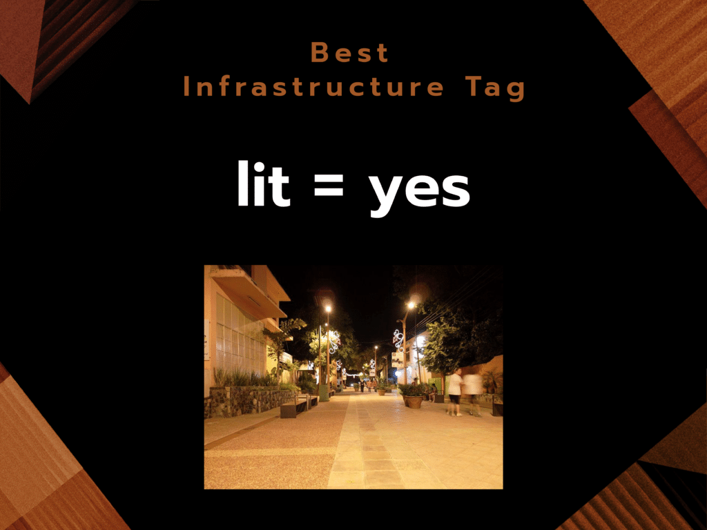
This tag is used to map the presence of lighting. Whether it’s because it’s helpful to delineate areas that have lighting or because it’s a good slang pun, lit=yes is this year’s best infrastructure tag!
Most Beautiful
This category is dedicated to the tags and features that improve the visual appeal of the map.
- natural=water
- landuse=grass **WINNER**
- highway=*
- place=island
- natural=reef
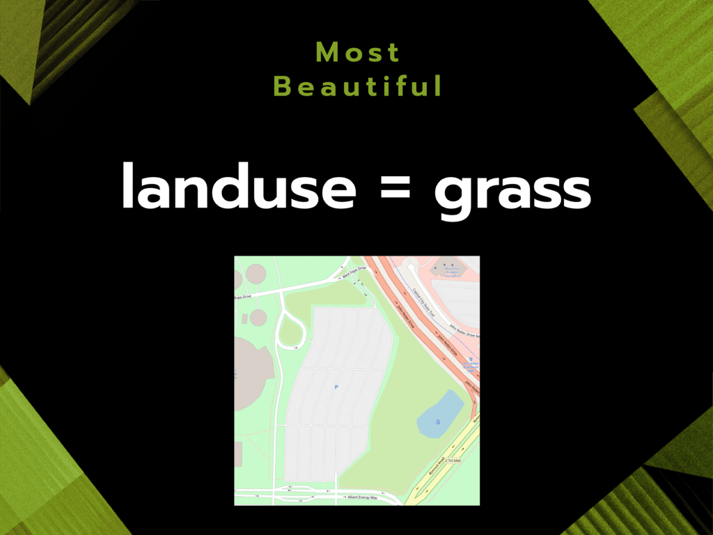
OpenStreetMap (and all the maps built from it) wouldn’t be nearly as cartographically pleasing if it wasn’t for the robust population of landuse and natural tags. To the voters, landuse=grass is the tag that does this the best!
Coolest Shape
This category is dedicated to the features that have the coolest arrangement or shape.
- AV-8C Harrier
- CHUBU CENTRAIR
- Horse Solar Panels
- Milk River
- Triangle Ponds **WINNER**
- Tree Crop Circles

While the world is filled with lots of intriguing shapes and features, not all of those are mapped! This year, the Triangle Ponds (which reside on a massive estate in Cambridge, Maryland) take home the award for the coolest shape.
Most Original / Unique
This category is dedicated to the tags that stand out amongst the rest.
- highway=footway at Oracle Park
- playground=map **WINNER**
- mimics=*
- name:etymology:wikidata=*
- material=thermoplastic_road_marking_paint paired with tourism=artwork
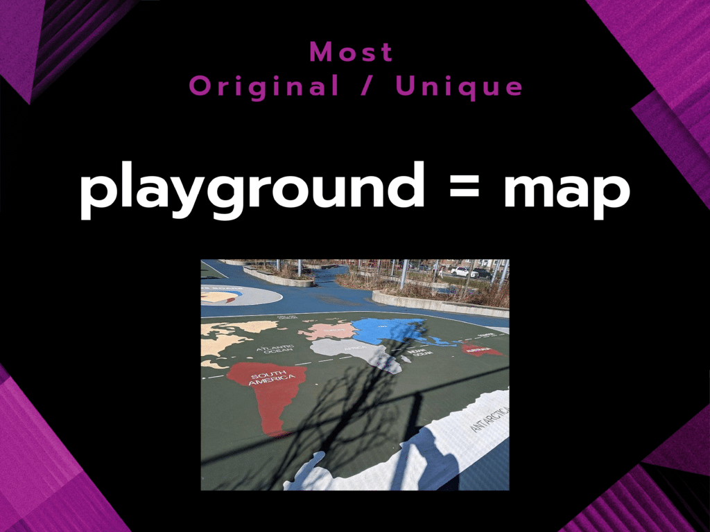
An inspiration for many young geography enthusiasts across the world, this tag is used for maps painted on a paved surface at a playground or school. Congratulations, playground=map for being the most original/unique in OpenStreetMap!
Most Absurd / Funny
This category is dedicated to the tags and features that make us laugh.
- yes=yes
- cats=lots
- smoothness=horrible **WINNER**
- was:hazard_to_flying_goose=yes
- My Secret Fishing Spot
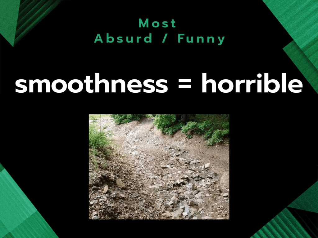
A practical tag for denoting if something is terribly rough, smoothness=horrible takes home the award for the most absurd/funny tag!
Best Typo / Error
This category is dedicated to the notable errors in tags and features.
- Gnis:feature_id =1668305News Highlights – Canucks vs Red Wings (Dec.20,1978)….Kings vs Canucks (Dec.23,1978)….Sabres vs Canucks (Dec.28,1978)
- building:levels=212 **WINNER*
- name=Hog Cannon Creek
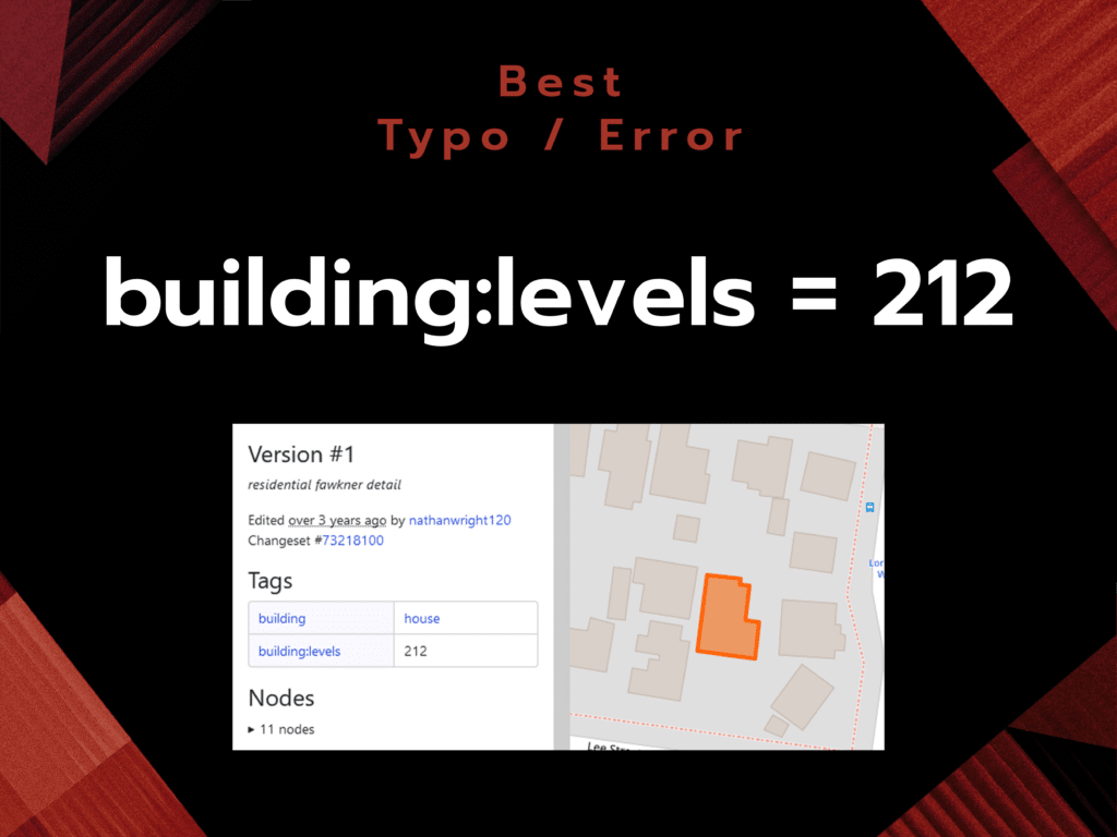
An innocent mixup that led to a 2-story residential home rendering as a 200+ story building in Microsoft Flight Simulator, our winner for best typo/error is building:levels=212! It has since been corrected and is no longer a hazard to virtual pilots.
And now for the very best of the best! All nominees in the above categories were eligible for the Best Overall Tag/Feature award. And in a landslide, the winner is…
Best Overall Tag / Feature
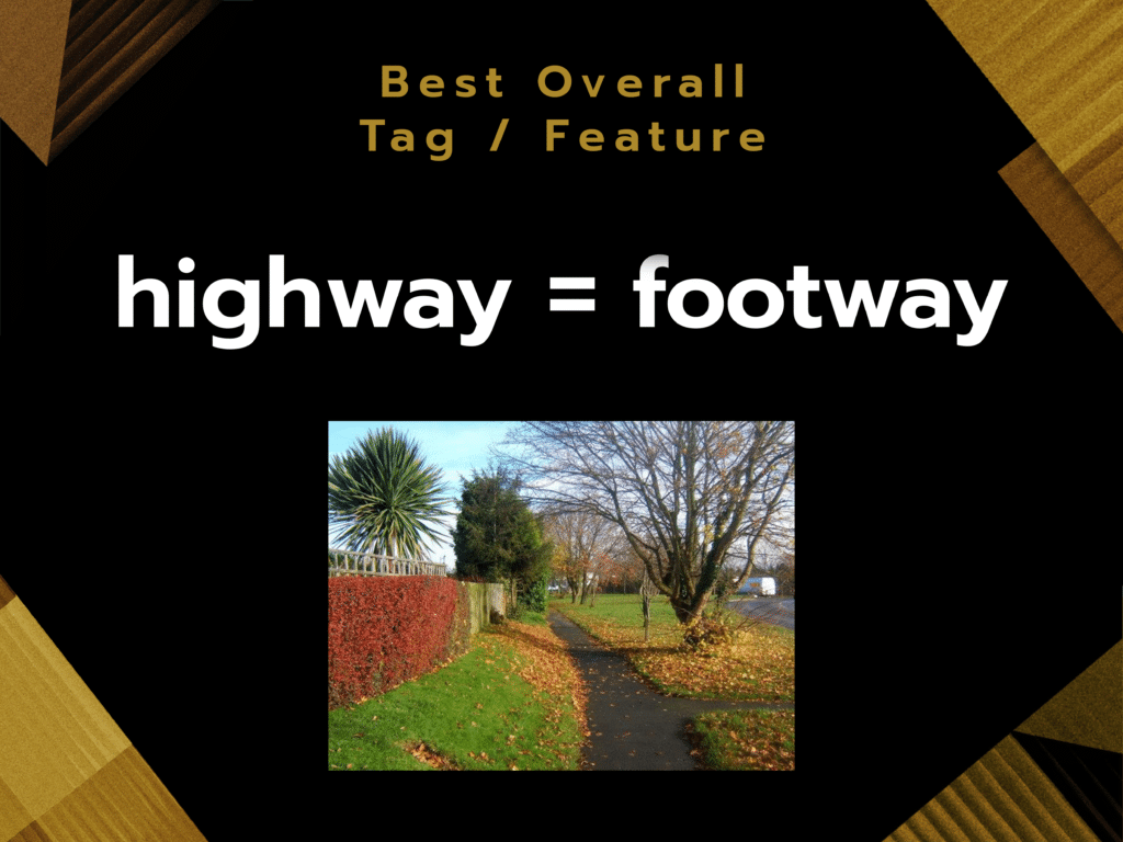
While it may only be #4 amongst all highway features in OpenStreetMap, highway=footway is #1 in our hearts this year! Its prevalence and usefulness in pedestrian routing earned it the right to be named our best overall tag/feature!
Thanks to everyone who submitted nominations and voted! We had a lot of looking at all the tags and features that you all hold dear and hope that this is a tradition that can continue in some way!