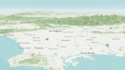
Cartographers Play Video Games – A Review of the Map in The Legend of Zelda: Breath of the Wild

At Stamen, our appreciation and opinions of maps go beyond just our professional work here and often bleed over into our personal interests as well. Our eye for interactivity, color palettes, contour lines, and labels doesn’t stop once we log off at the end of the day. As we covered in a previous post by...

Making a snappy raster map with shaders

| 04.18.23

One of the exciting aspects of working at Stamen Design is that we work with all kinds of data. Not only do we get to explore what story the data is telling us, but we also get to explore how to tell it from a technical perspective. A challenging data type for web mapping are...

Pollinate Ep. 17- Jeffrey Linn & Speculative Cartography

| 04.13.23

As we emerge from three years of pandemic, social isolation, and political instability, how do we as humans cope with living in an uncertain world? How do we find joy and connection while acknowledging the inevitability and looming threat of climate change? In this podcast episode, Cartographer Jeffrey Linn introduces us to the concept of...

Pollinate Ep. 16- Mamata Akella & Collaborating with Maps

| 03.09.23

Collaborative tools for work and everyday life are more important now than ever before. Cartographer Mamata Akella brings “mapmaking thinking” to Felt, a fresh mapping platform that allows people to create maps together in real-time. With a portfolio of projects ranging from The National Park Service to Esri, Mamata has been a force in shaping...

Visualizing critical disaster data with ReadyMapper

| 03.08.23

With climate-related natural disasters on the rise, it has become increasingly obvious that we lack the tools to provide useful information as crises unfold—the venn diagram of crucial data and real-time communication has painfully little overlap. Since early 2022, Stamen has had the pleasure of working with CrisisReady and Direct Relief to create ReadyMapper, an...

When Creating a Digital Map, Know Your Options

| 02.23.23

Digital maps are everywhere. Through real-time data feeds and integrations, maps can turn into comprehensive multi-purpose tools within your organization, as well as a core part of operations, logistics, and customer-facing products. Geospatial analysis and location intelligence is a business priority for all industries, including governmental agencies, non-profit organizations, telecommunications groups, manufacturing and retail. At...

2022!

| 02.22.23

Remote dataviz & maps in the cloud 2022 was our first full year at Stamen being really remote. We’ve been out of our beautiful San Francisco office since the beginning of the COVID-19 pandemic, which I’ve reflected on before, but for the first year or two, we all assumed being remote was temporary. 2021 saw...

Announcing the Inaugural OSM Oscars!

| 02.21.23

At Stamen, we love OpenStreetmap. I mean we REALLY love it. We’ve used it in several of our mapping projects. We want to share our enthusiasm for OSM and continue to foster a culture of map knowledge-sharing and collaboration. And with that… We are pleased to announce the first ever OpenStreetMap Oscar awards! While awards...

Down In the Sewers Tracking Viruses with WastewaterSCAN

| 02.16.23

Late last year, Stamen worked with the group WastewaterSCAN to build a new home for the group’s public-facing charts that visualize the data they collect from wastewater treatment plants across the US. If you’ve been keeping an eye on the latest data regarding COVID-19 and other viruses like RSV, you might have noticed that there...

Pollinate Ep. 15- Tanya Ruka & Mapping Native Lands

| 02.09.23

Cartography is a powerful tool for understanding the world and our place within it, but sometimes maps conceal more than they reveal. Throughout much of the history of cartography, maps have been used to forcibly claim territory and exploit the land, erasing the histories and claims of the people who lived there before. Native Land...