Visualizing critical disaster data with ReadyMapper

| 03.08.23

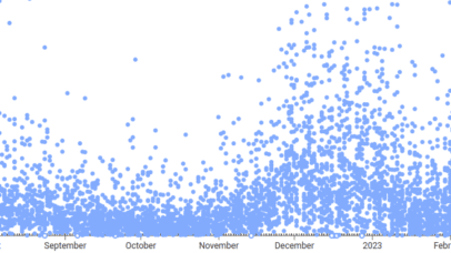
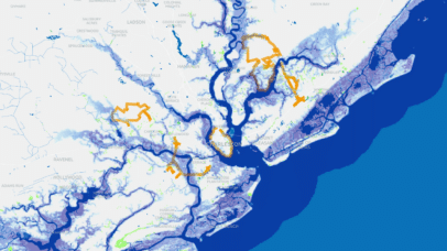
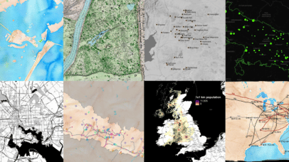
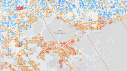
With climate-related natural disasters on the rise, it has become increasingly obvious that we lack the tools to provide useful information as crises unfold—the venn diagram of crucial data and real-time communication has painfully little overlap. Since early 2022, Stamen has had the pleasure of working with CrisisReady and Direct Relief to create ReadyMapper, an...

When Creating a Digital Map, Know Your Options

| 02.23.23

Digital maps are everywhere. Through real-time data feeds and integrations, maps can turn into comprehensive multi-purpose tools within your organization, as well as a core part of operations, logistics, and customer-facing products. Geospatial analysis and location intelligence is a business priority for all industries, including governmental agencies, non-profit organizations, telecommunications groups, manufacturing and retail. At...

2022!

| 02.22.23

Remote dataviz & maps in the cloud 2022 was our first full year at Stamen being really remote. We’ve been out of our beautiful San Francisco office since the beginning of the COVID-19 pandemic, which I’ve reflected on before, but for the first year or two, we all assumed being remote was temporary. 2021 saw...

Announcing the Inaugural OSM Oscars!

| 02.21.23

At Stamen, we love OpenStreetmap. I mean we REALLY love it. We’ve used it in several of our mapping projects. We want to share our enthusiasm for OSM and continue to foster a culture of map knowledge-sharing and collaboration. And with that… We are pleased to announce the first ever OpenStreetMap Oscar awards! While awards...

Down In the Sewers Tracking Viruses with WastewaterSCAN

| 02.16.23

Late last year, Stamen worked with the group WastewaterSCAN to build a new home for the group’s public-facing charts that visualize the data they collect from wastewater treatment plants across the US. If you’ve been keeping an eye on the latest data regarding COVID-19 and other viruses like RSV, you might have noticed that there...

Pollinate Ep. 15- Tanya Ruka & Mapping Native Lands

| 02.09.23

Cartography is a powerful tool for understanding the world and our place within it, but sometimes maps conceal more than they reveal. Throughout much of the history of cartography, maps have been used to forcibly claim territory and exploit the land, erasing the histories and claims of the people who lived there before. Native Land...

Mapping the Changing Coast with the Southern Environmental Law Center

| 02.07.23

In 2022 we had the pleasure of sitting down with Jovian Sackett from the Southern Environmental Law Center to talk about our collaboration on The Changing Coast and the work Jovian does more broadly. The conversation ranged from the decisions that went into making The Changing Coast map, communicating with data, and the data questions...

Pollinate Ep. 14- Stephanie May & Interdisciplinary Cartography

| 01.13.23

The modern cartographer needs a lot more than mapping software alone to be successful. Map solutions often require a breadth of knowledge across a team of capable people who know how to speak each other’s language. That’s something Stephanie May learned throughout her career in the geospatial industry. In this episode, the Director of Geospatial...

#30DayMapChallenge 2022

| 12.02.22

Every year in November, cartographers around the world take part in the 30 Day Map Challenge, spending their free time creating a new map each day, working through a list of different prompts posted by organizer Topi Tjukanov, and sharing their maps on social media at the #30DayMapChallenge hashtag.  This year, watching the stream of...

Pollinate Ep.12- Andy Woodruff & Griping About Daylight Saving Time

| 11.11.22

Twice a year, people in every hemisphere of the world adjust their clocks to adhere to Daylight Saving Time (DST). Whether you prefer these biannual changes or you’d rather leave your clock alone, cartographer Andy Woodruff has made an interactive map to help you make your case when complaining about it on social media. In...